
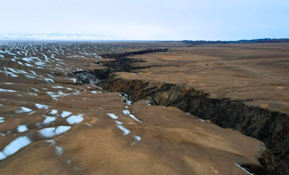
In central Turkey, beneath the arid plains surrounding Lake Tuz, a silent geological shift is underway. A fault zone once thought to mirror the lateral motion of neighboring systems is instead tearing open the crust, millimeter by millimeter.
The Tuz Gölü Fault Zone spans nearly 200 kilometers, sitting at a tectonic crossroads between the Eurasian, Arabian, and African plates. For years, geophysical models categorized it as a strike-slip fault—expected to accommodate sideways movement typical of Turkey’s earthquake-prone regions. That classification now appears deeply flawed.
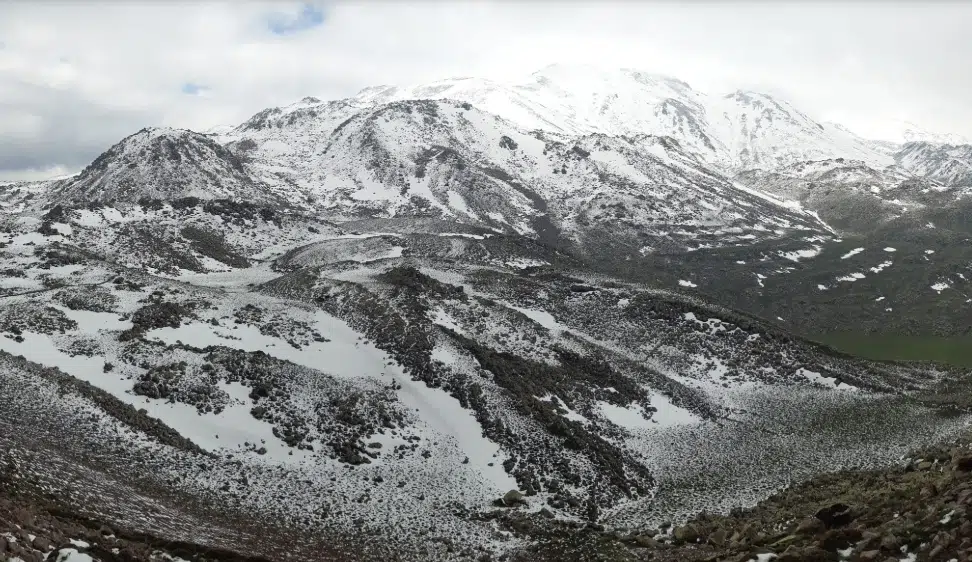
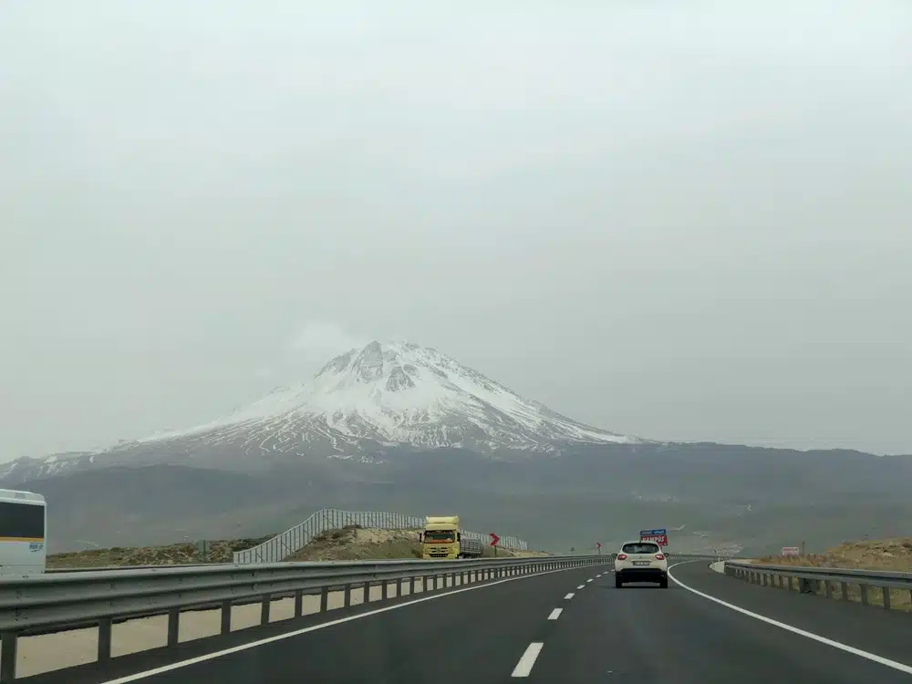 Mount Hasan, a volcano that is 3253 meters high in the Anatolia. Credit: Shutterstock
A recent study published in Nature’s Communications Earth & Environment presents clear evidence that this fault is not sliding but extending vertically. Instead of shearing past one another, the crustal blocks are pulling apart—transforming how geologists understand regional deformation in Anatolia and beyond.
A Quiet Rift Beneath Turkey’s Tectonic Shell
The breakthrough comes from fieldwork around Hasandağ, a dormant stratovolcano near the fault’s center. Researchers led by Axel Schmitt at Curtin University studied ancient Pleistocene lava flows dissected by the fault to reconstruct long-term displacement.
Using zircon double-dating (ZDD)—a high-precision method combining uranium-thorium and helium isotope dating—they dated four lava flows ranging from 151,000 to 38,800 years old. These flows, once continuous, were fractured vertically but remained laterally aligned, showing little to no horizontal offset.
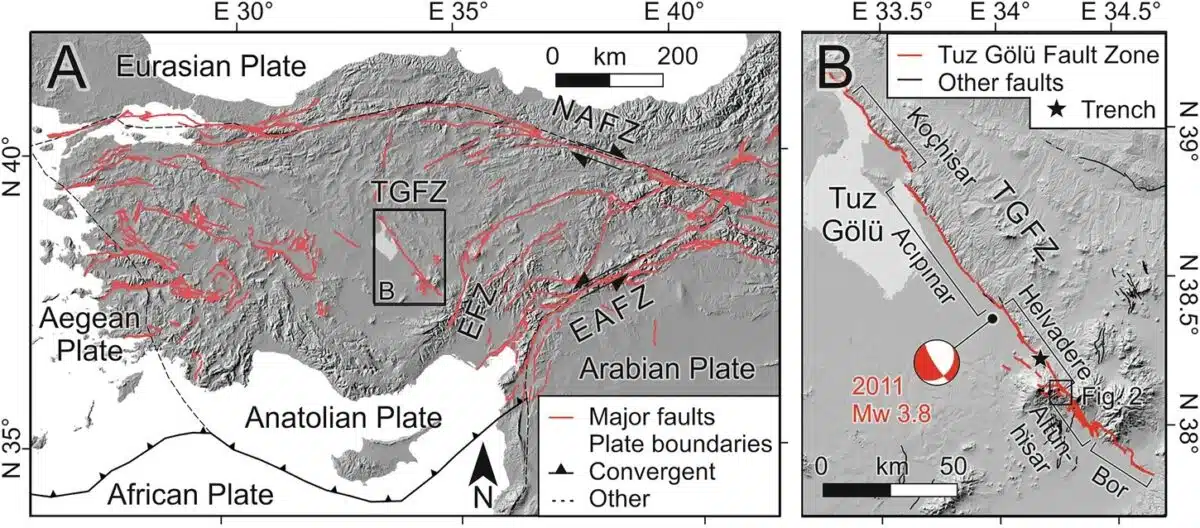 Tectonic framework of Anatolia and the Tuz Gölü Fault Zone. Credit: Communications Earth & Environment
The researchers measured vertical displacement rates between 0.90 and 1.23 millimeters per year, consistent across all flows. Strike-slip movement—previously thought dominant—was found to be negligible, contradicting decades of geodetic models that estimated right-lateral motion of up to 4.7 mm/year.
As summarized in Techno-Science’s coverage, zircon crystals from the flows acted as natural chronometers, allowing researchers to pinpoint both eruption dates and post-eruption deformation with unmatched precision.
Models Meet the Ground—And Lose
Remote sensing data and GPS-derived motion vectors have long formed the basis for tectonic modeling in Turkey. These methods predicted substantial lateral displacement along the Tuz Gölü Fault, fitting neatly into the prevailing model of tectonic escape, where the Anatolian plate is squeezed westward between colliding plates.
Yet on-the-ground evidence from this study paints a different picture. The consistent vertical offsets across four distinct lava flows, particularly the F3 flow—whose original shape could be precisely restored—revealed a net dip-slip motion (vertical movement) with a near absence of strike-slip (lateral movement).
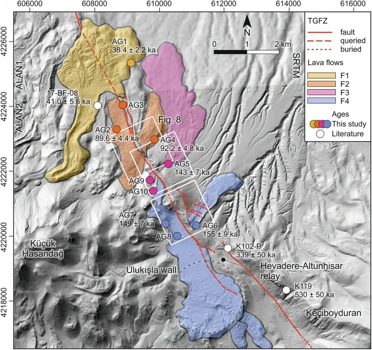 Hillshaded digital elevation model (General Directorate of Mapping, Republic of Türkiye; WGS84 UTM zone 36 N) and sampling locations with (U-Th)/He eruption ages for F1–4 lava flows. Credit: Communications Earth & Environment
This challenges earlier interpretations that the fault serves as a conjugate strike-slip system in tandem with the Ecemiş Fault Zone. The new data suggest instead that the Tuz Gölü Fault Zone accommodates east-west crustal extension, not horizontal escape.
Satellite-based models lacked the temporal resolution to capture this slow, persistent movement. In contrast, the lava flow reconstructions spanned over 100,000 years, providing a long-term view that reveals trends invisible on decadal timescales.
Hidden Deformation in an Overlooked Zone
Unlike the North Anatolian Fault, notorious for its frequent earthquakes, the Tuz Gölü Fault has remained relatively quiet—both seismically and scientifically. But this absence of surface-level drama masks deeper structural change.
The researchers note that vertical movement is concentrated in segments near Hasandağ, a region where tectonic forces and past volcanic activity converge. Despite the lack of major seismic events in this zone, the fault is actively reshaping the landscape beneath it.
Throughout its mapped length, the fault’s linearity and morphology show no signs of transitioning into a strike-slip system elsewhere. Fault scarp features, slope reconstructions, and zircon-dated offsets all point toward uniform normal faulting behavior.
This undermines earlier assumptions that local stress variations might produce the apparent extension. Instead, the evidence suggests a systemic recharacterization is warranted—not just for this fault, but for others in intraplate settings worldwide.
Tectonics Beyond the Textbook
The findings raise broader questions about how we evaluate tectonic systems that don’t conform to surface observations or short-term datasets. Many active faults exist in regions with limited instrumentation, and GPS-based models, while powerful, are often blind to slow or vertical deformation over geological timescales.
 Mount Hasan volcano, source of the studied lava flows. Credit: Axel Schmitt
The Tuz Gölü study reaffirms the value of morphological restoration—analyzing how ancient geologic features have been reshaped—to understand subtle yet significant crustal motions. In this case, what the lava flows preserved over millennia speaks louder than any GPS sensor.
With climate change, population growth, and urbanization amplifying the risks of underestimated seismic zones, the study also reinforces the need for integrating long-term data into hazard models. The Alpine-Himalayan seismic belt, of which Turkey is a central component, is far more complex than previously mapped.