
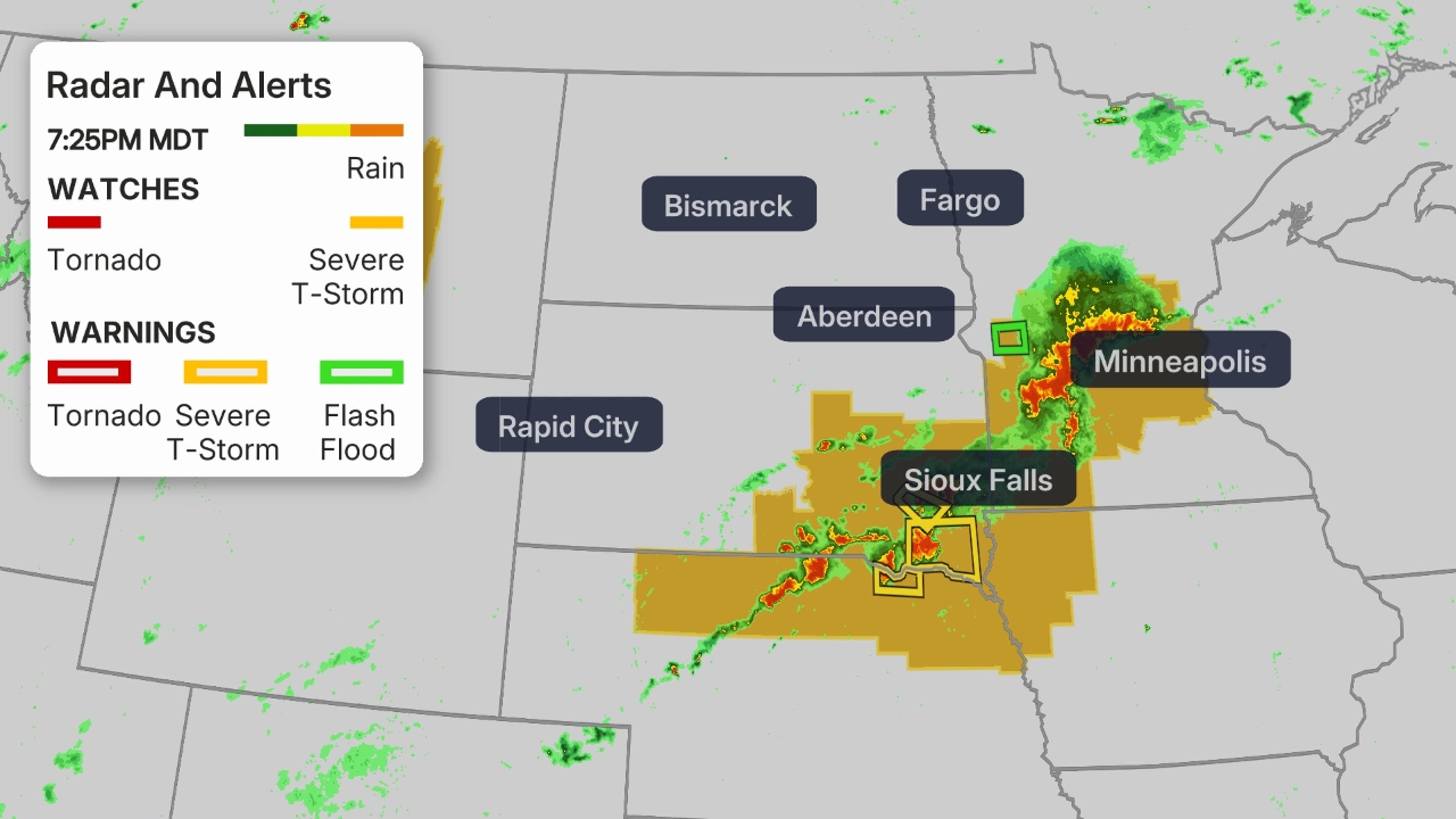
Current Radar, Watches And Warnings
A fierce and long-lasting line of severe thunderstorms called a derecho is likely to tear across the Northern Plains to kick off the week, causing damage to trees, structures and knocking out power.
What To Expect
Storms tracking with the clockwise flow on the northern rim of a heat dome that’s bringing another bout of sweltering temperatures to the central U.S. will grow increasingly organized into a line over the Northern Plains to close out Monday.
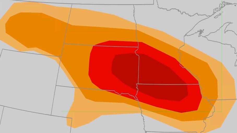
Widespread wind damage from those storms is most likely in the red-shaded areas of the map below, stretching from South Dakota into southern Minnesota and northern Iowa, including Aberdeen, Watertown and Sioux Falls, South Dakota. This is where a concentrated area of 75+ mph wind gusts is most likely as well as a few tornadoes and large hail.
![]()
Weather in your inbox
By signing up you agree to the Terms & Privacy Policy. Unsubscribe at any time.
Some of this severe weather could spread as far east as the upper Mississippi valley, including Minneapolis-St. Paul, overnight.
Potential impacts include damage to trees and structures as well as numerous power outages.
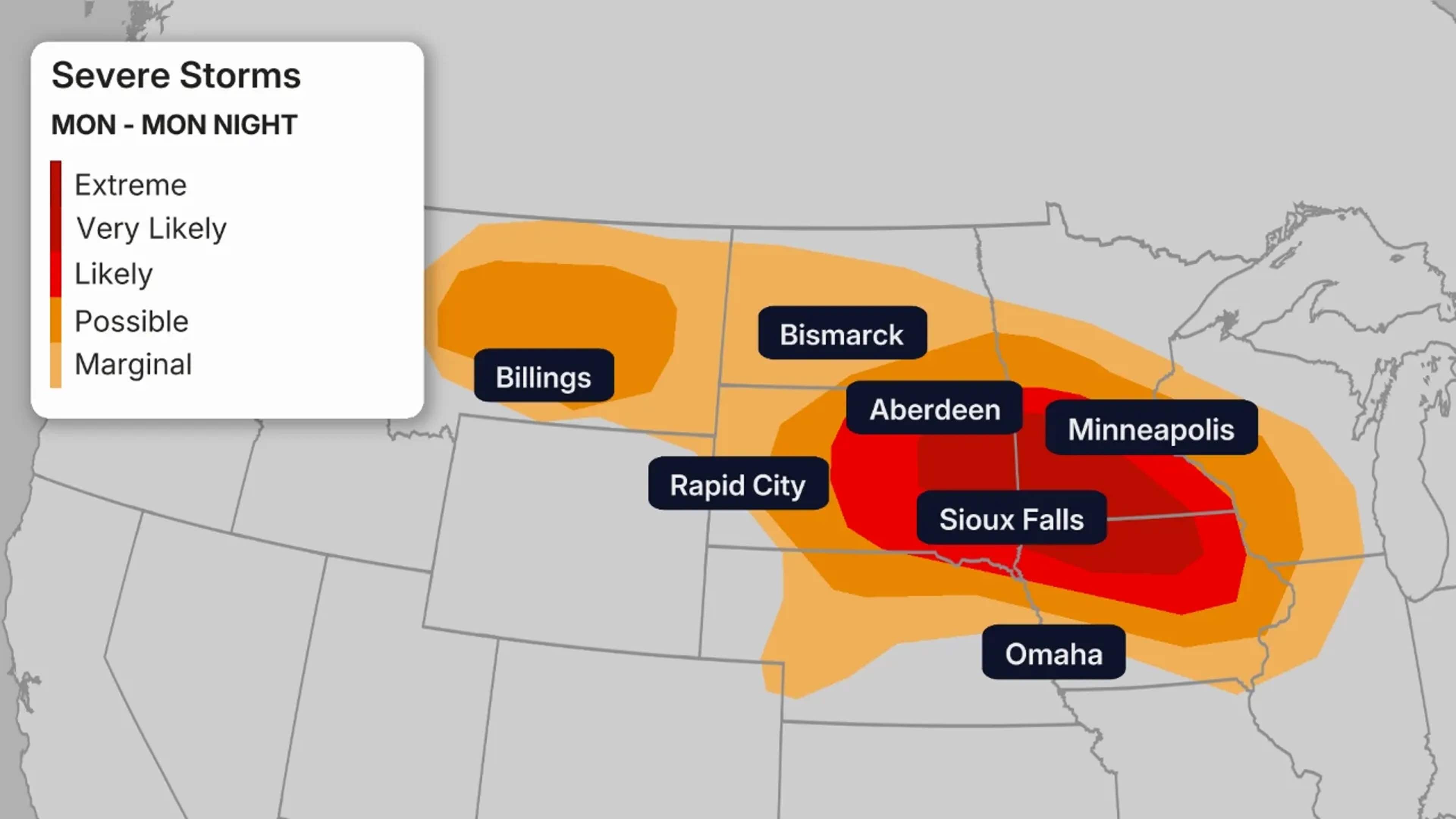
Severe Weather Forecast Through Monday Night
This would be the second derecho to strike the Northern Plains region this summer. In late June, North Dakota and northern Minnesota were hit hard by an intense line of storms that produced wind gusts up to 106 mph and several tornadoes.
Defining A Derecho
A single severe thunderstorm may produce an area of damaging winds only a mile or two wide and perhaps a few miles long, but derechos can produce damage tens of miles wide and hundreds of miles long.
To be called a derecho, the thunderstorm-generated high winds and wind damage should cover a distance of at least 250 miles long and produce at least a handful of 74+ mph wind gusts, according to a January 2025 proposal led by Brian Squitieri.
They are most numerous in late-spring and summer, particularly in the Great Plains and Midwest.
(MORE: Derechoes 101)
Stay Safe
As with any severe weather situation, planning ahead and staying informed are key.
First, know where you’ll seek safe shelter if a National Weather Service warning is issued. If you live in a mobile or manufactured home, find either a sturdy building or community shelter ahead of time and know how to reach it quickly. A derecho’s strongest winds can heavily damage or blow over a mobile home.
Next, have multiple ways of receiving NWS warnings, including by smartphone and from NOAA weather radio. These are two sources that can also wake you if a warning is issued while you’re sleeping. Make sure each is charged fully before the storms arrive.
Move to shelter immediately when a warning is issued, including both severe thunderstorm and tornado warnings.