
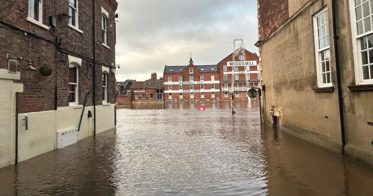
The Ouse is three times higher than the river’s normal level – with the latest recording measuring at 3.53 metres on the Viking Recorder.
Property flooding is possible, the Environment Agency said, when the river exceeds 3.40 metres.
It comes as increased rainfall associated with Storm Bram in the Ouse’s upper catchments has moved downstream.
Recommended reading:
A flood warning remains in place for riverside properties in York.
Areas most affected include King’s Staith – the footpath of which remains completely blocked with floodwater – and riverside areas from Lendal Bridge to Millennium Bridge.
King’s Staith was seen completely flooded, with barricades on the door of the Kings Arms (Image: Newsquest)
The footpath in Tower Gardens, close to Clifford’s Tower is also closed, along with SOPHiE’s lower floor seating area beneath Skeldergate Bridge.
The City of York Council have closed St George’s Field carpark, coach park, Rowntree Park, Rowntree carpark, Rowntree Park play area.
Meanwhile, the river Ouse at St George’s Field and Queen’s Staith, and Naburn Lock, are included in separate flooding warnings, still currently in place.
The riverside seating area of SOPHiE’s on Skeldergate Bridge (Image: Newsquest)
Lock Cottages and Naburn Lock Buildings are the most vulnerable to flood water incursion after the Viking Recorder documented swells above the property flooding metre.
Rising river levels are also continuing to affect footpaths and low-lying land and properties at Kexby Bridge in Stamford Bridge, including the Weir Caravan Park.
A spokesperson for the Environment Agency said: “The River Derwent level at Stamford Bridge was 9.24 metres. Property flooding is possible when it goes above 9.20 metres.”
An alert was in place for low-lying land and roads near rivers in the following locations: Stamford Bridge, Pocklington, Wressle, Wilberfoss, Elvington, the Lower River Nidd and its tributaries including Sand Beck, Sike Beck, Pool Beck and Great Gutter, along with the Upper Derwent and Scarborough areas.
Communities listed above will be updated by 8pm on Wednesday (December 10), or as the situation changes, while the Environment Agency continues to monitor the regions.
The flood warning for River Ure at Boroughbridge Camping and Caravan Site was lifted at 10.31am, with further updates scheduled to be announced at 3pm today.
As reported in The Press, The Environment Agency is urging people in the areas at risk of flooding to “take care and consider activating your flood plan if you have one”.
It has warned residents and visitors of each area to avoid using low lying footpaths and any bridges near local watercourses, taking care not to attempt to walk, drive or cycle through flood water.
The footpath in Tower Gardens, near Clifford’s Tower has been closed, due to the flooding (Image: Newsquest)
A spokesperson furthered: “The Foss Barrier is operating, and flood gates in York have been closed.
“We are closely monitoring the situation.”
The Press will be keeping readers updated throughout the day.