

 The disputed recent history of the Skipperpublished at 17:57 GMT
17:57 GMT
By Joshua Cheetham, Matt Murphy and Richard Irvine-Brown
The oil tanker seized by US forces on Wednesday had a track record of faking or concealing its location information, apparently to hide its activities, ship tracking data shows.
Under a UN treaty, all ships above a certain tonnage have an onboard tracker called an Automatic Identification System (AIS) which broadcasts its position and can be seen on websites like MarineTraffic.
Ship-tracking firms, including Kpler and TankerTrackers.com, have said the Skipper has been transmitting false AIS data about its location, a practice known as spoofing. At times, in summer and off the coast of Guyana in early November, the data is simply not there.
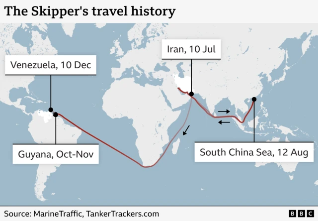
For instance, there is agreement, from July to October, the ship was in the Persian Gulf, the South China Sea, and the Gulf of Oman, then passed between Mozambique and Madagascar.
Kpler noted, however, that while its AIS showed the ship at Iraq’s Basrah Oil Terminal on 7 and 8 July, terminal reports showed no record of the vessel there. Instead, the Skipper loaded crude oil at Kharg Island in Iran, Kpler said.
Likewise, AIS data puts the Skipper off Guyana in late October until 7 November. The signal for its onboard tracker is not picked up again on MarineTraffic until 10 December, after the US seizure.
During this signal loss, TankerTrackers.com says it spent this time near Barcelona, Venezuela, and says a satellite image shows it at a terminal near there, before heading north-west toward Curacao.
The firm, and Kpler, both say that on 7 December, satellite imagery shows the Skipper engaged in a ship-to-ship transfer with another vessel.
It’s unclear how much oil cargo was transferred.