
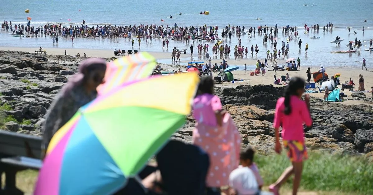
It’s warm and sunny until thundery showers arrive this weekend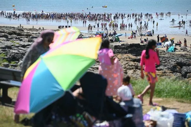 Busy scenes on Rest Bay, Porthcawl as surfers gather in the water(Image: Richard Swingler)
Met Office weather maps show that parts of Wales are on the brink of yet another heatwave within the coming days, but as soon as the school summer holidays start, so does the rain.
A UK heatwave threshold is met when a location records a period of at least three consecutive days with daily maximum temperatures meeting or exceeding the heatwave temperature threshold, which is 25°C in Wales. Temperatures in parts of the country including Monmouth, Newport, and Wrexham, are forecast to hit 24-25°C on Wednesday, Thursday, and Friday.
4pm on Wednesday:
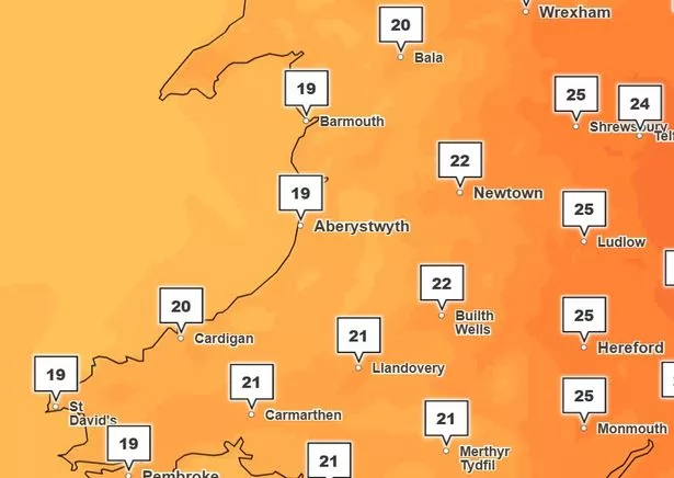
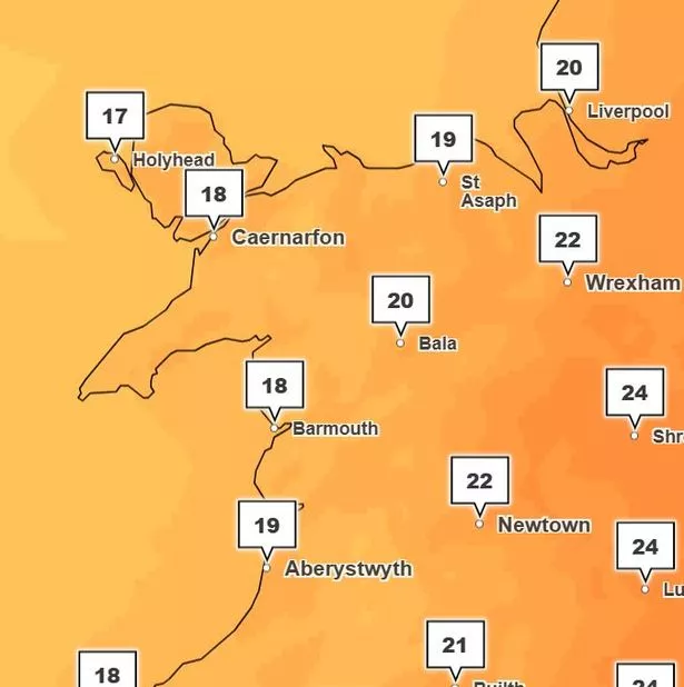 A warm, sunny and dry day is forecast for Wales on Wednesday
4pm on Thursday:
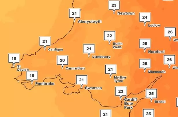 Another warm day is forecast for Thursday, with Monmouth set to reach 25 degrees
4pm on Friday:
 The second day of 25 degrees in Monmouth means it is just shy of hitting heatwave status
This will last until Saturday, the start of the six-week long school summer holidays, when rain is set to replace the sun, and lash down on our nation.
If you live in mid or West Wales, the rain for you might even come early. On Friday, between 4am and 7am 48mm of rainfall is forecast in Llandeilo, all the way up to Lampeter. It will be raining, though less heavily, in areas surrounding and including Pembrokeshire, Swansea, Aberystwyth, and Llandovery at this time.
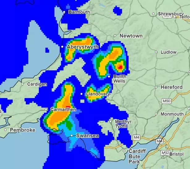 The highlighted areas show the worst rainfall in red and amber colours
The worst of the rain is due on Saturday and Sunday, with weather maps showing around 75% of the nation covered in rainfall at 10am. By 1pm the rain moves west and will be hammering down on Pembroke, St David’s, and Fishguard. By 4pm, the rain will stop in the West and return to mid-Wales.
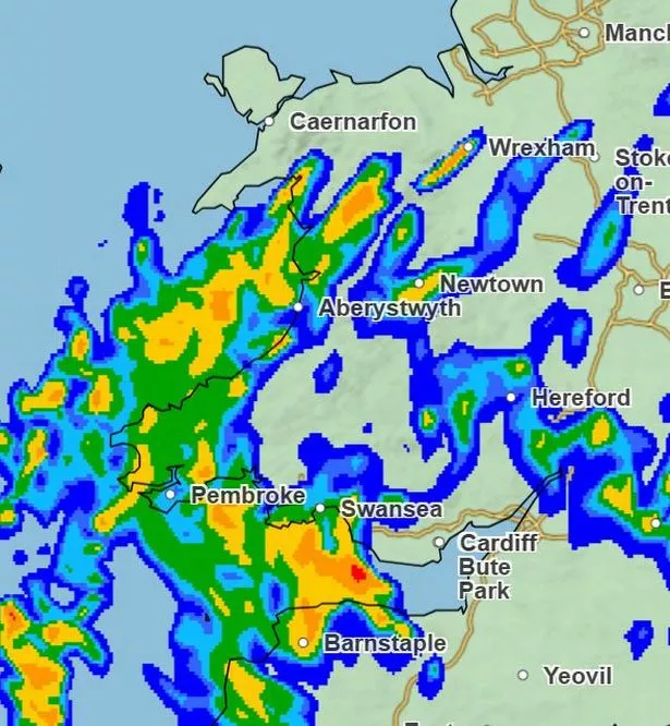 On Saturday, almost all of the nation will experience heavy rainfall, and thundery showers.
On Sunday, maps show that rainfall will be less severe, but will continue to cover a large area in mid to north Wales.
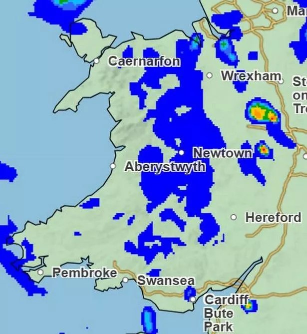 The rainfall on Sunday will cover a large area, but will not be as heavy
A spokesperson for the Met Office said: “Wednesday will be a largely dry and bright day with some spells of sunshine. Thicker cloud and patchy rain however may arrive into the southwest later. Feeling warmer, especially in the sunshine.
“It will get warmer on Thursday and Friday with a mix of sunshine and a scattering of showers.
“Rain chances increase on Saturday, with some heavy and thundery rain possibly developing.”