
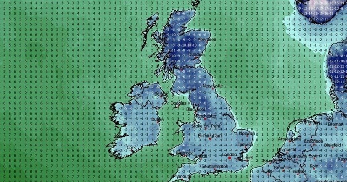
The UK is set for a brutal Arctic blast with a week of temperatures which could drop as low as -14C while more than 40cm of snow could fall in parts of the country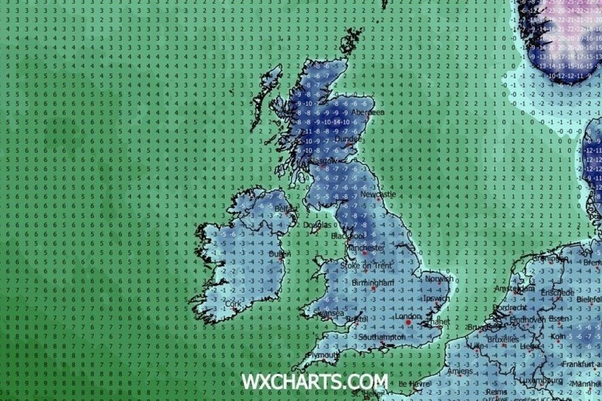 A map turns blue as the country faces an Arctic blast(Image: WX Charts)
Brits are facing an Arctic blast to start the New Year with a week of icy temperatures which could dip as low as -14C as well as more than 40cm of snow falling.
The cold air has already started to arrive with colder northern air moving down over the UK which means people are advised to wrap up warm for end of year festivities. But it is expected to get notably colder still according to weather maps which have turned a dark blue while they also indicate snow up and down the country.
According to the latest weather models from WX Charts, the UK will be in the grasp of the cold snap from January 4 until January 10, as Brits can expect seven days of serious chills.
 A temperature map for January 8(Image: WX Charts)READ MORE: Boy, 13, seriously injured after Boxing Day horror crash between car and dirt bikeREAD MORE: Pensioner dies after Christmas day ‘disturbance’ near retirement home
During that time, sub-zero lows are widespread overnight and highs struggling to rise much above freezing for the entire week.
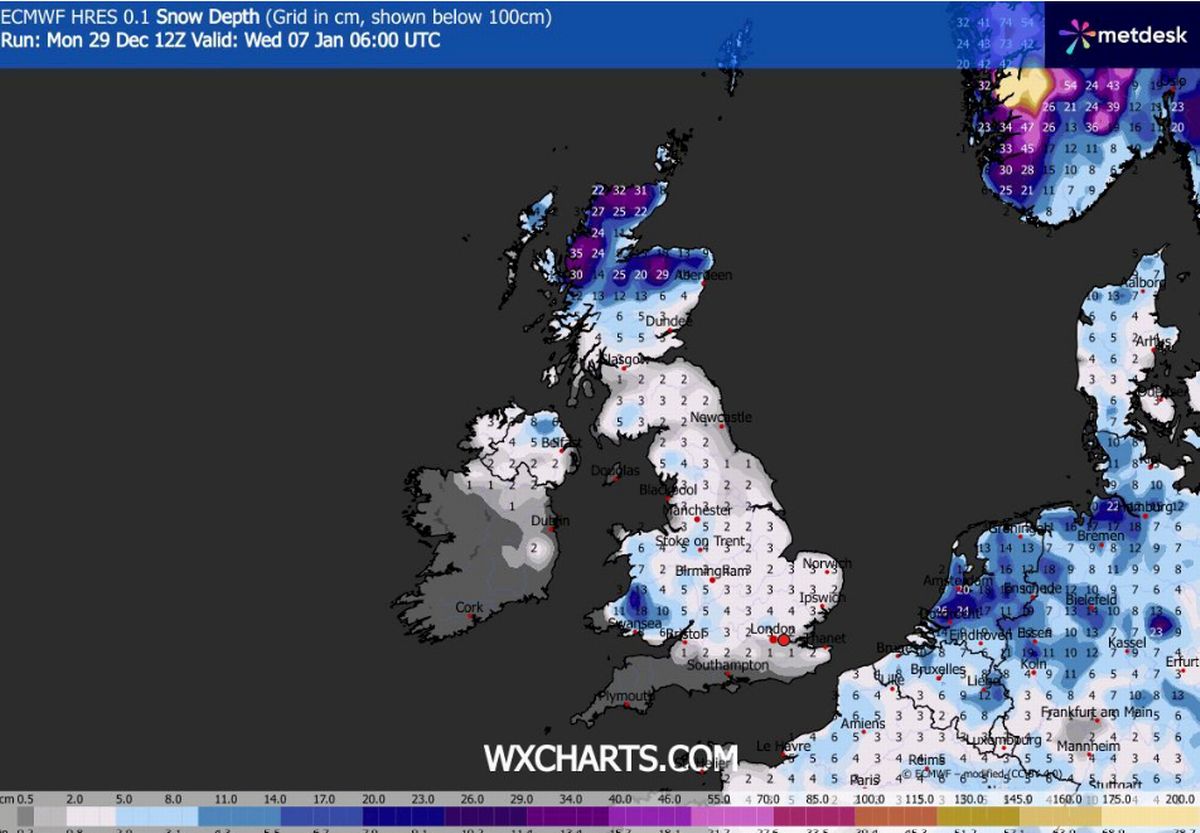
With the arrival of low pressure systems from the west hitting the cold air, it also means there will be plenty of snow and by January 6 it will cover the length of the UK down to the south coast.
And by January 8 there could be as much as 43cm of snow in western Scotland and up to 17cm could fall in northern England. Here’s how the cold spell is shaping up day by day:
January 4
The freeze well and truly begins on January 4 with much of the UK only experiencing daytime highs of around 1C to 3C, while overnight, the mercury can expect to drop significantly. By midnight, areas in northern Scotland may drop to -10C, while the vast majority of the UK will experience an overnight freeze with temperatures of -4C.
January 5
Much of that cold air will continue to pool the following day and by midday, only some areas in southern England will crawl into positives, with WX Charts forecasting highs of around 1C.
By 6pm a notable freeze will arrive with the whole of the UK dropping well into the negatives with widespread -6C, -7C and -8C overnight. Parts of Scotland will be hit by the worst cold, with areas near Aberdeen set to see -14C.
 A snow map for January 7(Image: WX Charts)January 6
This looks to be the coldest night of the period, at 6pm temperatures dip below -5C across much of the UK, with the east of England among the worst hit areas, with parts of Norfolk to hit -7C in the early evening.
January 7
The colder-than-average conditions persist. Frost and icy surfaces will make travel hazardous, particularly in rural and exposed areas. Daytime temperatures seem to be slightly higher with highs of around 5C in central England.
Into the evening, the mercury in England and Wales will remain just above freezing, while Scotland will brace for another one of the coldest nights, with temperatures reaching -12C.
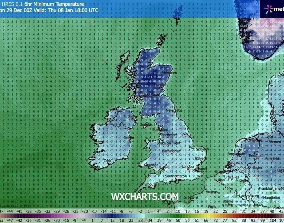
January 8
On Thursday, daytime highs in England will reach 2C or 3C, while areas in Scotland will be stuck dealing with highs of -7C. The evening will bring widespread -10C in Scotland.
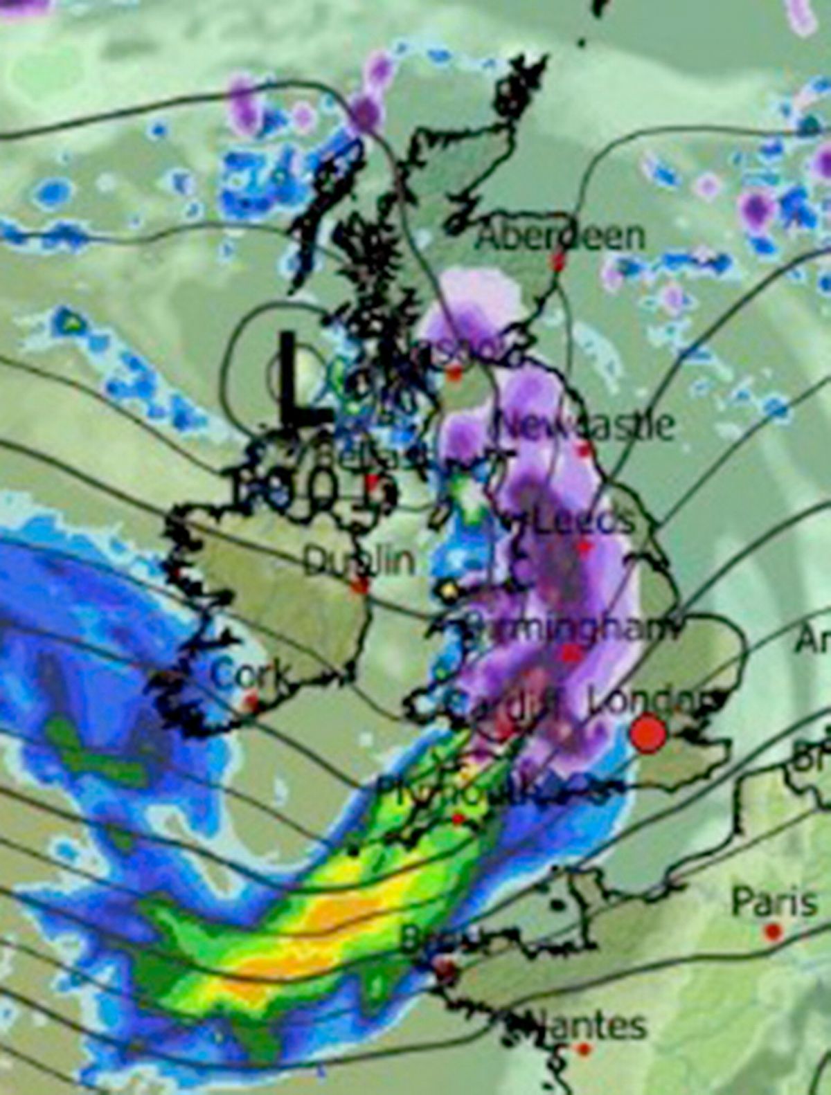 A low pressure is moving in from the west and will meet the cold air(Image: WX Charts)January 9
Colder air still holds firm, with daytime highs dropping once again, with only a small part of southern England reaching above 0C. Scotland will remain with highs of around -5C, which is once again set to drop overnight, seeing lows drop to -10C and -11C.
January 10
The cold snap begins to ease slightly, with daytime temperatures creeping up to highs of around 5C in England and 2C in Scotland. However, nights remain freezing and widespread frost and ice are still set to cause some disruption.
In a Met Office forecast, the agency says wind will bring arctic conditions. It adds: “These will bring snow showers to areas that are exposed to onshore winds. Subtle day-to-day changes in wind direction will change the places most exposed to the showers, but where they occur, some significant accumulations of snow are likely.
“There are likely to be some more coherent bands of sleet and snow working south, and these may bring a risk of more prolonged and widespread wintry precipitation affecting some inland areas.
“Things become less certain by the second week of January, however, it’s possible the cold conditions may persist with an ongoing risk of winter hazards across much of the UK.”