

Hundreds of postcodes across the UK are due to receive cold weather payments as temperatures plummet to -5C.
Snowfall is expected across much of the UK in a chilly start to the new year, with multiple ice and weather warnings in place.
As much as 40cm of snowfall is possible in the highest parts of Scotland, with 1-2cm widely expected across affected parts of England, forecasters said.
The Met Office has issued a yellow weather warning for snow and ice across large parts of England and Wales between midnight and noon on January 2, with nearly 700,000 households eligible for support.
The freezing weather gripping the UK means some people could qualify for a cold weather payment from the government to help pay for heating bills.
What are cold weather payments, and who is eligible?
Cold weather payments are given to people claiming benefits like universal credit and pension credit to help them cope with the additional costs of heating a home in sub-zero temperatures.
The eligible benefits are:
Income-based jobseeker’s allowance (JSA)
Income-related employment and support allowance (ESA)
Support for mortgage interest (SMI)
Payments are for households where the average temperature in their area is recorded as, or forecast to be, zero degrees celsius or below over seven consecutive days.
Households get £25 for each seven-day period of very cold weather between 1 November 2025 and 31 March 2026.
How do I claim a cold weather payment?
If you get a qualifying benefit, the system should add the payment automatically after each seven‑day period of very cold weather between 1 November and 31 March.
The money should reach a qualifying person’s account within about 14 working days of each cold spell and will appear alongside your usual benefit or pension payments.
If you believe your area had a cold‑weather trigger and you meet the benefit conditions but no payment has arrived, contact your local pension centre or Jobcentre Plus.
If you are on universal credit, you can use your online journal or call the universal credit helpline to report it.
Unsure if your postcode is eligible? Check using the postcode tracker tool on gov.uk.
What households are eligible for cold weather payments?
Around 674,000 people under 18 different postcodes are eligible for cold weather payments over the next week.
The list of postcodes triggered are:
North Yorkshire / Craven
BD23 – Skipton and surrounding villages
DL8 – Leyburn / Wensleydale
DL11 – Reeth / Swaledale
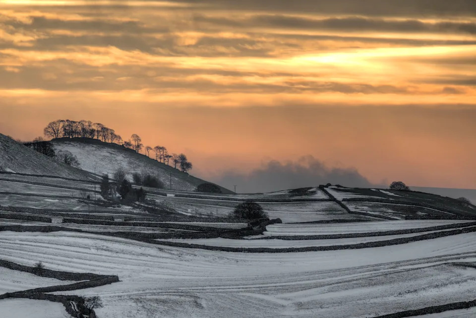
Areas of the Yorkshire Dales are experiencing sub-zero temperatures (PA)
County Durham & Darlington area
DH6 – Bowburn / Coxhoe area
DH7 – Sacriston / Lanchester area
DL5 – Newton Aycliffe
DL12 – Barnard Castle
DL13 – Stanhope / upper Weardale
DL14 – Bishop Auckland
DL17 – Ferryhill / Chilton
TS21 – Sedgefield / west of Stockton
TS29 – Trimdon Station / Deaf Hill
Cumbria / Brecon & mid‑Wales fringe
LD3 – Brecon and surrounding area (Powys)
Cambridgeshire (Cambridge, Ely, South Cambs, East Cambs)
CB1, CB2, CB3, CB4, CB5 – Cambridge city districts
CB6, CB7 – Ely and nearby villages
CB10, CB11 – Saffron Walden area (Essex but in CB area)
CB21, CB22, CB23, CB24, CB25 – South and east Cambridgeshire villages (Linton, Sawston, Cambourne, Cottenham, Bottisham etc.)
PE19 – St Neots (Hunts / Cambs edge)
Essex (Chelmsford, Braintree, Maldon, Uttlesford, Harlow)
CM1, CM2 – Chelmsford
CM3 – Rural east of Chelmsford / South Woodham Ferrers fringe
CM6 – Great Dunmow (Uttlesford)
CM7, CM77 – Braintree districts
CM9 – Maldon / Heybridge
CM11, CM12 – Billericay
CM13, CM14, CM15 – Brentwood
CM17, CM18, CM19, CM20 – Harlow
CM21 – Sawbridgeworth
CM22, CM23, CM24 – Takeley / Bishop’s Stortford / Stansted Mountfitchet
RM4 – Rural fringe: Havering‑atte‑Bower / Stapleford Abbotts / Abridge (Essex–London border)
Hertfordshire & Bedfordshire (SG + parts of CM/MK)
SG5 – Hitchin and surrounding villages (Herts/Beds)
SG6 – Letchworth Garden City
SG8 – Royston and surrounding villages
SG10, SG11 – Much Hadham / Standon / Puckeridge area
SG19 – Sandy and nearby villages
MK40, MK41, MK42 – Bedford
MK43 – Marston Moretaine / Cranfield area
MK44 – North‑east Bedford rural
MK45 – Ampthill / Flitwick
MK46 – Olney (Bucks/Beds/Northants border
Milton Keynes & north Buckinghamshire
MK1, MK2, MK3 – Bletchley districts
MK4, MK5, MK6, MK7, MK8, MK9, MK10, MK11, MK12, MK13, MK14, MK15 – Milton Keynes urban districts
MK16 – Newport Pagnell
MK17 – Woburn Sands and nearby villages
MK18 – Buckingham and villages
MK19 – Hanslope / rural north‑west of MK
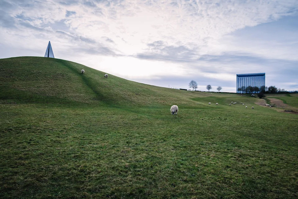
Campbell Park in Milton Keynes, where temperatures have dipped below zero (Alamy)
Northamptonshire
NN1, NN2, NN3, NN4, NN5 – Northampton urban area
NN6, NN7 – Rural north and south‑west of Northampton
NN8 – Wellingborough
NN9 – Raunds / Irthlingborough
NN29 – Wollaston and nearby villages
Norfolk (Norwich, King’s Lynn, Breckland, North Norfolk, Great Yarmouth, Waveney)
NR1, NR2, NR3, NR4, NR5, NR6, NR7 – Norwich city and suburbs
NR8, NR9, NR10 – Taverham / Drayton / Hethersett / Coltishall belts
NR11, NR12, NR13 – North‑east Norfolk / Broads villages
NR14, NR15 – Poringland / Loddon / Long Stratton
NR16, NR17, NR18 – East Harling / Attleborough / Wymondham area
NR19, NR20 – Dereham and rural surrounds
NR22, NR23 – Walsingham / Wells‑next‑the‑Sea area
NR24, NR25 – Melton Constable / Holt / Blakeney
NR28 – North Walsham
NR29 – Martham / north of Great Yarmouth
NR30, NR31 – Great Yarmouth / Gorleston
NR32, NR33 – Lowestoft (Suffolk)
NR34 – Beccles (Suffolk/Norfolk border)
NR35 – Bungay (Suffolk/Norfolk border)
PE30, PE31, PE32, PE33, PE34, PE35, PE36, PE37, PE38 – King’s Lynn, Hunstanton, Swaffham, Downham Market and surrounding Norfolk villages
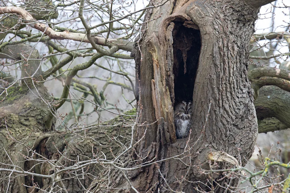
A tawny owl roosting in freezing Norwich (Getty)
Suffolk / Norfolk fringe (Thetford, Brandon, Mildenhall)
IP24 – Thetford (Breckland, Norfolk, close to Suffolk border)
IP25 – Watton (Breckland)
IP26 – Mundford and villages
IP27 – Brandon (Suffolk/Norfolk border)
IP28 – Mildenhall / Lakenheath (Suffolk)
PE12, PE13, PE14 – Long Sutton / Holbeach / Wisbech and Fens (Lincs/Cambs/Norfolk fringes)
North‑East England (Northumberland / Tyne Valley)
NE18 – Stamfordham area (Northumberland)
South Wales – Cardiff, Valleys, Gwent
CF37, CF38 – Pontypridd / Tonteg / Llantwit Fardre (Rhondda Cynon Taf)
CF39, CF40, CF41, CF42, CF43 – Porth, Tonypandy, Pentre, Treorchy, Ferndale (Rhondda Cynon Taf)
CF44, CF45 – Aberdare / Mountain Ash (Rhondda Cynon Taf)
CF46 – Treharris (Merthyr Tydfil / Caerphilly border)
CF47, CF48 – Merthyr Tydfil districts
CF81, CF82 – Bargoed / Ystrad Mynach (Caerphilly)
CF83 – Caerphilly and Bedwas area
NP4 – Pontypool (Torfaen)
NP11 – Risca / Abercarn (Caerphilly)
NP12 – Blackwood (Caerphilly)
NP13 – Abertillery (Blaenau Gwent)
NP22 – Tredegar (Blaenau Gwent)
NP23 – Ebbw Vale (Blaenau Gwent)
NP24 – New Tredegar (Caerphilly/Blaenau Gwent)
NP44 – Cwmbran (Torfaen)