
There could be further weather warnings issued next week by the Met Office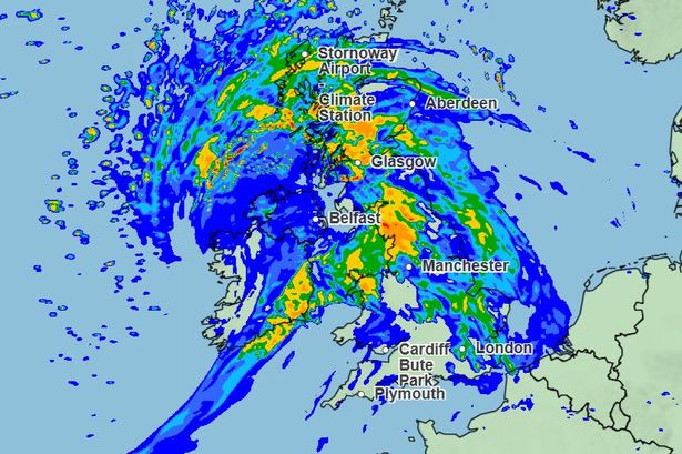 Met Office weather maps show a huge band of rain set to hit the UK on Monday(Image: Met Office)
The UK is set for some “unseasonably wet and windy” weather next week as a huge band of rain is heading towards the country.
Currently there is a yellow thunderstorm warning in place in the south of England which is set to remain in place until 9pm on Thursday (July 31), but there could be further warnings issued next week.
Speaking about the current warning, which affects parts of south west England, London, and east England, Met Office spokesperson Stephen Dixon said: “It’s important to note that not everywhere within that warning area will see those kind of rainfall totals.
“It’s a thunderstorm warning and thunderstorms by their very nature are fairly hit and miss. So some areas will see significantly less in the way of rainfall, but where you do see those heavier bursts of rain there’s the potential for some impacts which has resulted in that warning.”
He added: “It’s a bit of a messy meteorological set up over the UK.”
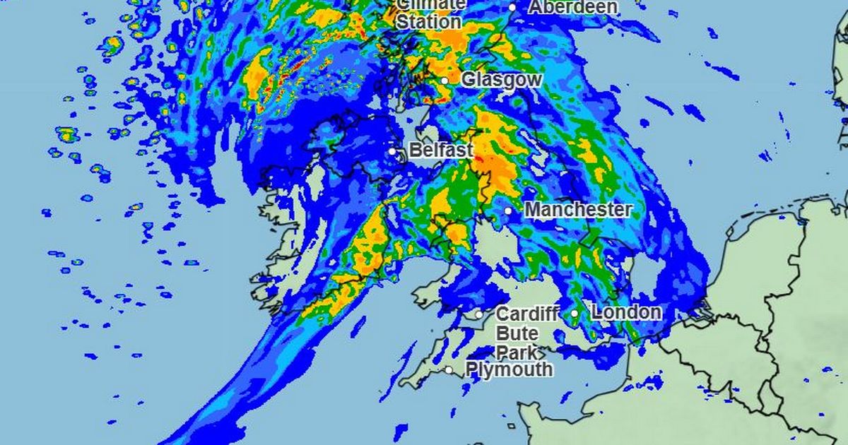
Looking at Monday (August 4), Met Office weather maps show a huge band of rain set to hit the UK from around 4am that day.
 This Met Office rainfall map shows a band of rain over the UK at 4pm on Monday (August 4)(Image: Met Office)
Further weather warnings may be issued for Monday as there is a “fairly good degree of confidence” that the UK will be hit by “some very strong winds and some heavy rain”, he added.
“Really what we’re looking at in the medium-range forecast period is the potential for some unseasonably wet and windy weather on Monday.”
Looking ahead at the period between August 5 and 14, the Met Office UK-wide forecast warns of more “windy and wet” weather, which changes to a higher chance of high pressure later in the month.
The forecast reads: “An unseasonably deep area of low pressure clearing to the east, may bring widely windy and wet weather at first, especially for the north or northeast of the UK.
“Following this will be a breezy but sunny day for most with a risk of showers in the north. The forecast around this is rather uncertain, however, and it is also possible that it will clear more quickly.
“As we move towards mid-month, there is an increased chance of high pressure becoming more dominant, leading to drier, warmer and more settled conditions becoming more widespread.”
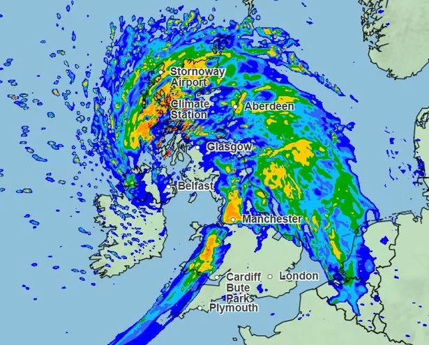
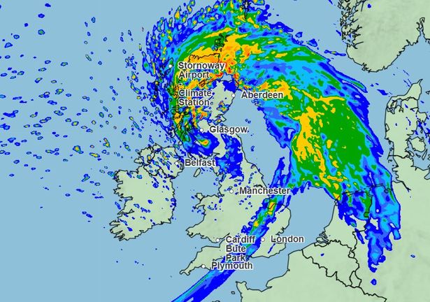 This Met Office map shows the rain above the UK on Monday (August 4) at 7pm(Image: Met Office)
The second half of August is set to be more settled, with “predominantly dry weather” and potential for “hot spells”.
Met Office’s UK-wide forecast for the final two weeks of August reads: “High pressure, and therefore fairly settled conditions overall, appears most likely for the second half of August, though the northwest may see more in the way of occasional rain or showers than other areas.
“For most, predominantly dry weather is likely to continue, although short periods of showers and thunderstorms cannot be ruled out.
“Above average temperatures overall seem most likely, with the potential for hot spells to develop, especially in the east and south, these more probable further into August.”