
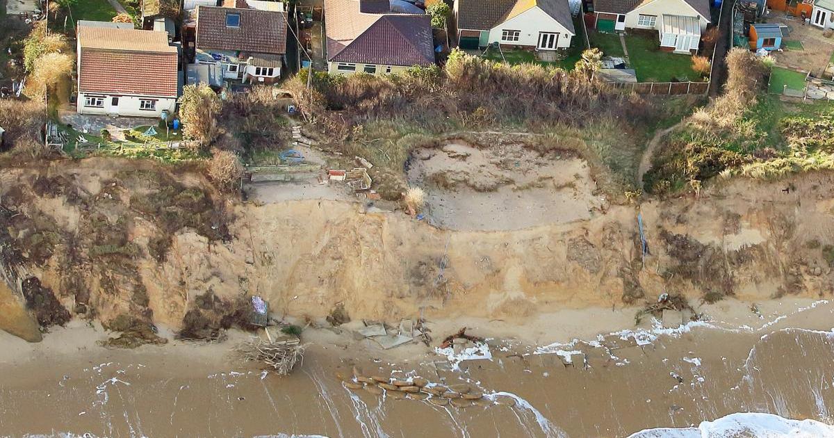
The walkway followed a road through the dunes in Hemsby and was used when high tides made the beach section of the walking route impassable.
However, much of the road, which is known as The Marrams, has been swept away in recent years by strong winds, high tides and storms.
Last February, after part of the path was declared unsafe and inaccessible to the public, Norfolk County Council proposed finding a replacement route.
The remains of the road through The Marrams, pictured last year, after the erosion due to high tides at Hemsby (Image: Denise Bradley)
One year on – and after at least another 10 metres of land were lost to erosion – an alternative path has not yet been located.
A spokesperson for County Hall said: “We continue to work closely with the community, coastal management representatives from Great Yarmouth Borough Council and Natural England to find a new route for the Norfolk Coast Path National Trail in this area.”
The section of the path at Sidestrand has also been affected by coastal erosion, and has been rolled back four metres away from the edge of the cliff.
At Happisburgh, another erosion hotspot, the path has been re-routed along a permissive path and a permanent longer-term route is being planned.
The cliff edge at Hemsby pictured in December. (Image: Sonya Duncan)
The trail, which stretches 84 miles from Hunstanton in the west to Hopton in the east, is used year-round by both residents and visitors to Norfolk.
It attracts thousands of people to the region every year. The route was opened in 1986 and forms part of the 2,700-mile England Coast Path.
In 2009, the Marine and Coastal Access Act allowed provision for the paths to move back with erosion, ensuring continuity of access for walkers.
Since the middle of December last year, Great Yarmouth Borough Council has been demolishing 23 houses on the Hemsby coast which were declared at imminent risk of collapsing into the sea.
Over the past 12 years, Hemsby has lost a total of 34 homes to the North Sea.