
It will be wet, windy and snowy in parts of Wales next week and into February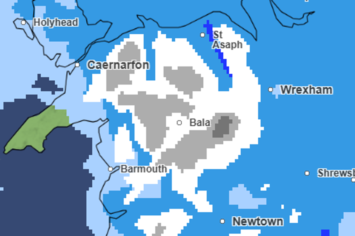
Snow and wintry conditions is expected for Wales next week(Image: Met Office )
Snow is expected across Wales next week as temperatures drop in the last week of the month and could continue for the next month. This weekend is looking like a wet and windy two days as Met Office forecasts suggest heavy showers and “coastal gales” possible.
The forecaster has also said that Wales will see unsettled weather at the start of next week as “bands of rain bring prolonged heavy downpours.” Weather maps also show snow across Wales from Monday, January 26 , through to Wednesday, January 28.
Met Office forecasters say the UK continues to sit between the influence of high pressure to the northeast, and low pressure trying to move in from the southwest. This is leading to a continuation of unsettled weather, and a mix of conditions across different parts of the UK. For our free daily briefing on the biggest issues facing the nation sign up to the Wales Matters newsletter here.
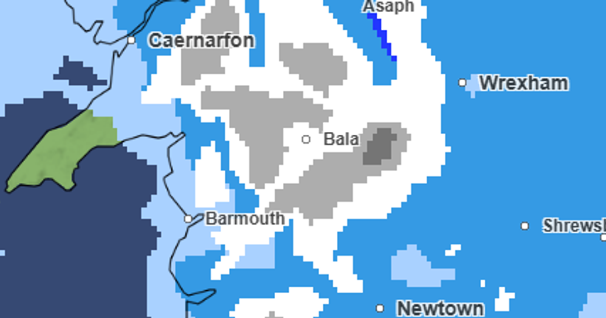
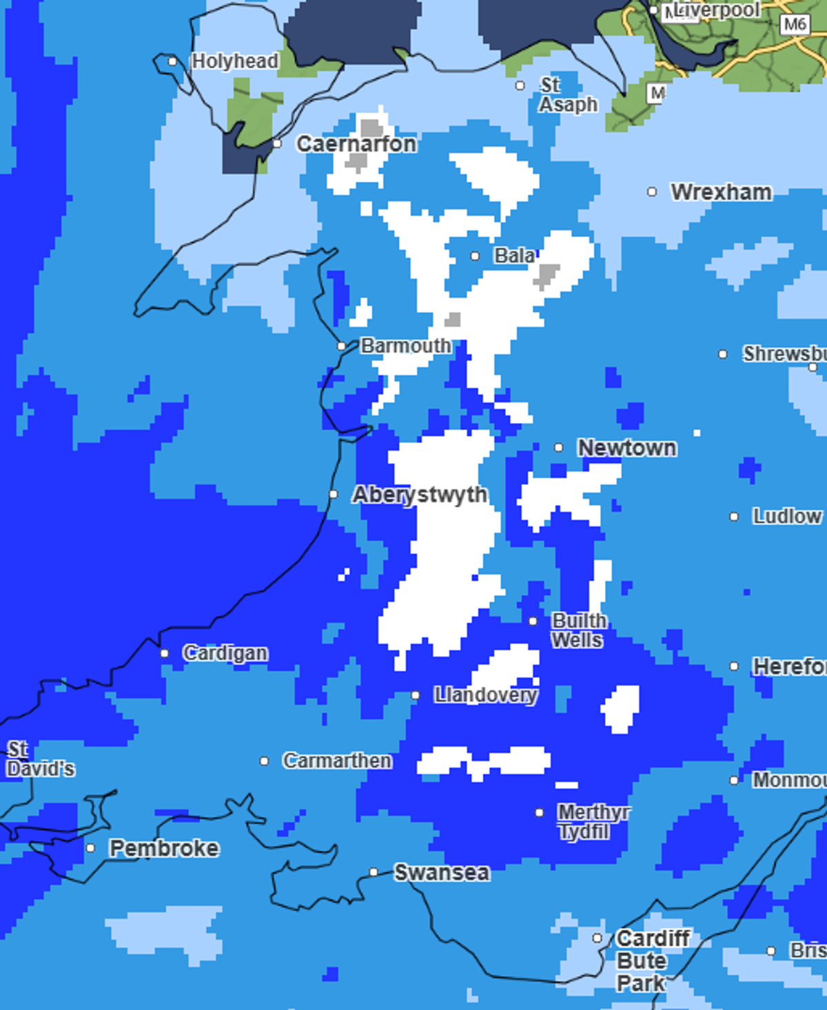
Met Office weather maps show snowfall near Aberystwyth on Monday afternoon around 3pm heading to Caernarfon and Bala as precipitation moves westwards.
Tuesday, January 27, will have the most snow according to the maps, spreading across a larger area of Wales than Monday and Wednesday hitting mainly north and mid Wales.
Weather maps show snow in Wales on Tuesday at 9am (Image: Met Office )
Rain will pour across the rest of Wales next week with some areas seeing heavy downpours that could cause flooding. For the biggest stories in Wales first, sign up to our daily newsletter here.
The Met Office says that it is possible another deep area of low pressure could approach the southwest of the UK through Tuesday morning. This could bring another day of very wet and windy conditions to areas that have suffered from stormy conditions through January. Other scenarios would see the low track further south, reducing the risk of impactful weather.
Deputy chief forecaster, Steve Kocher, said: “With the jet stream directing areas of low pressure towards the south of the UK, there is a possibility of another very unsettled spell of weather as we move through Tuesday and Wednesday.
“While there is still uncertainty at this lead time, there is the chance of very wet and windy weather in the southwest again, with rain possibly turning to snow as it moves further north and interacts with colder air being dragged in from the east.
“The forecast will certainly develop over the coming days, so it is important to keep up to date and be aware of any severe weather warnings that are issued.”
Moving into the end of January and beginning of February the weather throughout the UK unsettled weather will continue to bring rain, wind and there is the risk of some snow.
The Met Office long range forecast for Wednesday, January 28, to Friday, February 6, across the UK states: “Further spells of rain or showers are expected at times.
“These may be heavy and persistent, especially in the south and west. Whilst mild conditions are expected to encroach into the south and southwest at times, cold air is likely to be positioned to the northeast, bringing wintry showers at times.”
It add: “Where fronts from the south west do reach the cold air towards the north east, there is the risk of some snow, most likely across hills, but perhaps extending to other areas at times.”
Get daily breaking news updates on your phone by joining our WhatsApp community here. We occasionally treat members to special offers, promotions and ads from us and our partners. See our Privacy Notice