
River deltas are among the most complex and productive environments on Earth. Yet, they face serious threats from upstream industrialization and climate change, which alter supplies of water, sediment and contaminants. Even deltas distant from densely populated and industrialized areas are not immune to these stressors.
Nestled in a remote area of northeastern Alberta is the world’s largest freshwater boreal delta. Spanning 6,000 km², the Peace-Athabasca Delta is the traditional territory of Indigenous nations and a haven for biodiversity. The Delta is recognized internationally as a Ramsar Wetland of International Importance. It also contributes to Wood Buffalo National Park’s designation as a UNESCO World Heritage Site.
Despite these recognitions, concerns have persisted for decades that hydroelectric dams on the Peace River, oilsands mines along the Athabasca River and climate change are degrading the Delta by reducing freshwater availability and increasing contaminants.
In 2014, the Mikisew Cree First Nation highlighted these concerns and petitioned UNESCO to include the park on UNESCO’s list of world heritage sites in danger.
This designation would be a first for Canada.
This has renewed calls to establish a lake monitoring program to track environmental changes and their causes. Yet, the Delta’s vast size, remoteness and hydrological complexity pose challenges that are difficult to overcome.

Fort Chipewyan, on the boundary of Wood Buffalo National Park, is home to many members of the Mikisew Cree First Nation, Athabasca Chipewyan First Nation and Fort Chipewyan Métis Nation who have expressed concerns about the impact of industrial development on the Peace-Athabasca Delta.
THE CANADIAN PRESS/Jeff McIntosh
Freshwater availability
During our 25 years of research in the delta, we also recognized the need for lake monitoring to track environmental changes caused by the threats. After engaging with stakeholders and rightsholders, we launched an intensive, multi-faceted seven-year research program in 2015. The research demonstrates methods for ongoing monitoring of freshwater availability and contaminants across the Peace-Athabasca Delta.
Our research highlights that water isotope tracers are effective for tracking freshwater availability across space and time. This method measures ratios of naturally occurring stable isotopes of hydrogen and oxygen in water molecules. It can identify the roles of snowmelt, rainfall, river flooding and evaporation on lake water balance.
Using water isotope tracers, freshwater availability can be expressed as evaporation-to-inflow (E/I) ratios. This metric compares how much water flows into a lake versus how much water leaves by evaporation.
Maps of E/I ratios reveal where lakes are prone to drying from evaporation (areas in orange and red). It also reveals where lakes receive large inputs of river floodwater and precipitation (blue areas).

Three maps showing lake evaporation-to-inflow (E/I) ratios across the Peace-Athabasca Delta. Correspondence of trendlines for lake E/I ratios and a climate index reveals strong influence of climate on freshwater availability.
(Author provided)
Time-series graphs reveal a strong influence of climate on freshwater availability. They demonstrate that E/I ratios at 60 lakes across the Delta correspond with a climate index. Departures from this correspondence would potentially signal that freshwater availability is being altered by other human activities.
Industrial contaminants
In 2010, freshwater scientist David Schindler drew attention to the inability of existing monitoring programs to determine “the extent to which mining has increased concentrations of contaminants in the [Athabasca] river over natural background levels.” A key missing piece was that natural background levels, before mining began, remained unknown.
Following subsequent recommendations of a federal Oilsands Advisory Panel report in 2010, we determined the natural (baseline) concentrations of contaminants in lake sediment deposited before oilsands mining began. We then compared this to concentrations in sediment deposited afterwards to assess for pollution.

Time series of Enrichment Factors (EF) reveals enrichment of vanadium after the onset of mining at a lake in the heart of oilsands development (‘Down 1’), but not at lakes in the Peace-Athabasca Delta.
(Data derived from Neary et al. (2024) and Klemt et al. (2020)), Author provided (no reuse)
As shown in the above graph, we applied this method to measurements of vanadium, a metal abundant in bitumen and mine wastes. Results show enrichment at a lake near the mines due to emissions from the mines, but no enrichment at lakes in the Delta. In other words, mining has not increased vanadium concentrations in the lakes of the Delta.
Monitoring is needed to inform policy
Continued use of these approaches is critical for tracking freshwater availability, detecting pollution and determining causes of change. Such information is needed to inform upstream land-use and water-use decisions and policies, and to evaluate their effectiveness.
Water releases from the W.A.C. Bennett Dam on the Peace River are being considered as a strategy to increase freshwater availability in the Delta. Also under consideration is the release of treated oilsands mine wastewater into the Athabasca River to enable landscape remediation.
These decisions come with costs and risks, and their effectiveness must be evaluated if implemented.
Evaluating strategic water releases could be done by measuring water isotope tracers and depth variation at lakes across the Delta before and after each release. These measurements have been adopted for lake monitoring elsewhere in Northern Canada. Their benefit is that these measurements allow us to determine the impact of river floodwaters versus snowmelt on the amount of freshwater in a lake.

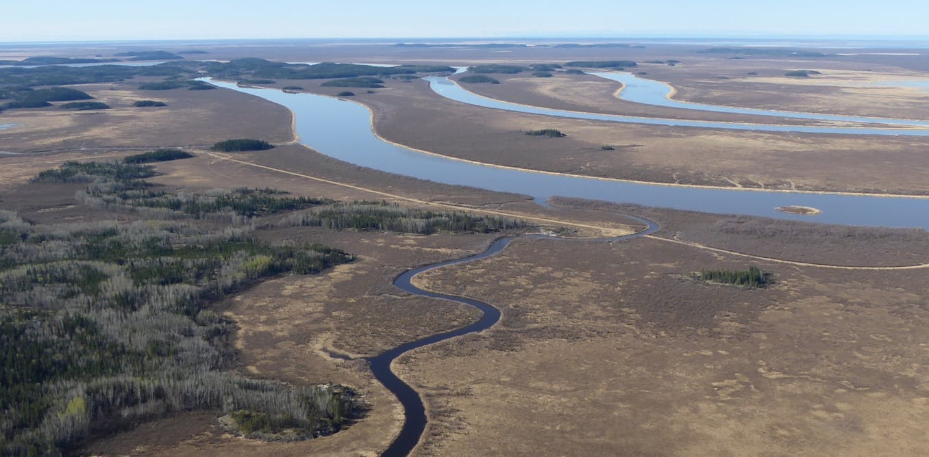
An aerial image of a river and lake in the Peace-Athabasca Delta.
(Casey Remmer), Author provided (no reuse)
New legislation may allow the release of treated mine wastewater into the Athabasca River. If so, robust baselines generated from lake sediment deposited before oilsands development can be used to detect pollution in recently deposited surface sediment.
More than 50 years ago, the Peace-Athabasca Delta Project Group identified the need for long-term monitoring in the Delta. Many years later, UNESCO’s first fact-finding mission recommended expanding monitoring and project assessments to include possible individual and cumulative impacts of industrial developments on Wood Buffalo and the Peace-Athabasca Delta.
This year, UNESCO will conduct another fact-finding mission to decide on Wood Buffalo National Park’s World Heritage status. The approaches we have developed for monitoring directly address long-standing recommendations from UNESCO and many other governance bodies. They also provide stakeholders with tools to safeguard this world-renowned Delta now and in the future.