

Satellite picture said to show damage to US Navy base is AI fakepublished at 11:55 GMT
11:55 GMT
 Thomas Copeland
BBC Verify Live journalist
An image claiming to show damage to a US naval base in Qatar as seen from space is an AI fake, based on an old satellite image from a different place.
The image, posted on X by Iran’s state-aligned Tehran Times and shared widely online over the weekend, claims it shows destroyed US radar equipment in Qatar.
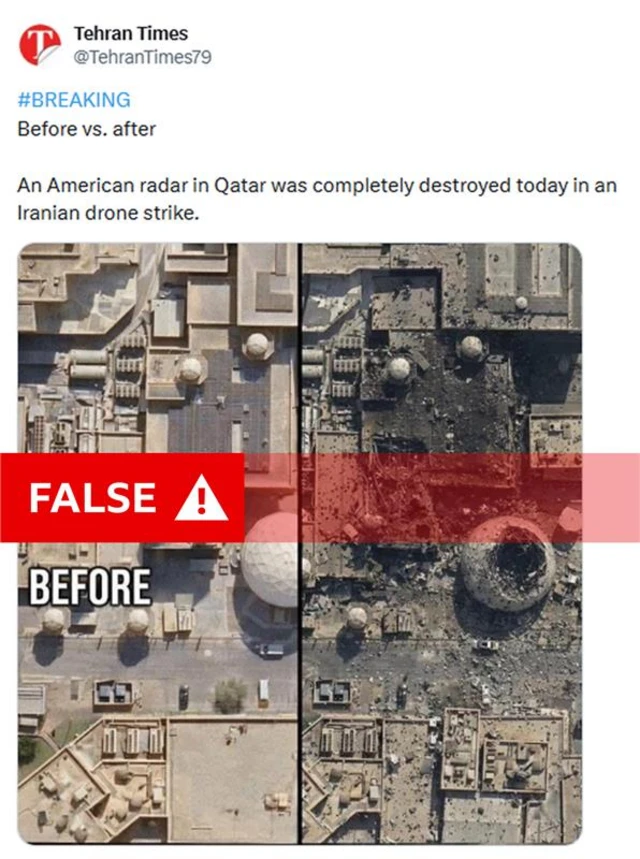
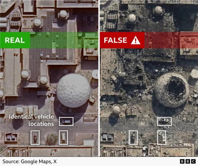
The fake picture of damage appears to be based on real satellite imagery of a US base in Bahrain from February 2025, which is publicly available on Google Maps and Google Earth.
The before and after image was generated or edited with Google AI, according to Google’s SynthID watermark detector.
We can also see discrepancies in the roof of the building at the bottom of the so-called “after” picture compared with the original satellite image. We can also see three vehicles parked in the exact same spaces in both the genuine satellite imagery and the AI picture – despite the pictures allegedly having been taken a year apart.
We have verified multiple videos showing strikes on the US Navy’s Fifth Fleet headquarters in Bahrain on Saturday.
A senior Bahraini official told BBC News the base was struck on Saturday evening by an Iranian drone that caused a major fire.
The drone impacted right next to the UK naval facility that adjoins the US area but there were no casualties as the area had been evacuated, the official added.