
Weather maps show parts of the UK dropping to -12C this month
18:32, 07 Mar 2026Updated 18:32, 07 Mar 2026
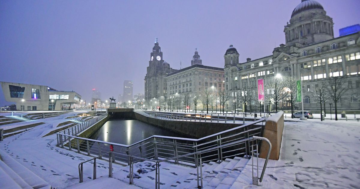
Snow falls on the Liverpool waterfront(Image: Colin Lane/Liverpool Echo)
Temperatures are expected to drop sharply as snow moves across large parts of the UK, with weather maps indicating a significant cold snap could arrive within days. However, both the Met Office and BBC Weather say the colder conditions are more likely later in the month and should be manageable in areas such as Liverpool compared with the far north of Scotland.
According to the GFS weather model, snowfall is expected to spread across a huge area of the country by around 9am on Sunday, March 15. While the heaviest snow is initially forecast for northern Scotland, flurries are also predicted across Northern Ireland, Wales and parts of the North West, putting cities such as Liverpool and Manchester at risk.
Conditions could deteriorate further overnight into March 16 as another wave of snow pushes across southern England and Wales. Areas including South Wales, Gloucestershire and Hampshire are forecast to see heavy snowfall first before the system shifts.
By around 3am, the maps indicate intense snowfall could move across parts of the Midlands and the south east, including London and Essex. However, by the afternoon the snow band is expected to drift northwards again, bringing wintry conditions back across North Wales, the Pennines and large parts of the North West.

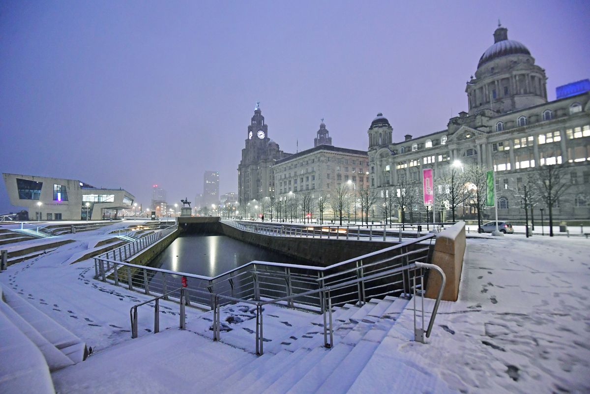
Snow falls on the Liverpool waterfront(Image: Colin Lane/Liverpool Echo)
Snow coverage charts suggest that by 6am on March 16, widespread areas – including the North West, Wales, the Midlands, southern England, Northern Ireland and Scotland – could see snow lying on the ground.
Temperatures are also expected to drop sharply, with lows potentially reaching -12C in the far north of Scotland. Northern England and Northern Ireland could see temperatures fall to around -3C, while parts of Wales may drop to -5C.
Met Office’s Liverpool report for March 22 to April 5 says there could be periods of unsettled conditions across the UK with spells of rain and strong winds.
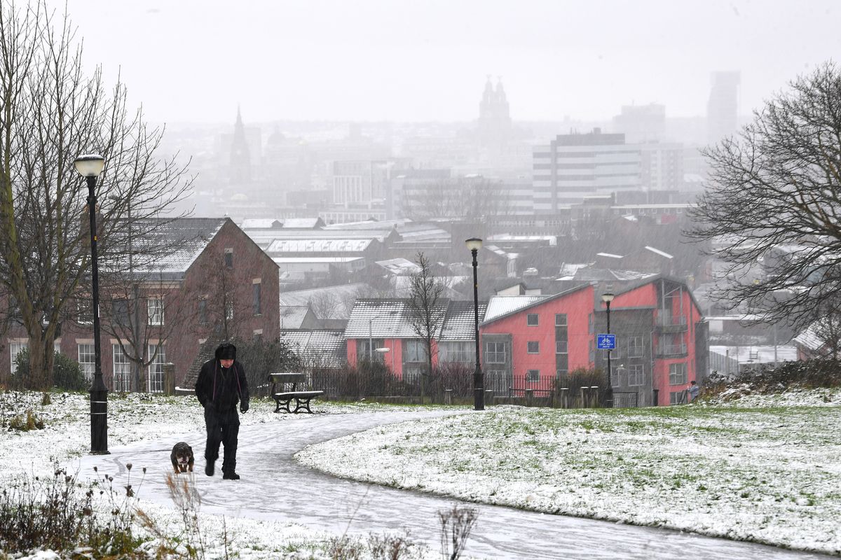
Snow falls in Everton Park(Image: Liverpool ECHO)
It said: “There is the potential for weather patterns to become slower-moving by late March, bringing more settled and drier conditions . Overall, temperatures will probably end up near to average, though there are indications of a cooler spell near the turn of the month.”
BBC Weather has warned of “wintry showers” from March 16 to 22. The report said: “It will probably be a little bit cooler overall, although day to day temperatures will vary a bit as weather systems come in from the Atlantic.
“These weather systems will also bring spells of showery weather, and it is still early enough in the year for there to be a chance of some wintry showers over higher ground in the north of the UK.”