
A compass doesn’t point where you think it does. It chases a moving target, one that just crossed into territory no navigation system has ever mapped. The magnetic north pole now has a freshly certified location, and the update confirms something that would unsettle any pilot or ship captain relying on old charts. The pole is no longer closest to Canada.
It now sits officially closer to northern Russia, completing a drift that began more than 190 years ago in the high Canadian Arctic. The numbers come from the World Magnetic Model 2025, released by NOAA’s National Centers for Environmental Information and the British Geological Survey. This is the same model that feeds correction data into the navigation systems of commercial airliners, NATO warships, and the compass app on your phone.
The pole didn’t just shift. It decelerated sharply. After tearing across the Arctic at speeds up to 60 kilometers per year during the 1990s, the drift has slowed to roughly 35 kilometers per year. Researchers have recorded it as the largest single deceleration in pole speed ever measured. Something nearly 3,000 kilometers beneath the surface, in the planet’s molten outer core, changed tempo.
A 2,200-Kilometer March Into Uncharted Magnetic Territory
Geographic north stays put. It’s pinned to the axis. Magnetic north obeys a different master entirely. Electric currents generated by churning liquid iron and nickel in Earth’s outer core produce the magnetic field, and when those currents shift, the pole moves with them.
Since its documented position in the Canadian Arctic, the pole has covered more than 2,200 kilometers. For most of that journey, the pace was manageable. Then the 1990s arrived and the pole sprinted. The recent braking has given scientists a rare chance to study what drives these speed changes, though the mechanisms remain an open question.
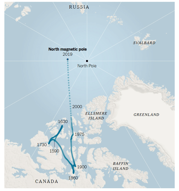 The north magnetic pole, the point on the Earth where a compass needle would point down, is sliding about 35 miles closer to Russia each year. By Jonathan Corum | Source: National Oceanic and Atmospheric Administration
The practical problem is immediate. Older models assumed the pole was somewhere it no longer is. Every degree of error in magnetic declination compounds across distance. For a transpolar flight or a submarine running silent, that error isn’t theoretical.
Two Models, One Upgrade That Changes Navigation
NOAA and the British Geological Survey didn’t just issue a routine update this cycle. They released two versions. The standard WMM2025 covers the baseline correction for most global navigation systems. Alongside it comes the first-ever World Magnetic Model High Resolution (WMMHR2025).
The difference in resolution is substantial. The standard model works at roughly 3,300 kilometers at the equator. The high-resolution version sharpens that to approximately 300 kilometers. For polar aviation corridors and military operations near the top of the world, that jump in spatial detail translates directly into safer routing and fewer blind spots.
NOAA is actively urging users to adopt the high-resolution product. The agencies also redrew the boundaries of magnetic blackout zones, the polar regions where compass needles become erratic and unreliable. Those zones migrated along with the pole toward Siberia, a shift that matters for anyone planning expeditions or operations at high latitudes.
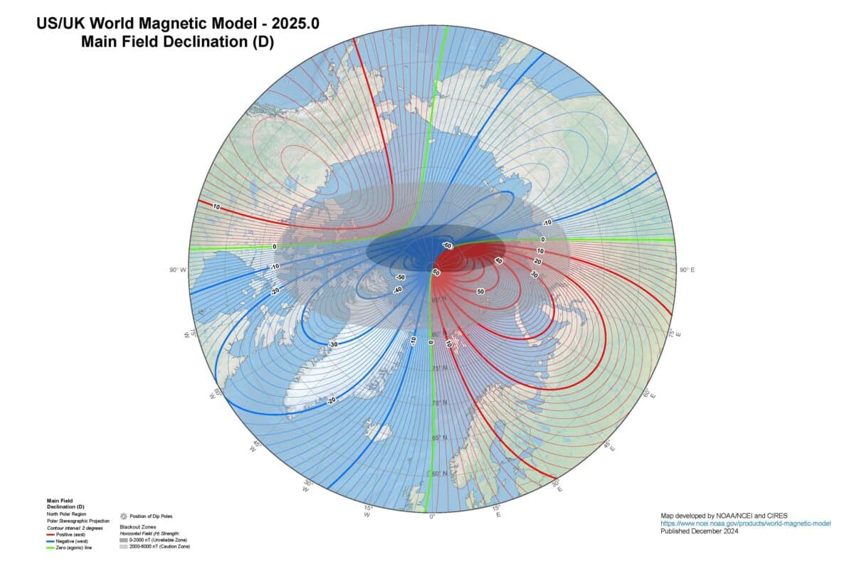 A closer look at the map above shows the north dip magnetic pole (marked by a bold white asterisk) is now closer to Siberia than it is to Canada. Credit: NOAA/NCEI
The World Magnetic Model is a joint product of the United States’ National Geospatial-Intelligence Agency and the United Kingdom’s Defence Geographic Centre. Development and distribution are handled by NCEI and the British Geological Survey.
From Your Phone to a Nuclear Submarine
The WMM’s reach is hard to overstate. The U.S. Federal Aviation Administration bakes its corrections into commercial flight routing. The U.S. Department of Defense and NATO rely on the model for positioning across air, land, and sea domains. The UK Ministry of Defence and the UK Hydrographic Office treat it as their standard reference.
Consumer technology depends on it just as heavily. Smartphone operating systems pull magnetic declination data from the WMM to make compass apps and map orientations accurate. Every time you see that blue dot steady itself on a map, part of that calculation traces back to this model. GPS satellites themselves factor in magnetic field variations when determining position fixes.
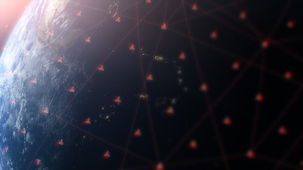 Every map app, airliner, and submarine relies on this model. An outdated compass reading isn’t a glitch. It’s a growing danger. Credit: Shutterstock
The stakes climb in environments where GPS signals weaken or disappear. Submarines navigating below the surface and aircraft crossing Arctic routes keep magnetic compasses as backups. If those backups rely on an outdated model, the margin for error narrows fast. The five-year update cycle isn’t bureaucratic routine. It’s a hard deadline driven by the unpredictable behavior of the magnetic field itself.
No Flip Coming, Just Constant Motion
A geomagnetic reversal sounds apocalyptic. North becomes south, south becomes north, and the magnetic field temporarily weakens. The geological record shows these flips happen roughly every few hundred thousand years. Nothing in the current data suggests one is approaching.
What the data does show is a magnetic field in constant, uneven motion. Changes in core dynamics and interactions with solar activity keep the field in flux. The agencies monitoring it describe an evolving system, not a collapsing one.
The outcome of this update is concrete. The pole moved. The model caught up. Navigation systems that touch nearly every sector of modern life now operate with a more accurate picture of where magnetic north actually sits. And the field itself keeps moving, indifferent to the maps drawn above it.