
Your support helps us to tell the story
From reproductive rights to climate change to Big Tech, The Independent is on the ground when the story is developing. Whether it’s investigating the financials of Elon Musk’s pro-Trump PAC or producing our latest documentary, ‘The A Word’, which shines a light on the American women fighting for reproductive rights, we know how important it is to parse out the facts from the messaging.
At such a critical moment in US history, we need reporters on the ground. Your donation allows us to keep sending journalists to speak to both sides of the story.
The Independent is trusted by Americans across the entire political spectrum. And unlike many other quality news outlets, we choose not to lock Americans out of our reporting and analysis with paywalls. We believe quality journalism should be available to everyone, paid for by those who can afford it.
Your support makes all the difference.Read more
Temperatures are set to peak again this week, after this summer was named the hottest since records began nearly 150 years ago.
The UK experienced a wetter and colder end to August, following five back-to-back heatwaves that plunged most of the country into drought.
Yellow warnings were in place for heavy showers and thunderstorms over the weekend.
Related: How will extreme weather caused by the El Nino affect the UK?
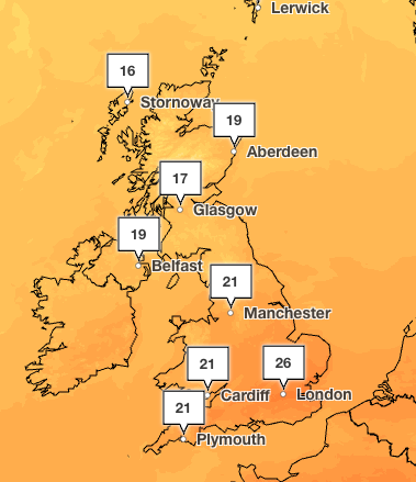 Temperatures are forecast to hit 26C on Thursday in London (Met Office)
But by 4pm Thursday, temperatures are set to creep back up to the mid-20s and hit 26C in London.
Most of the UK will enjoy temperatures in the low 20C with Manchester, Cardiff and Plymouth seeing highs of 21C.
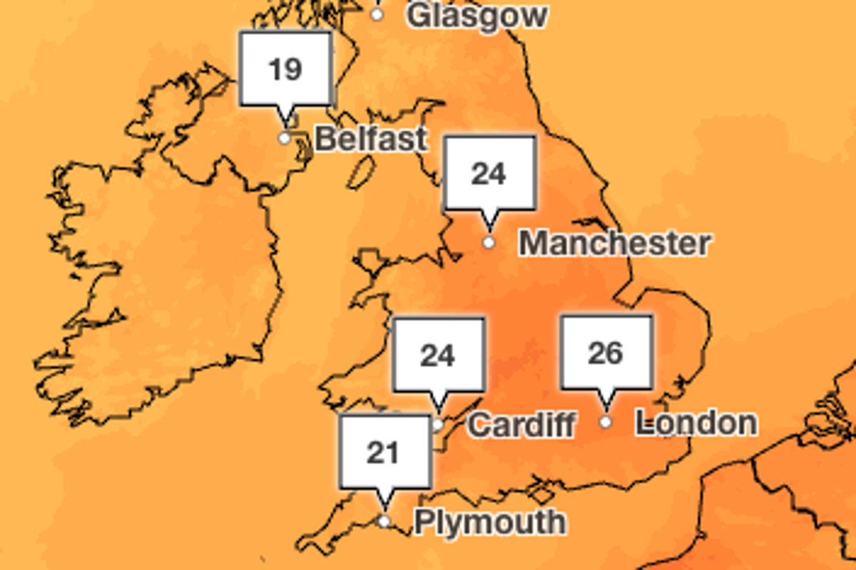
The warm weather is expected to last the weekend, with London also seeing highs of 26C and Manchester peaking at 24C on Sunday.
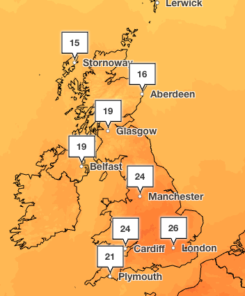 The warm weather is forecast to last until Sunday, which will also see highs of 26C (Met Office)
However, rain is forecast to sweep across the UK from the Atlantic, bringing showers to Scotland, Wales and the north of England on Thursday evening.
According to the Met Office long-range weather forecast, the first half of September will see warm spells, but it’s expected to be unsettled.
The Met Office said: “Rain will likely be most frequent across northern and western areas, while the south and east are more likely to see some drier interludes. There is also the potential for some strong and gusty winds, particularly in the northwest.
“Temperatures are likely to be near average, although brief warm or very warm spells are possible, especially in the south.”
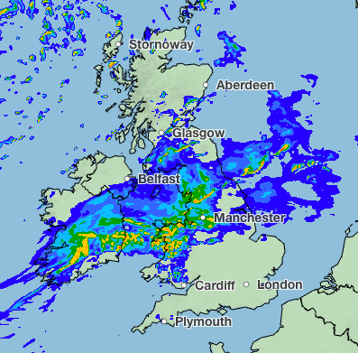 Rain is expected to sweep across the UK on Thursday evening (Met Office)
It comes after the UK recorded a mean average temperature across June, July and August of 16.5C, beating the previous seasonal high of 16.1C set last year, the Met Office said.
The highest temperature recorded this summer was on 13 August at Kew Gardens, when the mercury hit 38.1C.
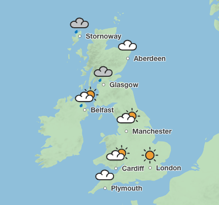 England and Wales are forecast to see sunny weather on Sunday, while showers sweep across Scotland (Met Office)
While this did not beat the all-time highest record, which was measured at 40.3C in Lincolnshire in July 2022, several other records were broken, including a temperature of 37C or higher being recorded on three separate days.
Five-day weather forecast
Wednesday (September 2):
Outbreaks of rain will move eastwards across the country today. Central areas likely to see the wettest weather, whilst the far southeast of England and northern Scotland will remain mostly dry and bright. Breezy across central and southern areas.
Wednesday night:
Mostly cloudy with outbreaks of rain and drizzle, most persistent in the far north and northwest. A rather warm and humid night to come, especially in the south.
Thursday (September 3):
A rather cloudy start across the south with patchy rain, but this clearing to sunshine and showers. Elsewhere, bright spells initially but further cloud and rain arriving from the west.
Outlook for Friday to Sunday:
Remaining unsettled with further spells of rain moving across the UK. Some drier and brighter interludes developing, especially on Saturday. Temperatures around average, but nights remaining on the mild side.