
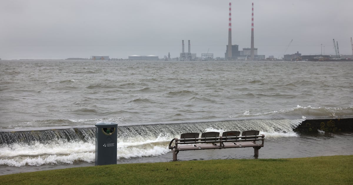
One-fifth of the Republic’s coastline is at very high risk from flooding, erosion, sea level rise or other coastal hazards set to worsen with climate change, analysis from University College Cork (UCC) shows.
The most exposed areas include some of Ireland’s most densely populated neighbourhoods.
More than 20,000 people in Dublin and 9,971 people in Galway city live within 500 metres of coastline classified as at “very high exposure”, according to the analysis.
A further one-fifth of the coastline, also with areas of high population concentration, is deemed to be at “high exposure”.
The analysis also reveals how vulnerable Ireland’s historical sites and monuments are. Of 8,871 raths, forts, ancient burial grounds and other cultural heritage sites located within 500 metres of the coast, one in five lie within “very high exposure” zones.
The details feature in an online interactive coastal exposure index and map that allows anyone to click on any of 34,303 points to find out the type and scale of risks facing that area.
Each point represents a 250 metre section of coastline and is colour-coded according to a five-level exposure rating, with red denoting very high and green representing very low.
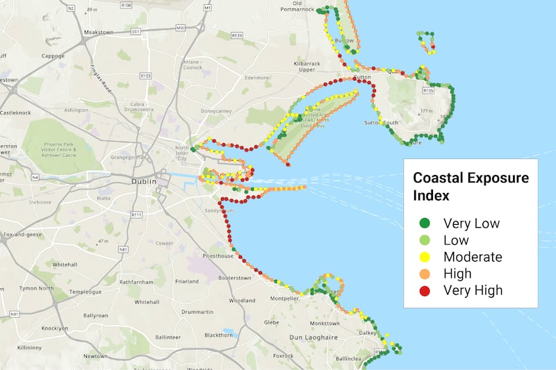 Graphic: Ireland’s Coastal Hazard Exposure Index
 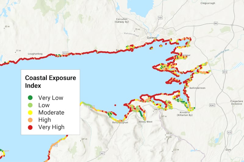 Graphic: Ireland’s Coastal Hazard Exposure Index
Underlying factors are examined – for example, whether an area is low-lying and easily flooded or composed of soft sand or mud that gets washed away in storms.
Hazards are rated using decades of wind and wave data to work out how big a threat sea level rise, storm surges and winter weather present.
In total, 60 per cent of the 8,575km coastline is ranked as being at moderate, high or very high exposure.
But while Co Mayo records the greatest extent of very high exposure coastline – 24 per cent of the national total – fewer people are at risk there due to the sparser population.
By contrast, Dublin, Wicklow, Wexford, Louth and Meath combined have just 8 per cent of the very high exposure coastline but have 44 per cent of the coastal populations that live within 500m of those stretches.
Global average sea levels are projected to rise by up to 1.1 metres above 1900 levels by the end of this century, having already risen by about 23cm since that starting point.
Dr Aaron Lim, head of the Earth and ocean lab at UCC, said the index and map were intended to help people understand and prepare for hazards today and into the future.
“This research gives Ireland a unique opportunity to be proactive rather than reactive,” he said. “For the first time, we can identify where exposure to coastal climate hazards is greatest and use that evidence to guide national strategy and targeted regional action.
“The decisions we make over the coming decade will shape how well our communities, infrastructure, businesses and cultural heritage can adapt to rising seas, coastal flooding and erosion.”
The research also found that 38 per cent of the coastline benefited or could benefit from protections nature provided. Sand dunes, salt marsh, seagrass and coastal grasslands called machair act as buffers to storms and sea level rise and help stabilise land against erosion.
The study lead, geoscientist Kevin Walsh, said protecting and restoring these habitats could prevent the need for costly engineered responses such as sea walls and groynes.
“Unfortunately, the places these natural protections are needed most are the places where the habitats no longer exist because they are built on,” he said.
“But they do provide solutions in more remote areas that are unlikely to get investment in hard, engineered structures – and where ideally you don’t want them anyway – so it shows how much more work we could do on natural solutions.”
Walsh said he hoped people would be curious enough about their local area to go on the map and get a better understanding of what makes places vulnerable.
“Sometimes there’s an overly simplistic view that the west is exposed to the Atlantic so that’s why it gets more flooding, but there are other factors,” he said.
“I didn’t know, for example, why Salthill in Galway floods so much until I found out it was reclaimed land.”
The index and map are the work of the team from the DETECT (Digital Environmental Technology for Enhanced Coastal Zone Management) project at UCC.