
Although the calendar indicates that we’ve flipped to fall, and a cold front appears to be stalling in North Texas, Austin weather will still feel more like summer across Central Texas through the upcoming weekend, with temperatures running well above normal.
This video created with the assistance of AI.

Wednesday will be especially warm, with both morning and afternoon temperatures running about 10 degrees above seasonable averages. We’ll start the day partly cloudy with light north-northeast winds and temperatures in the upper 70s, compared with an average low of 69 degrees. By lunchtime, clouds will increase, winds will shift to the east at 5 to 10 mph and temperatures will climb into the lower 90s, with the humidity making the heat feel closer to 100 degrees.
A few spotty showers and thunderstorms will also develop across the region Wednesday afternoon and evening, mainly after 2 p.m. through about 10 p.m. Rain chances are only around 20%, so most locations will stay dry, but a few lucky spots could pick up a quick quarter-inch of rain.

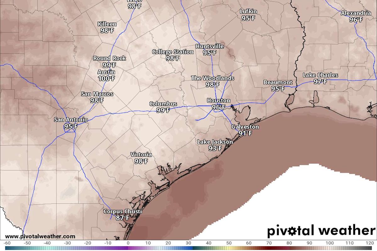
Temperatures in Austin will climb to near 100 degrees Wednesday, potentially adding to our tally of days with triple-digit heat for the year, which is approaching 50 days. (Pivotal)
Wednesday temperatures at Camp Mabry, Austin’s main weather observation site, will likely reach the 100-degree mark again, making it the 50th day of triple-digit temperatures in Austin so far this year. In the past 10 years, Austin has averaged about 44 such days. So even though we’re above that average, we are well below our record, which was 90 days of triple-digit heat in 2011.
What’s the forecast for the weekend?
A ridge of high atmospheric pressure that’s kept Central Texas baking will strengthen, shutting down rain chances and keeping cooler air from pushing into the region. For now, we’re stuck with a stagnant, hot and humid air mass that will keep temperatures in the upper 90s to near 100 degrees.
“One wrinkle in the forecast is that the high amplitude ridging will allow drier air to be siphoned off from the Midwest, which will allow dew points to drop into the 50s Friday and possibly Saturday mainly north of Interstate 10, providing more of a dry heat,” meteorologists from the National Weather Service wrote in their daily forecast. “This will be short-lived as southerly flow re-strengthens ahead of a trough (of low pressure) over the western U.S., resulting in a return to more humid conditions to start next week.”
Is a weather shift happening next week?
Beyond the weekend, we’ll turn our attention to a potentially wetter weather pattern with scattered thundershowers starting as early as Sunday. Next week looks a little more interesting as the ridge of high pressure gets shoved south. That should open the door for several atmospheric disturbances to roll over Texas, leading to a decent rain chance by Tuesday and Wednesday.

After Wednesday’s storm chances for Austin, we’ll see a few dry days through the weekend before rain chances ramp up early next week. (National Weather Service)
Wednesday’s forecast by region
Hill Country (Fredericksburg, Blanco, Llano and Burnet): Mostly sunny with a 20% chance of rain or thunderstorms. High temperatures from 90 to 95 degrees.
I-35 corridor (Round Rock, Austin, San Marcos): Partly cloudy with a 20% chance of rain or storms. High temps from 97 to 101 degrees.
Coastal Plains (Bastrop. Smithville, Lockhart): Mostly sunny and hot with a 10% chance of rain. High temp from 98 to 102, with a heat index of up to 105 degrees.
This article originally published at Is another 100-degree day ahead for Central Texas? Here’s Wednesday’s weather forecast.