
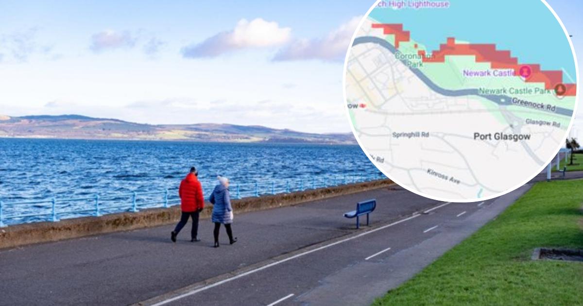
New images from Climate Central’s Coastal Risk Screening Tool highlight stretches of the Inverclyde waterfront which could be vulnerable to flooding in the coming decades.
Climate Central is an independent group of scientists and communicators which researches climate change and its impacts.
Its coastal mapping tool combines sea-level projections with elevation data to identify low-lying areas potentially exposed to coastal flooding.
Climate Central says its maps are intended to show areas at risk, rather than predict that they will definitely or permanently be underwater.
Port Glasgow
Port Glasgow remains one of the most prominently affected areas on the map.
Along the waterfront at Newark, the projected risk zone follows the shoreline around Coronation Park and Newark Castle Park, including land close to the A8 Greenock Road.
The map indicates that parts of the waterfront surrounding Newark Castle could also be exposed.
(Image: Climate Central)
Further east, a considerably larger risk zone is shown around the industrial waterfront near Dales Marine Services and the Tillicoultry Quarries Greenock Concrete Plant.
The red area extends across substantial sections of the waterfront and port land, while smaller stretches of the coastline towards Port Glasgow are also highlighted.
Greenock
The picture is different further west in Greenock, where the projected risk area is narrower but follows a lengthy stretch of the town’s shoreline.
Sections of Greenock Esplanade are highlighted, with the risk zone following the waterfront from around the western end of the Esplanade towards the town centre.
(Image: Climate Central)
The map suggests the most exposed areas are those immediately beside the Clyde, rather than large parts of residential Greenock further inland.
Land around the shoreline and waterfront paths is among the areas shown in red.
Gourock
Gourock also features prominently in the projections.
The map shows a continuous band of risk around sections of the town’s waterfront, including the coastline near Albert Road and around Gourock’s northern shore.
Areas close to the Caledonian MacBrayne ferry terminal are highlighted, with the projected zone continuing along the waterfront towards Cardwell Bay.
(Image: Climate Central)
The map indicates that parts of the shoreline around Cardwell Bay could be exposed, before the risk zone continues around the coast towards neighbouring Greenock.
Sections beside Battery Park, across the bay from Gourock, are also highlighted.
The projections do not mean all of the coloured areas will be permanently submerged by 2050.