
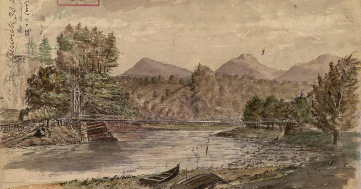
The painting, found in the archives of the British Geological Survey (BGS), depicts the Dryburgh Suspension Bridge and the River Tweed, offering a rare glimpse of the Borders landmark just a year after it was built in the early 1870s.
It was uncovered by a building stones specialist while examining historical field slips, which are geological maps and notes recorded during fieldwork.
Following further research, the watercolour is believed to have been painted around 1873 by Benjamin Neeve Peach, a geologist with the Geological Survey of Great Britain and Ireland who was known to be conducting fieldwork in the region around that time.
Daniel Burgess, geological data steward at the BGS, said: “Field slips have always been a vital tool for geologists since the inception of the survey in the 19th century, as a way of recording important observations, measurements and notes whilst out in the field.
“It was not unusual for geologists, who are often out in the field for weeks at a time, to sketch the landscapes that have been shaped by the underlying geology.
“In this example, peach is showing how the tough volcanic rocks of the Eildon Hills dominate the landscape around Dryburgh.”
The front of the Dryburgh field slip used by Benjamin Peach when surveying the area in the 1870s (Image: BGS / UKRI)
Mr Peach was also an accomplished artist, and his other works are held in the BGS archive and available on GeoScenic, the BGS’s public online geological photograph database.
Mr Burgess said: “Our extensive data holdings are still very relevant today and they do occasionally throw up a welcome surprise when accessing them as part of modern research.
“In this case, we knew almost instantly we had stumbled across a Ben Peach artwork, given his signature style and prolificacy.”
Peach worked at the BGS from 1862 until his retirement in 1905 and produced hundreds of sketches and paintings during his field surveys.
His drawings, often found in field notebooks and on the backs of maps, documented landscapes and everyday scenes across Scotland.
The geological field map now resides in the BGS Archives alongside around 40,000 other items, including administrative records and personal papers from BGS staff.