
Wind gusts up to 50mph and periods of heavy rain lay ahead
20:37, 13 Sep 2025Updated 20:51, 13 Sep 2025
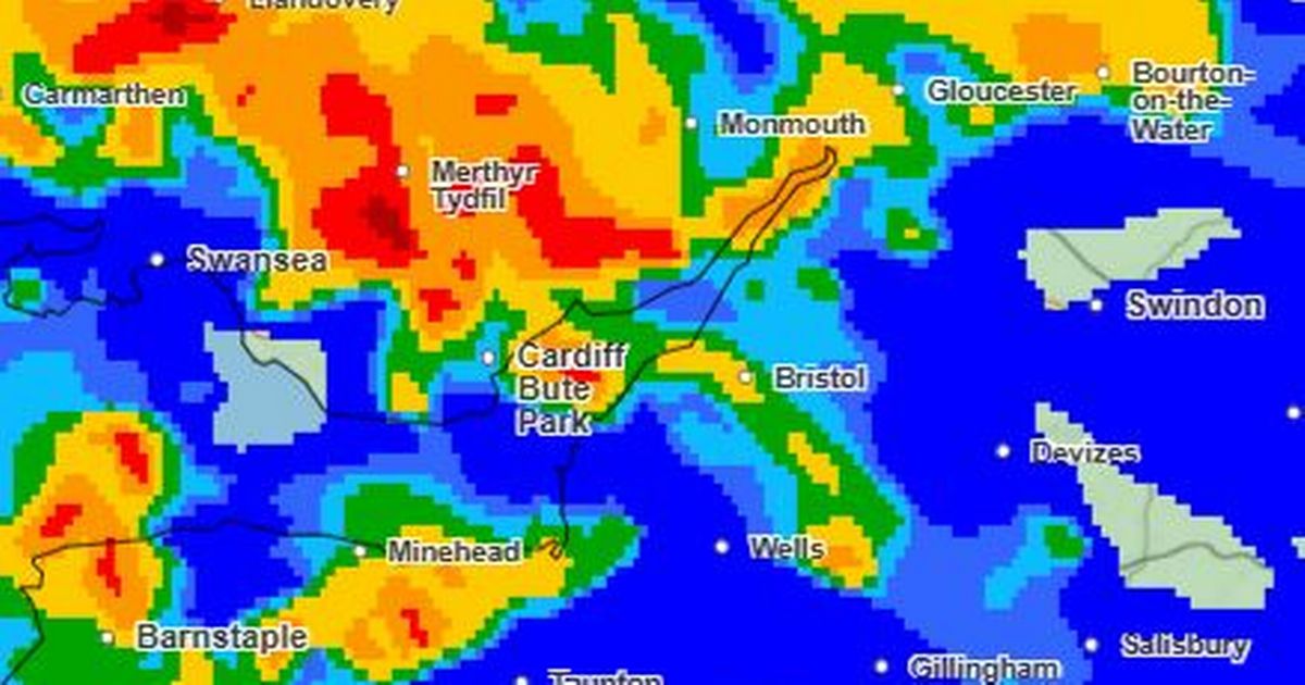
 A Met Office radar forecast map for 3.15pm on Sunday for rain(Image: Met Office)
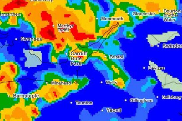
A severe weather warning will be activated within 24 hours in the South West as strong winds are forecast to cause travel disruption and the risk of power cuts.
The Met Office has put much of England in a yellow alert zone from 8pm on Sunday (September 14) to 6pm on Monday.
As well as the strong winds, there is also plenty of rain forecast in the county.
In its localised hourly forecast, the Met Office says heavy rain will start in Gloucestershire around 2pm on Sunday and continue until 6pm. Wind gusts in the county could be up to 34mph by Sunday afternoon by could reach 48mph by Monday lunchtime.
In Bristol, the heavy rain is due to start around 1pm on Sunday and last until 7pm. Wind gusts on Sunday afternoon up to 36mph and on Monday afternoon to 50mph.
Somerset could see heavy rain from noon to 2pm and again from 5pm to 6pm. Wind gusts up 36mph on Sunday and 48mph on Monday.
In it’s latest forecast, the Met Office said on Saturday evening: “Low pressure arriving on Sunday will squeeze the isobars together and bring an increasingly windy day
“Winds will strengthen further on Sunday night and remain strong in places on Monday, bringing the chance of severe gales on exposed coasts and some travel disruption.”
Met Office Deputy Chief Meteorologist Stephen Kocher said: “Strong west or southwesterly winds will arrive across coastal areas of southwest England and Wales during Sunday evening, spreading inland and eastwards during Monday morning.
“Gusts of 45-55 mph are expected widely in inland areas, while gusts of 60-70 mph are possible at times along exposed coasts and hills.”
What the warning says: Strong and gusty winds are likely to cause some disruption to travel and interruptions to power.
What to expect?Some delays to road, rail, air and ferry transport are likelyIt’s likely that some coastal routes, sea fronts and coastal communities will be affected by spray and/or large wavesProbably some bus and train services affected, with some journeys taking longerSome short term loss of power and other services is possibleDelays for high-sided vehicles on exposed routes and bridges likelyMet Office South West forecast
This Evening and Tonight: Some late evening sunshine as things briefly turn more settled overnight, with winds easing and showers gradually fading. Becoming increasingly cloudy from the southwest through the early hours, although feeling cooler than last night, especially in rural spots. Minimum temperature 6 °C.
Sunday: A band of rain, with prolonged or heavy downpours, will spread northeastwards through much of the day, bringing widespread strong winds, with gales likely. Showers follow later. Feeling muggy. Maximum temperature 18 °C.
Outlook for Monday to Wednesday: Strong winds and blustery showers continue on Monday, with winds easing and showers fading overnight. A brighter and drier day on Tuesday before turning wet and windy again on Wednesday.