
The Met Office has warned heavy rain could cause flooding on Saturday
11:25, 20 Sep 2025Updated 12:01, 20 Sep 2025
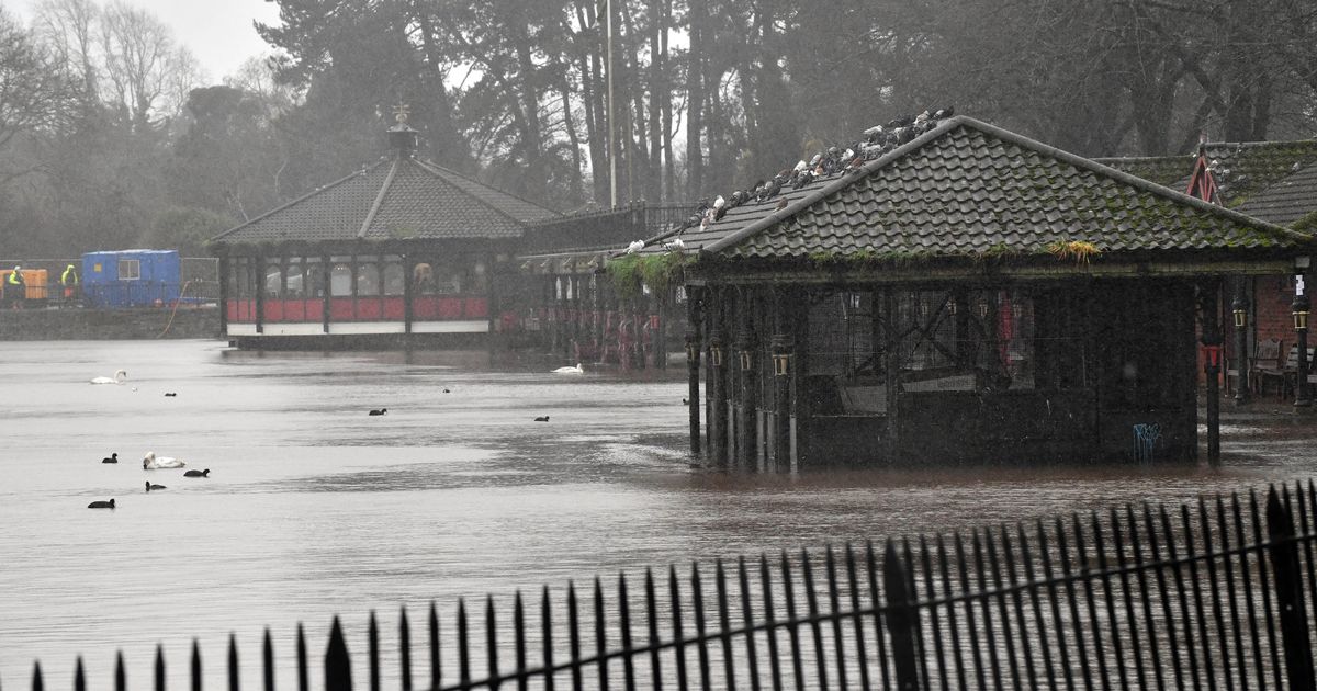
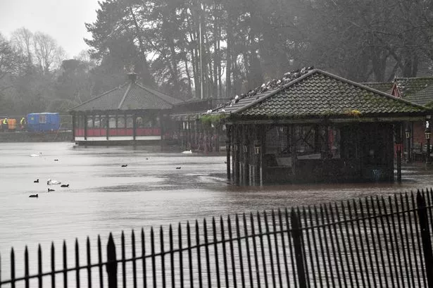 Flooding is expected across a number of areas in Wales on Saturday (Image: WalesOnline/ Rob Browne)
Multiple flood alerts have been issued for parts of the Welsh coastline and north Wales on Saturday as the Met Office has updated its yellow warning for rain, which is in force for the rest of the day. A second warning has since been issued.
Six flood alerts have been issued by Natural Resources Wales (NRW) for the following areas: Gower peninsula, Western Cleddau, rivers Taf and Cynin, north Gwynedd catchment, Conwy catchment, and Glaslyn and Dwyryd catchment. NRW warned residents and businesses there is a risk of flooding due to river levels being above normal as a result of increased rainfall.
There is also a risk that properties could become flooded in some areas.
The Met Office forecast for Wales on Saturday says: “Very wet today with heavy rain and possible flooding.” It adds that rain will be “persistent at times” causing flooding and travel disruption.
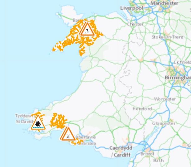 Six flood alerts have been issued by Natural Resources Wales(Image: Natural Resources Wales)
The flood alert from NRW for the rivers in the Taf and Cynin catchments in Pembrokeshire and Carmarthenshire states: “Flooding of low-lying land and roads is expected.
“Flooding to property is possible. Rainfall is currently affecting this area. River Levels are above normal levels. We will continue to monitor the situation.”
An yellow warning for rain was issued by the Met Office on Saturday morning. The alert, which covers several regions, is in force from 9am until 3am on Sunday.
The areas affected include Bridgend, Carmarthenshire, Ceredigion, Conwy, Denbighshire, Flintshire, Gwynedd, Isle of Anglesey, Merthyr Tydfil, Neath Port Talbot, Pembrokeshire, Powys, Rhondda Cynon Taf, Swansea, and Wrexham. For our free daily briefing on the biggest issues facing the nation, sign up to the Wales Matters newsletter here
The forecast reads: “A band of rain, heavy at times, across Wales, and northern and western England is expected to remain slow-moving during Saturday morning before making erratic eastward progress, eventually clearing early on Sunday.
“Whilst there is still some uncertainty in the focus for the heaviest rainfall 20-30 mm of rain is likely to fall quite widely with some locations in the warning area seeing 60-80 mm of rain.
“These higher accumulations may not be confined to high ground only with these more probable over north Wales and northern England. Should confidence increase in these higher totals falling over urban or sensitive areas this warning may be upgraded.”
But a change is on the cards as an area of high pressure moves over the UK once the rain clears.
Sunday will be a bit unsettled, with sunny spells and scattered showers in the forecast, before drier weather reaches the UK on Monday.
The Met Office’s outlook for Monday to Wednesday states: “High pressure will bring a much more settled picture early next week. Often sunny on Monday then somewhat cloudier on Tuesday and Wednesday. Feeling cool with rural frosts possible overnight.”
Get daily breaking news updates on your phone by joining our WhatsApp community here. We occasionally treat members to special offers, promotions and ads from us and our partners. See our Privacy Notice.