
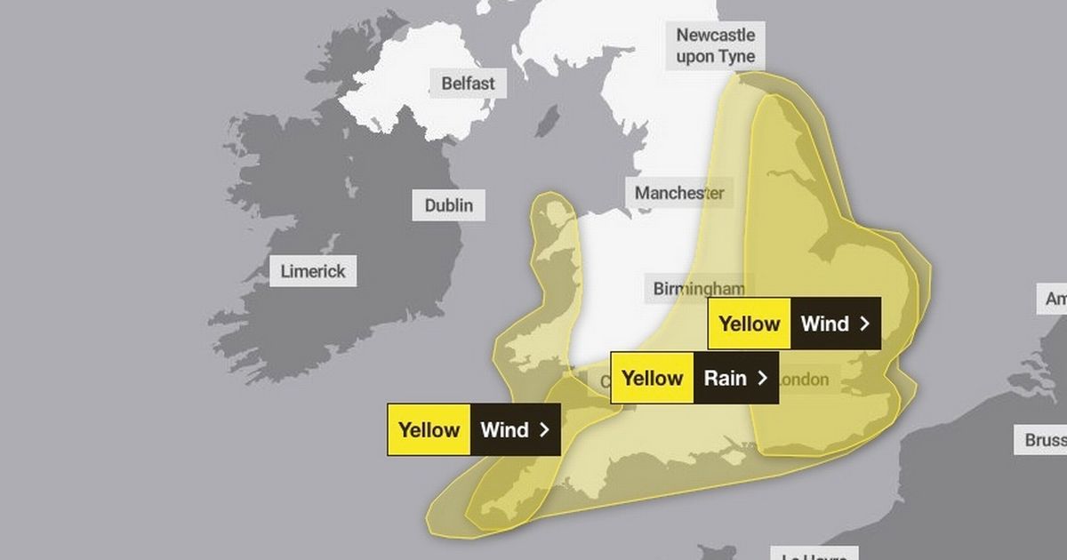
Storm Benjamin has made its way across the United Kingdom – and is set to stick around for a while – with the Met Office sharing an official warning and asking affected areas to prepare Map shows where 75mph winds will hit(Image: Met office)
Britain is set to be battered by Storm Benjamin as it makes its way across the country with 75mph winds. The tempest, named by Meteo France, will bring heavy downfalls and gale force winds.
Forecasters have urged those living certain areas to prepare an “emergency kit” of essentials in case their homes or businesses experience flooding. Isolated areas in the East of England, such as remote parts of Norfolk and Lincolnshire, could see up to four inches (90mm) of rain fall by 9pm tonight, the Met Office has warned.
Today (October 23) is set to feel colder than usual, with rain and wind hitting across the country. Winds will ease and rain should clear to sunshine and showers by Friday.
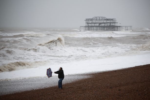 Some have been told to prepare an ’emergency kit'(Image: AFP via Getty Images)
There may be a colder start to Saturday with further scattered showers, which should be more wintry over the Scottish mountains.
The following ares could be subject to 70mph winds:
East Midlands
Leicester, Leicestershire, Lincolnshire, Northamptonshire, Nottingham, Nottinghamshire and Rutland
East of England
Bedford, Cambridgeshire, Central Bedfordshire, Essex, Hertfordshire, Luton, Norfolk, Peterborough, Southend-on-Sea, Suffolk and Thurrock
London & South East England
Bracknell Forest, Brighton and Hove, Buckinghamshire, East Sussex, Greater London, Hampshire, Kent, Medway, Milton Keynes, Oxfordshire, Reading, Slough, Surrey, West Berkshire, West Sussex, Windsor and Maidenhead and Wokingham
Yorkshire & Humber
East Riding of Yorkshire, Kingston upon Hull, North East Lincolnshire, North Lincolnshire, North Yorkshire, South Yorkshire and York.
Chief Meteorologist, Rebekah Hicks said: “Low pressure moving across the south of the UK tomorrow will bring both a spell of heavy rain and areas of strong winds.
 The bad weather is expected to ease on Friday (stock)(Image: Getty Images)
“The rain is expected to arrive from the southwest this evening, before spreading northeast to many parts of England and Wales during Thursday, leading to difficult driving conditions and the risk of flooding in a few places. At the same time, winds are expected to pick up along southern coastal areas.
“However, it is not until Thursday morning that significantly strong north-westerly winds will first begin to affect parts of the west with gusts of 45 to 55 mph, locally 55mph around coasts expected. At the same time, northerly winds are expected to develop more widely across eastern areas, with gusts of 50-60 mph fairly widely and up to 70 mph near some coasts. Should Storm Benjamin be at the stronger end of expectations, there is a small chance of wind gusts very locally exceeding 70 mph for a time.
“It is worth noting that there is a greater than usual uncertainty surrounding the track and intensity of this low-pressure system, so the public should stay up to date with the latest forecasts and warnings as the situation evolves, with adjustments to the forecasts likely at short notice.”
For the latest breaking news and stories from across the globe from the Daily Star, sign up for our newsletters.