
A strong sub-Arctic high could send a mass of cold air flooding across the UK from mid November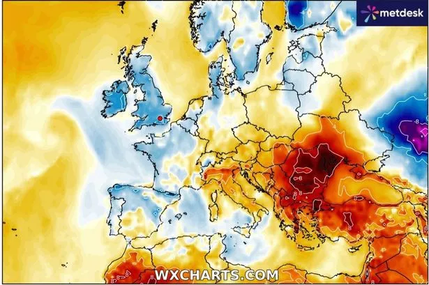 It could be set to get quite chilly(Image: WXCharts)
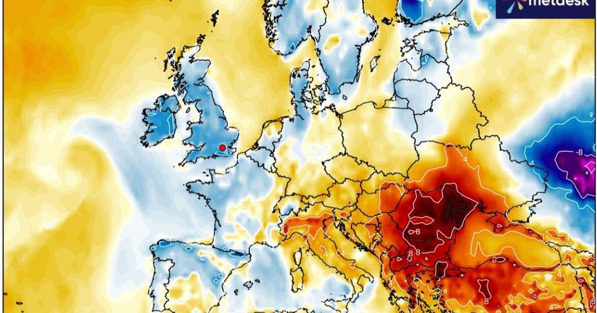
Weather models are suggesting that a strong sub-Arctic high could cause a mass of cold air to flood across the UK from mid-November. Classic blocking conditions over Scandinavia might then lead to an extended period of below-average daytime temperatures and overnight frosts.
While wintry conditions are not indicated, if a cold snap develops it will be a stark contrast from the current outlook. Ex-hurricane Melissa has brought rain and blustery conditions to western Britain. This system has also resulted in unseasonably mild temperatures.
The Met Office predicts that low pressure will continue to dominate the UK until around November 9-10, after which it should become drier.
However, the significant change is expected around Friday, November 14.
Recent model runs show cold air sinking south, initially affecting northern UK but eventually covering southern Britain too.
Both the American GFS and European ECMWF models are largely in agreement, reports North Wales Live.
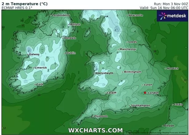 ECMWF’s 6am temperature outlook for Sunday, November 16(Image: WXCharts)
If this happens, models predict chilly easterly winds and low day-time temperatures for several days at least, with overnight frosts.
As things stand, this blocking is stronger than was being modelled a few days ago.
Despite the chilly forecast, there’s currently no snowfall predicted for this period.
Netweather meteorologist Ian Simpson has suggested that a ‘Beast from the East’ scenario is unlikely.
In his blog post on Sunday (November 2), he noted: “Easterly snowfalls have been known in November, including a notable one around 21-22 November 1993 as well as the ones at the end of November 2010.
“But most of the time easterlies in November are not quite cold enough to give widespread snowfall, as central and eastern Europe are still in the process of cooling down at this time of year.
“One fairly recent example of a November easterly that failed to deliver any snow for most lowland areas was in 2018, although it still turned colder than average for a time.”
He also mentioned another possibility of a UK or mid-Atlantic high, which would bring northerly winds.
Mr Simpson added: “All of these scenarios point towards it becoming rather less mild as well as less unsettled towards mid-November, with some colder spells, possibly cold enough for frosts at times, but not necessarily cold enough for widespread snow.”
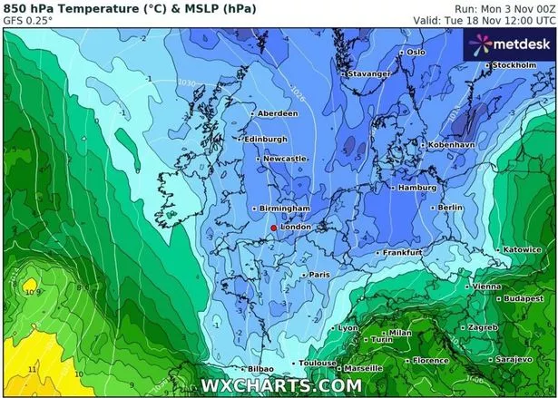 GFS atmospheric temperature forecast for Tuesday, November 18(Image: WXCharts)
It’s possible that low pressure could occasionally move into western Britain, including Wales, before the blocking high pressure system becomes fully established.
In its late November forecast, the Met Office indicates a “greater chance of periods of high pressure bringing more in the way of dry weather…. which also increases the chances of overnight fog and frost”.
At this distance, all weather predictions should be treated with caution. For the biggest stories in Wales first, sign up to our daily newsletter here.
Even if a cold spell does emerge, as anticipated, it wouldn’t be particularly unusual for mid to late November.