
Geologists have uncovered unexpected ground movement beneath central Turkey that’s reshaping the way we understand its seismic landscape. A major fault once believed to be stable is, in fact, pulling apart the Earth’s crust slowly, but steadily.
The Tuz Gölü Fault, stretching across central Anatolia, has long been overshadowed by Turkey’s more active tectonic zones. But new findings from a team at Curtin University show that this lesser-known fault is widening, not sliding, marking a significant shift in how scientists interpret the region’s geodynamics.
A Hidden Rift In Anatolia
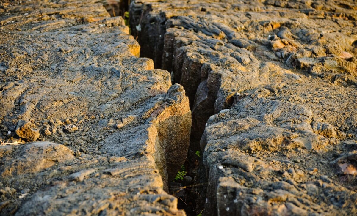
The Tuz Gölü Fault Zone, a 200-kilometer geological structure clearly visible from satellite imagery, lies in central Anatolia. Though it hasn’t produced any significant ground ruptures or major earthquakes, researchers now believe it plays arole in shaping the regional landscape. Its location, at the meeting point of the Eurasian, Arabian, and African tectonic plates, makes it a unique site for studying continental extension.
Until recently, the fault was classified as strike-slip, a type of fault where two blocks of crust slide past one another. But the new research, published in Nature Communications Earth & Environment, led by Professor Axel Schmitt from Curtin’s John de Laeter Centre shows the opposite: the two sides of the fault are drifting away from each other.
“Our findings unambiguously reveal the fault is pulling apart at a rate of about one millimeter per year, rather than shifting sideways. Understanding these movements is crucial not just for assessing volcanic and earthquake threats but also for improving global models of continental deformation,” Schmitt said, as reported by SciTechDaily.
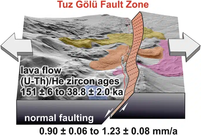 Illustration of the Tuz Gölü Fault Zone showing normal faulting and directional crustal extension. Credit: Nature Communications Earth & Environment
Following Lava’s Trail
The discovery came through the analysis of ancient lava flows from the Hasandağ volcano, which had cooled after eruptions and were later fractured by the fault. These lava layers acted as geological time markers. By reconstructing their original shape and comparing it with their current positions, the team was able to calculate how far the terrain had shifted.
According to Associate Professor Martin Danišík, also from the John de Laeter Centre, tiny zircon crystals inside the lava provided the necessary data. These minerals captured helium from the radioactive decay of uranium and thorium, making it possible to date the rocks with precision.
“By measuring uranium, thorium, and helium in zircon, we can accurately determine when the lava flows erupted, spilled across the fault, and subsequently cooled,” he also explained.
The results confirmed that the rocks were being pulled apart, consistent with the behavior of an extensional fault.
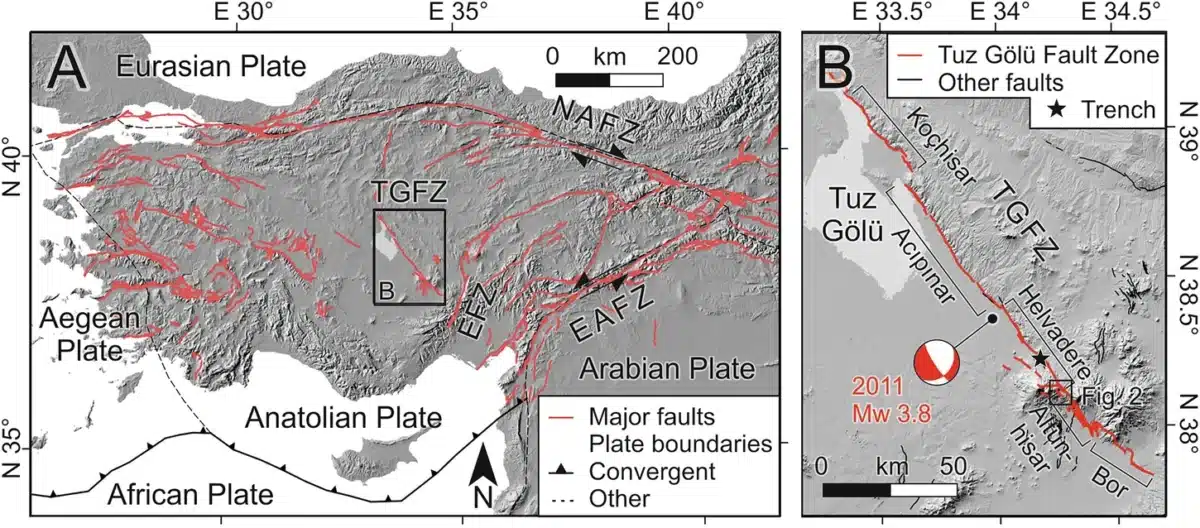 Tectonic overview map of Anatolia showing the major fault systems, along with a map (B) of the studied area and the active Tuz Gölü Fault Zone (TGFZ) on a digital elevation model. Credit: Nature Communications Earth & Environment
Can Today’s Tools Challenge the Geological Past?
The research relied heavily on advanced techniques, including helium dating and remote sensing. These tools enabled scientists to detect subtle ground shifts in the crust—movements far too small to register on standard seismological records.
“This research highlights the importance of revisiting long-held geological assumptions and using modern techniques to precisely measure how continents respond to the immense pressures of tectonic collisions,” noted Janet Harvey, a co-author and remote sensing expert at Curtin.
Because the Tuz Gölü Fault moves so slowly, it doesn’t generate the type of frequent, high-magnitude earthquakes that usually draw attention. But that’s precisely why this kind of study matters. With minimal modern seismic activity to study, the researchers had to turn to the landscape itself to uncover the fault’s quiet but steady evolution.