
Wales should brace for a ‘shock to the system’ this week as the Met Office predicts hail, sleet and snow with temperatures dropping below zeroAndrew Forgrave Countryside and tourism editor and Lucy John
20:59, 23 Mar 2026Updated 21:04, 23 Mar 2026
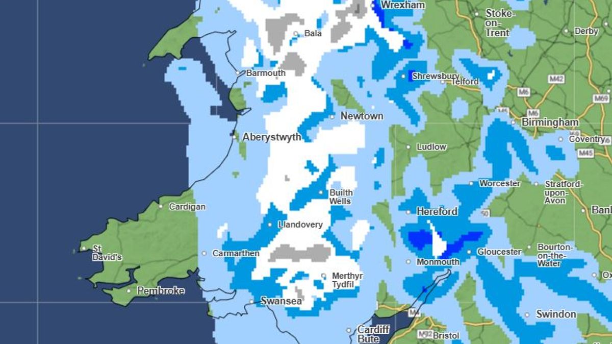
The wintry scene may come as a shock after a week of sunshine for most (map showing around 6am on Wednesday)(Image: Met Office)
Wales is set to have a “shock to the system” this week as parts of the country will see snow, according to a Met Office warning. A sharp drop in temperatures is anticipated to bring hail, sleet and snow in the coming days.
Thermometers are predicted to fall below zero on Wednesday night (March 25) in some parts, just a week after temperatures reached 20.9°C in west Wales, marking the warmest day in the UK so far. Weather experts anticipate a widespread frost on Wednesday night leading into Thursday morning.
This cold snap is expected to be accompanied by wintry showers for much of Wednesday, with a few more forecasted for Thursday morning. Most will occur on higher ground and accumulations are likely to be modest – potentially up to 5cm on Eryri’s highest peaks. Always keep on top of the latest Welsh news with our newsletter
The first sign of snow is forecasted to appear in the early hours of Wednesday morning, affecting parts of north and mid Wales. These wintry showers are predicted to persist throughout the day. At lower elevations, these showers will fall as rain.
By 6am a large white sheet can be seen covering the country from north Wales, reaching Merthyr Tydfil and Swansea. Temperatures are expected to sit at around 3°C or 4°C at this point.
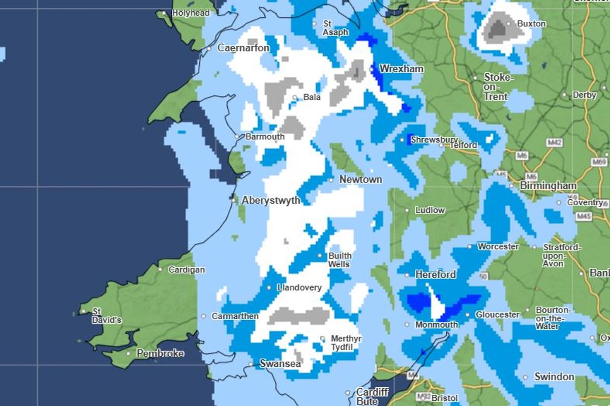
By mid-morning the snow is expected to become patchy and travel eastwards. Some patches of snow will continue throughout the day. At around midday a patch of white can be seen above Merthyr Tydfil as well as Barmouth, Builth Wells and St Asaph. More patches of snow are expected to come from the west and travel south easterly across Wales.
Broad-brush GFS estimate of sleet and snow at 9am on Wednesday, March 25(Image: WXCharts)
This will be preceded by a shift in weather patterns as high pressure succumbs to low pressure from the Atlantic on Tuesday, resulting in rain across Wales – with it expected to be particularly heavy in the north.
As the day progresses, the weather will veer to the north west, ushering in colder air that will feel even more biting in the wind.
Steven Keates, Deputy Chief Forecaster at the Met Office, stated: “After a spell of mild and brighter weather, the UK will turn increasingly unsettled in the coming days,” reports North Wales Live.
“A series of weather fronts will bring periods of rain, strong winds and much colder air by midweek. Wednesday could be quite a shock to the system.
“Temperatures will range from 6°C. to 10°C, but it will feel closer to low single figures for many areas in the wind. Wintry showers are likely, especially over higher ground in the north, and a widespread frost – with icy patches for some – is possible on Wednesday night.”
The Met Office forecast for Wales on Tuesday reads: “An unsettled day ahead. Often windy, particularly around coasts and hills, with outbreaks of rain, this turning heavy and persistent from the north through the day. Maximum temperature 13°C.”
Get daily breaking news updates on your phone by joining our WhatsApp community here.
We occasionally treat members to special offers, promotions and ads from us and our partners. See our Privacy Notice