
The Met Office has issued an updated snow warning during Storm Dave, with up to 30cm (12 inches) possible above 200m and blizzard conditions expected over Easter weekend
12:27, 04 Apr 2026Updated 14:48, 04 Apr 2026
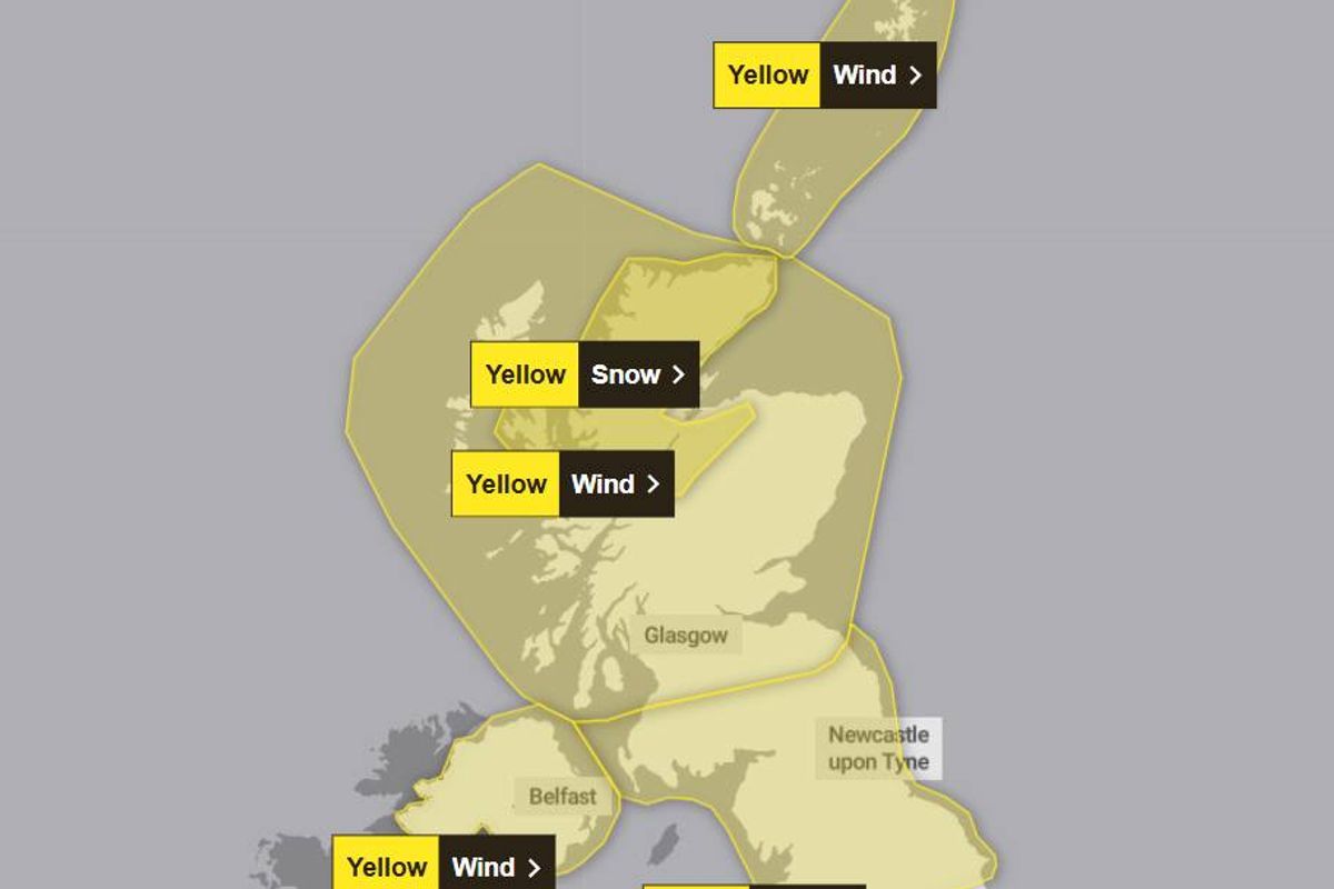
Warnings are in place across the UK(Image: Met Office)
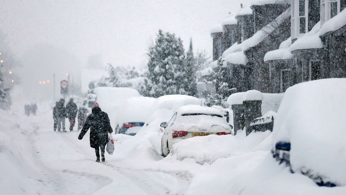
An updated snow warning has been issued, with the Met Office predicting that Brits could be faced with up to 12 inches of the white stuff. Multiple weather warnings are currently in effect across Wales, Scotland, England and Northern Ireland as Storm Dave sweeps across the UK over the Easter weekend.
The majority are for high winds, with gusts potentially reaching up to 90mph in some exposed areas. The national weather service released an updated snow warning this morning, effective from 2pm today until 3am on Sunday, covering regions in the north of Scotland, reports the Mirror.
The Met Office forecasts that 30cm (12 inches) of snow could accumulate on ground above 200m, while 5cm to 10cm is likely in many low-lying areas. “Strengthening winds will bring drifting of lying snow with the chance of blizzard conditions over the more exposed areas,” warns the Met Office.
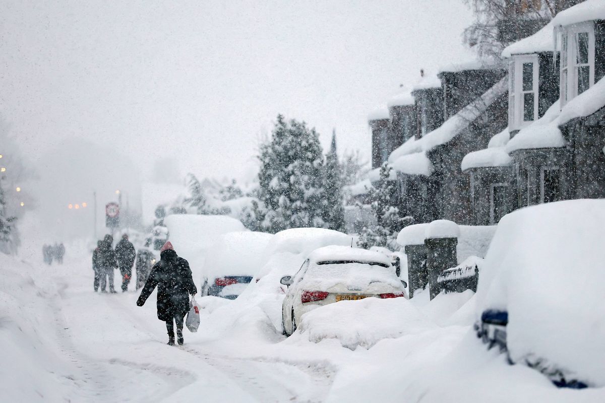
Snow is expected in some parts(Image: getty)
There’s also a risk of flooding. The Met Office states: “Some areas of low ground will see rain rather than snow which may lead to minor surface water flooding in places.”
Areas covered by Met Office snow warning:
Grampian
Highlands and Eilean Siar
The Met Office advises that people can anticipate travel disruptions on roads with stranded vehicles, and some rural communities may become isolated. “Power cuts may occur and other services, such as mobile phone coverage, may be affected,” it adds.
People are encouraged to prepare for potential power outages by gathering torches and batteries, a mobile phone power pack and other essential items.
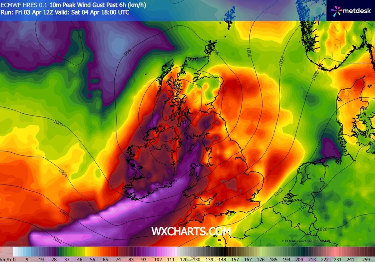
Saturday night is expected to see winds of 65km/h
The Met Office recommends motorists keep the following items in their vehicles: warm clothing, food, water, a blanket, a torch, ice scraper/de-icer, a warning triangle, high visibility vest and an in-car phone charger.
Meanwhile, Saturday’s Dublin forecast from Met Eireann warns of very windy conditions on Saturday with outbreaks of rain. There’s also a chance of spot flooding in parts.
It says: “Storm Dave will bring very windy conditions on Saturday with rain at times. South to southeast winds, veering southwesterly, will increase very strong and gusty through the day. Cloudy with outbreaks of rain and drizzle becoming isolated by midday.
“However, a band of heavier and more persistent rain will spread from the west later in the afternoon with spot flooding possible. A clearance to scattered showers will follow later in the evening. Highest temperatures of 10 to 12 degrees.”
Easter Sunday will be a cooler day overall, with chance of some hail and sleet. By evening the conditions should begin to ease.
Met Eireann continued: “A bright and breezy day with sunny spells and scattered showers. Some of the showers may be of hail or sleet early in the day on higher ground. The showers will become more isolated towards evening. Feeling cool with highest temperatures of just 7 to 10 degrees, with moderate to fresh westerly winds easing in the evening.”