
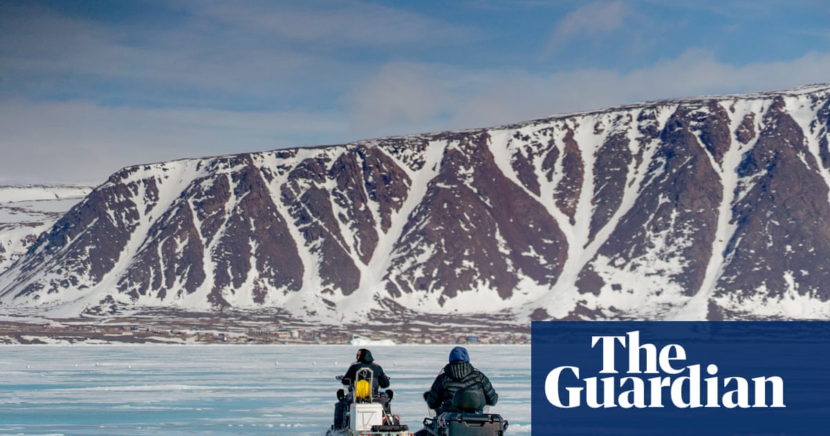
Electric-blue meltwater sprays up under Terry Noah’s snowmobile as he races across sea ice extending out from Canada’s northernmost public community: Grise Fiord in Nunavut, a hamlet of 144 people closer to Murmansk in Russia than the Canadian city of Toronto. The bay’s cliffs loom higher and higher like stone icebergs as he approaches his destination across the bay.
Noah pulls his sled carefully over a seal’s breathing hole, about the circumference of a basketball. Using a custom-made winch, he lowers a submersible instrument into the sea below the ice.
Noah will bring the data it collects back to his shipping container-based mobile lab and beam the data to the south, where his collaborator, research scientist Andrew Hamilton at the University of Alberta, can review it.
Water that stays ice-free all year – a ‘polynya’ – helps all life, from algae to whales needing air
As the climate emergency thins the ice, jumbles up the seasons and forces millennia-old Inuit cultures to adapt, Noah is part of a scientific effort that extends far beyond Grise Fiord. He says: “This science work, it’s the first step to preparing.”
The data Noah is collecting will help Hamilton and Noah understand changes taking place in Jones Sound, which empties into Baffin Bay to the east. There, in the bay’s northern reaches, one of the Arctic’s most important ecosystems is in the midst of a political and environmental upheaval – and Noah, Hamilton and a coalition of scientists have plans to better understand the changing waters before they’re beyond recognition.
It is an area of 85,000 sq km (33,000 sq miles), bigger than Austria, that goes by at least three names: 19th-century whalers called it the North Water; Kalaallit (Inuit of Greenland) call it Pikialasorsuaq, or “the great upwelling”; and to the Inuit of Nunavut, it is Sarvarjuaq, “the place that never freezes”.
Map showing the extent of North Water between Canada and GreenlandGreenland and Canada have proposed that they jointly manage the stretch of year-round open water as an internationally protected area
A stretch of year-round open water (known as a polynya) this far north is a boon to life of all kinds, from the algae that bloom in the summer and feed an entire web of other creatures to the whales that need access to the air in the depths of winter. Polar bears are drawn in by the whales, seals and walruses that migrate there; seabirds, too, have flown and paddled their way there by the millions, over millennia.
All of that activity is why the polynya is the focus of a unique proposal to become an internationally protected area jointly managed by Greenland and Canada. A 2017 report by the Pikialasorsuaq commission recommended the two countries create an Inuit-managed protected area. Canada followed up in March this year by designating the Sarvarjuaq marine protected area on its half of the zone, stretching 1,000km from just south of the open Arctic Ocean to northern Baffin Island.
But Greenland has fallen behind on its promises for protection.
Sara Olsvig, a former member of the Greenlandic parliament and chair of the Inuit Circumpolar Council until earlier this year, says it is not wise to move too quickly when the fundamental cultural rights of Inuit could be at stake.
An estimate in one study carried out in 2014 suggested that more than 2,500 walruses spent the winter in the North Water polynya, as well as large numbers of bearded seals and narwhals
“Some of the very good initiatives within conservation and nature preservation, and so forth, have unfortunately also resulted in violations of the rights of Indigenous peoples,” she says.
As negotiations slow, the physical process of change continues unabated, and the efforts to understand the polynya are accelerating.
The polynya’s size and shape ebb and flow with the seasons – depending, in part, on an “ice arch” that forms across its northern tip in Nares Strait. The arch, a strong crescent-shaped bridge of ice, jams the strait, preventing sea ice from being blown south from the Arctic Ocean. The lack of ice keeps the polynya open to the sunlight and the air, allowing algae to grow, the seabirds to dive and the whales to blow.
Terry Noah and Silas Pijamini collect data through the sea ice near Grise Fiord, Nunavut
Nearly 20 years ago, the Nares Strait ice arch failed to take shape for the first time. Now it often does not form – and in those years, the polynya itself has a harder time staying open through the spring. Instead, the sea ice drifts down to cover the water’s surface. It is an unusual and perverse effect of warming: more ice, not less, could ultimately become the problem here.
“I would say that at some point, when the ice bridge disappears, you’re probably going to have a drastic reduction in productivity – a collapse of the polynya,” says David Harning, a climate scientist at the University of Colorado, Boulder.
Finding out what is happening beneath the surface has become critical as the planet warms, and the Inuit experience that change first-hand. Researchers met in Nuuk in the autumn of 2025 and had initial conversations about developing what Hamilton calls an “observatory” to monitor the polynya from all sides.
That would require the involvement of a lot more people like Noah on both sides of Baffin Bay, but many Inuit do not have passports, and bringing them together physically is proving to be a problem.
Terry Noah in his mobile lab. A note saying ‘Don’t forget gun’ is taped to the door as a reminder to take protection against polar bears
“Being able to connect the knowledge of these communities between Canada and Greenland is super important in order to really understand how that environment is changing, because they’re the ones that are there every day of the year, all year long,” says Hamilton.
“The scientific aspect is important because it’s very difficult to understand how the ocean temperature is changing 300 metres below the surface unless you have particular instruments that you can deploy to measure those changes. But there are many other observations that I think are super critical to understand holistically what’s happening there.”
A few minutes after dropping his submersible to take measurements, Noah is packing it up for the return trip. Today’s journey was just off the coast of Grise Fiord, but others take him further afield, sometimes with his 13-year-old daughter, Madison, but often alone, hopping from station to station like a hunter checking his traps.
But Noah’s circle is widening. Wearing smart glasses that beam images to social media via portable satellite internet, he is a globally connected Inuk, part of a generation that grew up sharing hunting stories on Facebook.
Now, they are sharing data, too, recreating the knowledge transfer that helped Grise Fiord survive those hard early years. It is data that can help Inuit – and the rest of the world – understand their vast and rapidly changing home.
A qamutik, or traditional Inuit wooden sled, loaded with the two vital types of fuel for travel on the Arctic ice: petrol for the snowmobiles and a seal for the sled dogs
Noah has already been in talks with Hamilton about becoming a trainer for other communities, building a network across the High Arctic from Pond Inlet to Resolute to Arctic Bay, to monitor their home waters. The hunting and the science are all part of the same reconnection to the land.
“I get to take my friends out here,” says Noah. “And while we’re hunting, we’re collecting data.”
A version of this article was originally published in Canada’s National Observer and has been republished by Seascape as part of the Guardian’s ClimateDesk partnership. The reporting was made possible by a grant from the Institute for Journalism and Natural Resources and the Gordon and Betty Moore Foundation