
Multiple atmospheric rivers are forecast to impact California starting today. These will bring several rounds of heavy precipitation, sustained high-integrated vapor transport, and snow at high elevations across the states.
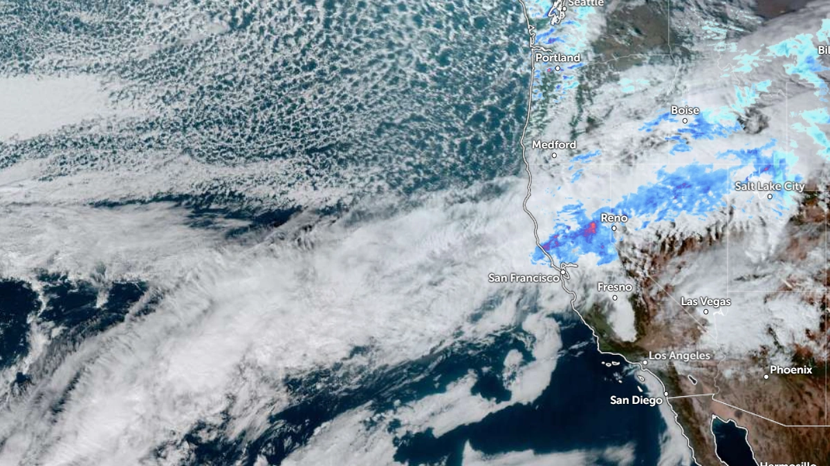
The first AR, currently over the Pacific Northwest, will shift south into northern and central California on December 20, with IVT values exceeding 650 kg m-1 s-1.
A second AR will develop offshore later the same day and maintain AR3-level conditions through December 22. Both systems have a 90–100% probability of IVT >250 kg m-1 s-1 across coastal and inland northern California.
A third and stronger AR is expected to form on December 23 as a deep mid-level trough approaches the coast, according to the Center for Western Weather and Water Extremes (CW3E).
West-WRF ensemble forecasts IVT intensities above 750 kg m-1 s-1 across central and southern California through December 25, with AR3–AR4 conditions possible along the coast and into the Sierra Nevada foothills.
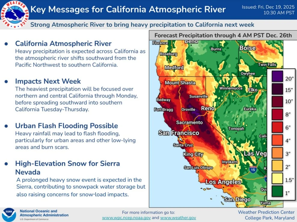
The National Weather Service (NWS) Weather Prediction Center forecasts seven-day rainfall totals of 250–510 mm (10–20 inches) across the Sierra Nevada, 180–250 mm (7–10 inches) along the northern and central coast ranges, and 75–180 mm (3–7 inches) across the Transverse Ranges of southern California.
The heaviest 24-hour precipitation is expected over the northern Sierra Nevada during the second AR and over the central and southern ranges during the third.
The NWS has issued marginal (level 1 of 4) and slight (level 2 of 4) excessive rainfall outlooks for much of northern and central California between December 19 and 24.
Video credit: CW3E
No major riverine flooding is currently forecast. However, data from the California-Nevada River Forecast Center (CNRFC) shows a 47% probability of the Russian River at Hopland exceeding flood stage and a 31% probability for the Ventura River near Foster Park within ten days. The back-to-back storms are likely to saturate the soil in the region, increasing the risk of runoff and flash flooding.
Freezing levels during the first two ARs will remain high, near 2 740 m (9 000 feet), limiting snow accumulation to the highest peaks.
Video credit: CW3E
Meanwhile, the third AR will bring cooler air and lower freezing levels to approximately 2 130 m (7 000 feet), resulting in heavy snow across the central and southern Sierra Nevada. CW3E forecasts indicate an 80% probability of more than 120 cm (48 inches) and a 55% probability of more than 180 cm (72 inches) of total snowfall at Tuolumne Meadows through December 25.
The NWS Winter Storm Severity Index shows over 70% probability of major winter storm impacts above 2 700 m (9 000 feet). This is consistent with ensemble snow projections and expected decreases in freezing level during the latter half of the sequence.
Additional moisture plumes could develop along the Pacific coast between December 27–January 2, extending the wet pattern into the end of the year.