
Residents in some of Southern California’s recent burn scar areas will be under flood watches and evacuation warnings and orders Tuesday morning as they prepare for the arrival of a powerful holiday storm.
The warnings will begin at 11 a.m. Tuesday and continue through 11 p.m. Thursday for most areas within the Palisades, Sunset and Hurst burn scar zones, according to the Los Angeles Emergency Management Department website. Los Angeles police officers will also be going door to door to issue evacuation orders to especially vulnerable addresses.
The National Weather Service is calling for an extreme risk of dangerous floods and debris flows on Christmas Eve and Christmas Day.

(National Weather Service – Los Angeles)
“Los Angeles City personnel continue preparing for the storm this holiday week. First responders, public works crews and utility personnel are ready to respond to potential impacts due to the weather,” Mayor Karen Bass said. “Angelenos planning to travel to spend time with family and loved ones this holiday week should follow official guidance, use caution on the roads, plan ahead and stay informed. Sign up for emergency alerts at NotifyLA.org.”
Forecasters describe the Christmas storm as the biggest in years to hit Southern California. In anticipation of potential debris flows following the January wildfires, officials positioned 13,000 feet of K-rail in Pacific Palisades and implemented measures to mitigate potential storm damage.
The National Weather Service (NWS) says a strong atmospheric river will affect the region from Tuesday through Saturday night, bringing 3 to 6 inches of rain to the coasts and valleys south of Point Conception and up to 11 inches in local mountains and foothills through Christmas Day.
“The atmospheric river, by the way, I want you to think of it as a hose,” KTLA meteorologist Henry DiCarlo said. “That hose is facing straight up south to north, and that’s why the south-facing areas are going to get those higher numbers.”

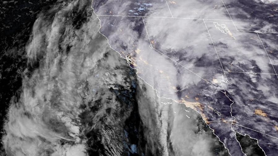
Satellite imagery shows a developing storm over California on Dec. 23, 2025. (NOAA)
The heaviest rain is expected late Tuesday night into Wednesday, with another intense period possible Wednesday night into Thursday, according to the NWS.
The likelihood of significant and widespread flooding with potential debris flows impacting recent burn scars has prompted officials to issue a flood watch from Tuesday afternoon through Thursday evening.
Many residents in flood-prone areas were seen filling sandbags on Monday to protect their properties from the upcoming storm. Distribution centers across Los Angeles County can be found here.
Snow levels are expected to remain above the 7,500- to 8,000-foot range through Christmas Eve but will drop to around 7,000 feet on Christmas Day. “So, no winter weather issues are expected through Christmas Eve, but some decent accumulating snowfall will be likely at the resort level on Christmas Day,” the NWS said.
The mayor urged Los Angeles residents to stay home during the peak of the storm if possible. “Angelenos planning to travel to spend time with family and loved ones this holiday week should use caution on the roads, plan ahead and stay informed,” Bass said.
Copyright 2025 Nexstar Media, Inc. All rights reserved. This material may not be published, broadcast, rewritten, or redistributed.
For the latest news, weather, sports, and streaming video, head to KTLA.