
A sweeping flood watch stretching more than 800 miles along California’s coast and interior plains is in effect this week as a series of powerful atmospheric river storms threaten widespread rainfall, flooding, and travel disruptions in the run-up to Christmas.
The National Weather Service has issued flood watches for nearly all of California through at least Friday as multiple Pacific moisture plumes — commonly known as “atmospheric rivers” — push inland, drenching both Northern and Southern California with prolonged heavy rain and elevating the risk of flash and urban flooding. Nearly 40 million residents are under some level of flood alert heading into the holiday period.
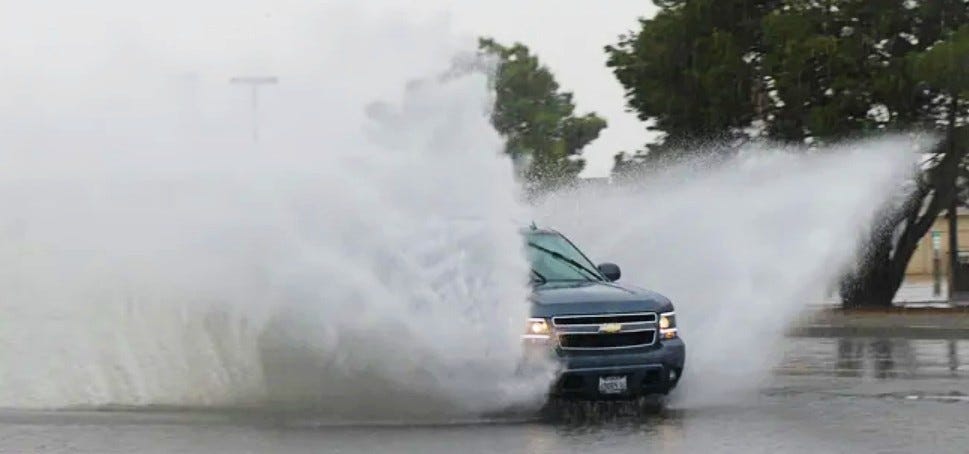
The same storm pattern that has already produced life-threatening flooding in places like Redding over the weekend — where emergency crews conducted water rescues and one person died amid flooded roadways — is poised to intensify
The same storm pattern that has already produced life-threatening flooding in places like Redding over the weekend — where emergency crews conducted water rescues and one person died amid flooded roadways — is poised to intensify.
“Tuesday through Saturday looks to be an extended period of significant rainfall,” the National Weather Service office in Los Angeles wrote. “By Saturday evening, rainfall totals will range 4–8 inches across coastal and valley areas to 8–12+ inches across the foothills and mountains.” Please take the necessary protective actions as flooding and debris flow will be a major issue this upcoming week.”
Aside from flooding, the system is accompanied by high winds and snow at higher elevations, with feet of snow forecast in the Sierra Nevada, posing a hazard to travel over major mountain passes during one of the busiest travel weeks of the year.
Emergency officials across the state are urging residents to prepare now: secure outdoor items, avoid driving through flooded roadways and sign up for local alerts as conditions evolve. Some local governments have issued evacuation warnings for communities near recent wildfire burn scars, where loose soil can trigger fast-moving debris flows when saturated.
How to prepare for an atmospheric river
The weather service in Portland said residents should take these steps to prepare for the heavy rain:
Check your home’s gutters and clean them out if they are clogged with leaves from recent winds.
Practice caution around low-water crossings, where street drains may back up, causing rain to pool.
Slow down when driving off interstates and bridge ramps, and when making turns. Recent heat has caused oil in the road to rise to the surface, making the roads slick when it rains.
Expect creeks to rise and have more flow in the Coastal Range, Willapa Hills, and Cascades.
Check your local weather forecast for expected rainfall amounts and timing.
California power outage mapCalifornia river water levelsExcessive rainfall forecast
The map shows the risk that rainfall could exceed flash flood guidance within 25 miles of a given location each day. Colors indicate the level of risk, with pink showing a high chance (70% or greater), red moderate (40% or greater), yellow slight (15% or greater), green marginal (5% or greater), and gray indicating a low risk (less than 10%).
California weather watches and warningsStay informed. Get weather alerts via text
Brandi D. Addison covers weather across the United States as the Weather Connect Reporter for the USA TODAY Network. She can be reached at baddison@gannett.com. Find her on Facebook here.
This article originally appeared on Palm Springs Desert Sun: California flood prompts alerts in all but 1 county. What they are, where