
Stormy weather remains in the forecast this week.
The first impact from the storm was gusty winds.
Bakersfield had a gust of 47 miles per hour Tuesday afternoon, and damage to trees and power outages were reported.
Winds will be gusty on and off through Thursday, but not as strong as what we saw Tuesday.
Our focus now shifts to rain.
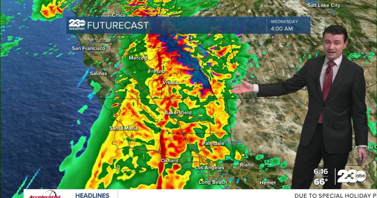
Rain will begin to move into Kern County Tuesday night, and become widespread by Wednesday morning.
Some clearing is expected Wednesday night, before another round of rain moves in Christmas Day, with lingering rain through at least Friday.
Everyone in Kern County will see rain, and it’s likely most will see rain totals over an inch.
Valley areas look to pick up 1.0″ – 2.0″, Desert areas are likely to receive 1.5″ – 3.0″, with mountain areas forecast to get 2.0″ – 4.0″.
It’s even possible that areas like Frazier Park, Pine Mountain Club, and Lebec pick up over 4″ of rain.
.
A Flood Watch is in effect for all of Kern County (and most of California) through Thursday.
Flooding of low-lying and poor drainage areas will be possible in the Valley.
Runoff flooding and washed out roads will be possible in our mountain and desert areas.
Mud and rock slides will be possible, too.
We’ll also see some snow this week.
As rain starts up Tuesday night only the very highest peaks in Kern will see snow, but snow levels look to drop to around 6,000 feet by Thursday night.
By Friday night snow levels drop to around 4,5000 feet, which means snowflakes over passes aren’t out of the question, but at this point travel impacts from snow are unlikely.
Stay in Touch with Us Anytime, Anywhere: