
LOS ANGELES – The third and final round of a holiday storm, fueled by an atmospheric river, has arrived in Southern California, bringing the continued threat of flooding, and mud and debris flow.
The final wave of the storm comes on one of the busiest travel days of the year.
Flood Watch
The National Weather Service (NWS) issued a Flood Watch through 4 p.m. Friday. The heaviest rainfall is expected in the Bridge Fire burn scar zone from 6 a.m. – 10 a.m., and from 8 a.m. to noon for the Line Fire burn scar zone.
The same weather advisory has been issued in Los Angeles and Ventura counties through 6 p.m. Friday.
SUGGESTED: Christmas storm rolls through Southern California: Timeline
Snow Levels
NWS forecasters said the snow level will fall to around 4,500 feet by Friday night.
For the San Bernardino County mountains, an additional 1 to 3 inches of snowfall is possible for elevations around 7,000 feet and between 8 and 14 inches for communities above 8,000 feet.
Below is a live update on the storm in Southern California:
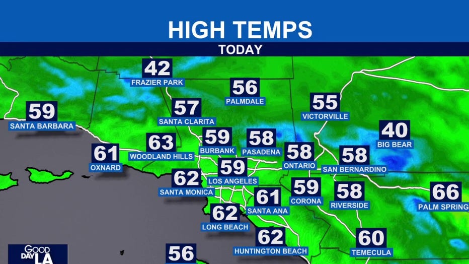
Afternoon highs in the region
6:15 a.m.: Along with consistent rain and strong winds, Southern California residents can expect cool conditions.
 Morning conditions in Malibu
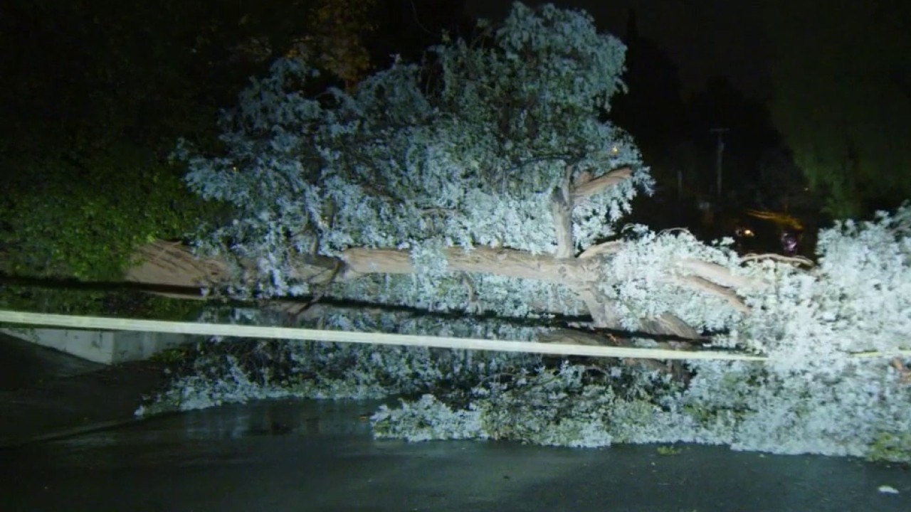
6 a.m.: FOX 11’s Mario Ramirez reported light but consistent rain in Malibu. Also, the winds were so powerful overnight, it caused a tree to topple over.
 Flash Flood Warning in Southern California
3:39 a.m.: The NWS issued a Flash Flood Warning for parts of LA County, including West Hollywood and Malibu, through noon.
Severe WeatherWeatherLos Angeles CountyVentura CountyRiverside CountySan Bernardino CountyOrange County