
Following several days of dry, sunny and windy conditions, a new storm packing rain and travel delays will roll into California later this week.
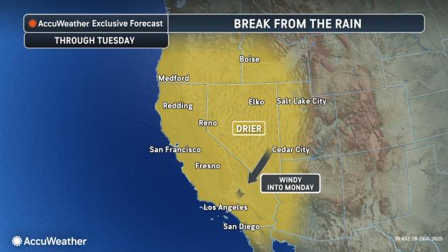
California and much of the Pacific Coast and interior western United States are getting a break from the siege of storms that had been ongoing for weeks in December. The storms brought one to three months’ worth of rain in just a few days. The dry pattern will last through Tuesday in most areas and is needed to help streams and rivers recede from their high levels.
The same pattern, however, is producing gusty winds from the Northeast, known to locals as a Santa Ana. The intensity of this particular Santa Ana event will fall into the moderate category, with gusts over the ridges and through the canyons and passes ranging from 40-60 mph. A few locally higher gusts are likely.
AccuWeather.com
Thanks to the recent drenching rain in the region, the brush will be moist enough to prevent a high risk of wildfires. There will still be some risk as the brush dries out after a couple of days.
More of a problem may be from wet soil and gusty winds, causing root systems of some trees to give way. This may lead to some trees toppling over that normally would not be a problem during a moderate Santa Ana.
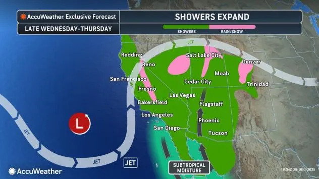
Looking ahead, all dry patterns must come to an end. However, rather than California and the Southwest remaining dry for weeks, moisture is expected to return to the area by the middle of the week.
This time, the moisture will move up from the south and the subtropical Pacific, rather than from the north or west.
AccuWeather.com
Despite the subtropical origin of the storm’s moisture, rainfall is not expected to be excessive in general. There will still be some pockets where the rain is heavy enough to renew the risk of mudslides and flash flooding, such as along the south- and west-facing slopes of the Transverse Range in Southern California. Fortunately, such heavy rain will not be widespread, nor will the related problems.
Most of the streams and rivers should be able to handle the rain without significant flooding. There can be the usual ponding along some streets and highways, where drainage is poor.
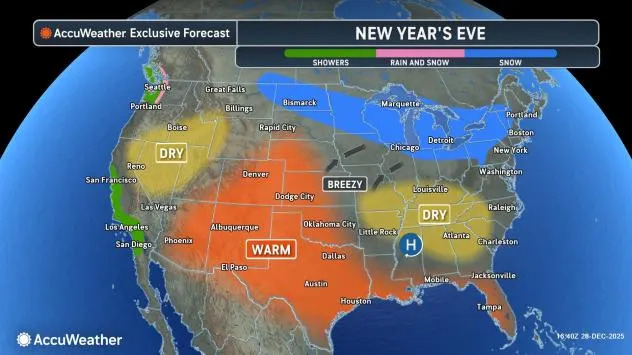
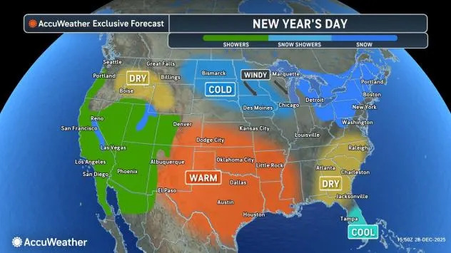
The showers may interfere with New Year’s Eve revelry.
AccuWeather.com
Showers will overspread much of Southern and Central California during the afternoon and early nighttime hours on New Year’s Eve, spreading to Northern California, Las Vegas and Reno, Nevada, and Phoenix late Wednesday night and Thursday.
People heading to and participating in the annual parade in Pasadena, California, on New Year’s Day may want to wear waterproof shoes, a warm jacket and a plastic rain poncho, as AccuWeather RealFeel Temperatures are forecast to be in the 50s F. Temperatures will recover a bit in the afternoon for the football game, but it is bound to shower at least once or twice and could rain a lot more often than that.
AccuWeather.com
Freezing levels will be above the Southern California passes with the storm. Freezing levels will rise as the storm progresses from Wednesday night to early Friday in the Sierra Nevada. There can be some slush at the onset at Donner Pass, California.
It may take until later Thursday afternoon or evening for showers to expand northward into western Oregon and Washington.
Have the app? Unlock AccuWeather Alerts™ with Premium+
When the main body of the Pacific storm swings toward the California coast, which may occur over the first weekend of 2026, freezing levels may drop low enough for snow to fall in earnest over Donner Pass, and heavy snow may accumulate over the Sierra Nevada.
The weather for the upcoming weekend will depend on the movement of the storm, with more showers versus the potential for widespread heavy rain to return.
Want next-level safety, ad-free? Unlock advanced, hyperlocal severe weather alerts when you subscribe to Premium+ on the AccuWeather app. AccuWeather Alerts™ are prompted by our expert meteorologists who monitor and analyze dangerous weather risks 24/7 to keep you and your family safer.