
Northern California forecast: Dense fog Monday, will it rain on New Year’s Eve?
HERE NOW WITH DETAILS ON THIS FORECAST. YEAH. THE FOG. THE BIGGEST CONCERN ESPECIALLY FOR THIS MORNING. BUT ONCE THE FOG MIXES OUT THIS AFTERNOON, WE’LL HAVE A BEAUTIFUL DAY AHEAD WITH SUNSHINE AND TEMPERATURES CLOSE TO NORMAL HEIGHTS. LIVE. LOOK OUTSIDE RIGHT NOW. THIS IS RANCHO CORDOVA. YEAH. FILLING IN WITH FOG SOUP. TEMPERATURES RIGHT NOW, UPPER 30S TO LOW 40S. MAKE YOUR WAY OUT THE DOOR HERE IN THE VALLEY. YOU DEFINITELY WANT THOSE LAYERS. AND MAYBE A WARM BEVERAGE OF YOUR CHOICE IN TUMBLER THIS MORNING TO KEEP IT WARM. EIGHT DEGREES SOUTH LAKE TAHOE SEEING SOME PATCHY AREAS OF FREEZING FOG AROUND TRUCKEE, BUT THE HEAVIER FOG THAT’S REALLY IMPACTING VISIBILITY FOR COMMUTERS ALONG I5 99. PARTS OF THE 80S SPOTS. SEEING SOME OF THIS FOG AND VISIBILITY DOWN TO QUARTER MILE OR LESS OUT NEAR THE AIRPORT THIS MORNING IN NEIGHBORHOODS LIKE WOODLAN AND NATOMAS, IT’S PRETTY HEAVY. WE’RE ALSO SEEING SOME PRETTY HEAVY FOG AS YOU GO EAST OF SACRAMENTO DRIVING. LET’S SAY INTERSTATE 80, IN THROUGH AREAS LIKE FAIR OAKS, CITRUS HEIGHTS, OR KINGVALE. YOU MAY BE SEEING A PRETTY GOOD DROP OFF VISIBILITY. SAME STORY FOR RANCHO CORDOVA SOUTH SACRAMENTO AROUND THE POCKET NEIGHBORHOOD, AND THEN YOU GET INTO STOCKTON MANTECA SALIDA MODESTO. WE’RE ALSO SEEING SOME ROUNDS OF HEAVIER FOG, AND THAT EXTENDS OUT TOWARDS THE TRACY TRIANGLE, WHERE TRACY RIGHT NOW IS UNDER A QUARTER OF A MILE. NOW, NOTICE THAT THE RADAR SATELLITE LOOP OVER THE LAST COUPLE OF HOURS. FAIRLY QUIET LANDSCAPE HERE ON THE WEST COAST. WE’RE GOING TO KEEP IT QUIET TODAY AND AGAIN TOMORROW, BUT IMPACT DAYS ARE ROLLING IN, ESPECIALLY BY THE END OF THE WEEK. THURSDAY AND FRIDAY. WANT TO HIGHLIGHT THIS FOR YOU? THEY’LL BE PERIODS OF STEADY RAINFALL, OCCASIONAL BREEZY CONDITIONS AND SNOW REALLY COMING DOWN IN THIS YEAR. BY FRIDAY NIGHT AND INTO SATURDAY. LET’S TIME THIS OUT NOW BECAUSE WE KNOW WE HAVE, OF COURSE, NEW YEAR’S EVE IN RANGE ON WEDNESDAY. THIS IS GOING TO BE WEDNESDAY NIGHT. IF YOU HAVE A DINNER RESERVATION, YOU WANT TO HAVE THE RAIN GEAR READY TO GO. AS WE COULD BE SEEING AGAIN, SOME GOOD STEADY RAINFALL OVERNIGHT WEDNESDAY INTO THURSDAY. THURSDAY MORNING. I KNOW NEW YEAR’S DAY. A LOT OF FOLKS LIKE TO GET OUTDOORS AND START THOSE RESOLUTIONS. I DO EXPECT THAT IT IS GOING TO BE A LITTLE BIT WET AND A LITTLE BIT BREEZY AS WELL. BY THURSDAY AFTERNOON, THIS IS 5 P.M. AS THE SUN IS DOWN, WE’RE STILL SEEING RAINFALL AND THEN EVENTUALLY WE’RE SEEING THIS RAIN. BY FRIDAY NIGHT INTO SATURDAY TURN INTO SNOW. SO EXTENDED SEVEN DAY FORECAST IN THE FOOTHILLS AND THE SIERRA AGAIN. DRY START TO THE WEEK. AND I THINK THAT BY WEDNESDAY NIGHT WE START TO GET RAIN IN THE FOOTHILLS. RAIN IN THE SIERRA WEDNESDAY NIGHT AND THEN TURNING OVER TO SNOWFALL BY FRIDAY NIGHT INTO SATURDAY. SEVEN DAY FORECAST HERE FOR THE VALLEY. YOU’RE GOING TO NOTICE THOSE TEMPERATURES KIND OF IN THAT RANGE OF LOW TO MID 50S WITH SOME GOOD STEADY RAINFALL EXPECTED STARTIN
Northern California forecast: Dense fog Monday, will it rain on New Year’s Eve?

Updated: 6:36 AM PST Dec 29, 2025
Commuters on Monday morning woke up to dense fog affecting visibility across Northern California.The National Weather Service issued a Dense Fog Advisory for parts of the Sacramento region and the Central Valley until 11 a.m. Drivers are recommended they drive more slowly and expect poor visibility on the highways.Meteorologist Tamara Berg said areas that don’t experience fog may see frost instead. By noon, the fog is likely to disappear, and conditions could become sunny.Dry weather is expected through early Wednesday, but Berg said chances for rain on the night of New Year’s Eve into New Year’s Day are possible.Rain and wind are likely to increase by Friday afternoon. Sierra snow could also return Friday night into Saturday.The KCRA 3 weather team is issuing Impact Days for both Thursday and Friday because of how rainy conditions could affect travel and outdoor activities.Details on the exact timing and amounts for wet weather are still developing. REAL-TIME TRAFFIC MAPClick here to see our interactive traffic map.TRACK INTERACTIVE, DOPPLER RADARClick here to see our interactive radar.DOWNLOAD OUR APP FOR THE LATESTHere is where you can download our app.Follow our KCRA weather team on social mediaMeteorologist Tamara Berg on Facebook and X.Meteorologist Dirk Verdoorn on FacebookMeteorologist/Climate Reporter Heather Waldman on Facebook and X.Meteorologist Kelly Curran on X.Meteorologist Ophelia Young on Facebook and X.Watch our forecasts on TV or onlineHere’s where to find our latest video forecast. You can also watch a livestream of our latest newscast here. The banner on our website turns red when we’re live.We’re also streaming on the Very Local app for Roku, Apple TV or Amazon Fire TV.See more coverage of top California stories here | Download our app | Subscribe to our morning newsletter | Find us on YouTube here and subscribe to our channel
SACRAMENTO, Calif. —
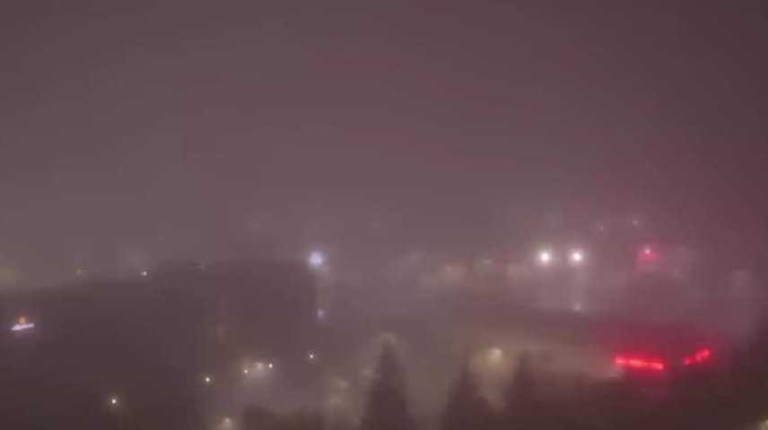
Commuters on Monday morning woke up to dense fog affecting visibility across Northern California.
The National Weather Service issued a Dense Fog Advisory for parts of the Sacramento region and the Central Valley until 11 a.m. Drivers are recommended they drive more slowly and expect poor visibility on the highways.
Meteorologist Tamara Berg said areas that don’t experience fog may see frost instead. By noon, the fog is likely to disappear, and conditions could become sunny.
Dry weather is expected through early Wednesday, but Berg said chances for rain on the night of New Year’s Eve into New Year’s Day are possible.
Rain and wind are likely to increase by Friday afternoon. Sierra snow could also return Friday night into Saturday.
The KCRA 3 weather team is issuing Impact Days for both Thursday and Friday because of how rainy conditions could affect travel and outdoor activities.
Details on the exact timing and amounts for wet weather are still developing.
REAL-TIME TRAFFIC MAP
Click here to see our interactive traffic map.
TRACK INTERACTIVE, DOPPLER RADAR
Click here to see our interactive radar.
DOWNLOAD OUR APP FOR THE LATEST
Here is where you can download our app.
Follow our KCRA weather team on social media
Meteorologist Tamara Berg on Facebook and X.Meteorologist Dirk Verdoorn on FacebookMeteorologist/Climate Reporter Heather Waldman on Facebook and X.Meteorologist Kelly Curran on X.Meteorologist Ophelia Young on Facebook and X.
Watch our forecasts on TV or online
Here’s where to find our latest video forecast. You can also watch a livestream of our latest newscast here. The banner on our website turns red when we’re live.
We’re also streaming on the Very Local app for Roku, Apple TV or Amazon Fire TV.
See more coverage of top California stories here | Download our app | Subscribe to our morning newsletter | Find us on YouTube here and subscribe to our channel