
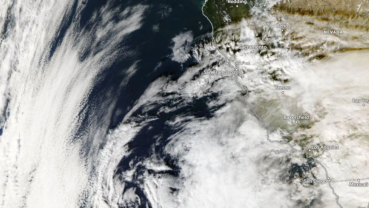
Two atmospheric rivers are forecast to make landfall over California, bringing heavy rain and snow accumulations across Southern California from late December through the first week of January.
The first AR made landfall along the Southern California coast late on December 30, driven by a subtropical moisture plume extending from the eastern North Pacific and strengthened by a mid-level cutoff low. Integrated vapor transport (IVT) values are forecast to reach moderate levels, with CW3E’s West-WRF model forecasting AR 2 intensity over coastal San Diego County.
Freezing levels during this first event are expected to remain near 3 650 m (12 000 feet) across the southern Sierra Nevada, leading to primarily rainfall rather than snow.
Video credit: CW3E
The Weather Prediction Center (WPC) has issued a Slight Risk (level 2 of 4) excessive rainfall outlook for coastal Southern California and a Marginal Risk (level 1 of 4) for coastal Central California through January 1.
A second, stronger AR is forecast to redevelop over the Northeast Pacific as a shortwave trough deepens and cyclogenesis occurs near the remnants of an earlier British Columbia system. It is forecast to make landfall late on January 1, 2026, continuing through January 4. IVT values between 800 and 1 000 kg m⁻¹ s⁻¹ are forecast along the northern and central California coastlines.
CW3E’s ensemble models show over 80% probability of AR conditions across coastal regions from Santa Cruz to Humboldt County.
The control member of the West-WRF ensemble indicates AR 3 intensity near Santa Cruz and AR 4 intensity along the Humboldt coast. The system will also be associated with a strengthening surface cyclone moving toward the West Coast on January 2.
Video credit: CW3E
WPC’s 72-hour forecast through 16:00 PST on January 4 shows over 100 mm (4 inches) of precipitation across the northern Coast Ranges, southern Cascades, and northern and central Sierra Nevada, with localized totals exceeding 180 mm (7 inches) in the northern Sierra.
Up to 75 mm (3 inches) or more precipitaion is forecast during the first AR due to strong southerly moisture flow.
Freezing levels are forecast to drop steadily from approximately 3 650 m (12 000 feet) to 1 830 m (6 000 feet) over the San Joaquin watershed by January 4. This will trigger a transition from rainfall to snow during the second AR, with heavier accumulations above 1 800 m.
CW3E ensemble snowfall projections show 80% probability of at least 45 cm (18 inches) of snow accumulation in Tuolumne Meadows by 16:00 PST on January 4.
 Image credit: WPC
The New Bullards Bar catchment in the northern Sierra Nevada foothills is projected to receive precipitation equivalent to more than 5% of its annual total between January 1 and 4, with some models exceeding 10%.
In southern California, the Prado Dam catchment is expected to receive between 25 and 50 mm (1 and 2 inches) during the same period.
Significant riverine flooding is not currently forecast, despite the heavy precipitation forecast. Joint assessments from the California Department of Water Resources (DWR) and the California–Nevada River Forecast Center (CNRFC) indicate that river levels will remain below major flood thresholds, though forecasters advise continued monitoring as the systems evolve.
According to the WPC’s Probabilistic Winter Storm Severity Index, moderate winter storm impacts are likely across the Sierra Nevada by the 24-hour period ending 04:00 PST on January 4, particularly from snowfall associated with the second AR.
CW3E noted that there is a low probability of the third AR around January 5, however uncertainty remains high due to long forecast time frame.
The heavy precipitation forecast has triggered evacuation warnings for multiple burn scar areas across Los Angeles County through New Year’s Day due to the risk of flash floods and debris flows.
Read more:
References:
1 Two atmospheric rivers to bring precipitation to California – CW3E -December 30, 2025