
BAKERSFIELD, Calif. (KBAK/KBFX) — The storm that bridged 2025 to 2026 has in a sense paved the way for the storm moving into our area this weekend.
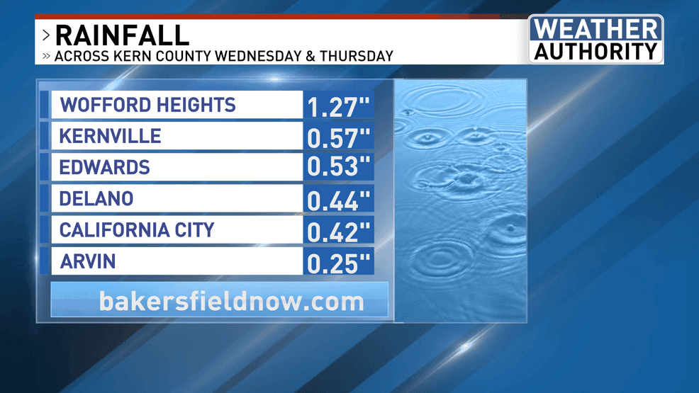
Rainfall amounts were generally on the lighter side within the South Valley, with more generous totals across the desert. The highest numbers came across the higher terrain surrounding the Kern River Valley.
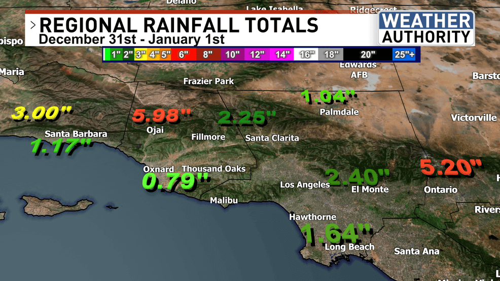
Further south, southern California took the cake with impressive rainfall across the mountains and substantial totals across the lower elevations.
The next storm system moves into our area from the Pacific with a front and potentially multiple rounds of precipitation, beginning Saturday and continuing Sunday.
The general forecast is for on and off rain as well as rainshowers. In addition, winds could start to stir again as the pressure gradient tightens.
Comment with Bubbles
BE THE FIRST TO COMMENT
Have a great weekend and stay safe out there!