
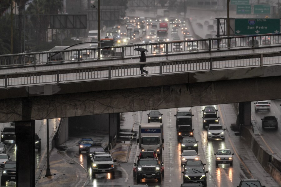
A series of storms is bringing heavy rain, gusty winds, elevated surf, and flood concerns to Southern California this weekend and into early next week, with the highest risks centered on Los Angeles, Ventura, Santa Barbara, and coastal burn areas, according to the National Weather Service.
Forecasters warn the current storm could produce road flooding, fast-moving creeks and rivers, and debris flows, especially in recent wildfire burn scars, KTLA weathercaster Kacey Montoya said. Evacuation warnings were issued Saturday morning for parts of Pacific Palisades, Topanga, and Malibu as burn-scar areas braced for heavy rain.
Current storm: Heavy rain through tonight, more Sunday
The storm is arriving in two main phases, the NWS said.
Later Saturday and into early Sunday, heavy rain over western Ventura County is moving east into Los Angeles County, gradually weakening but still capable of causing significant roadway flooding and minor debris flows.
Rainfall rates could reach 0.10 to 0.33 inches per hour, with localized bursts up to 0.66 inches per hour in stronger cells. Officials warn drivers not to cross flooded roads.
On Sunday, on-and-off showers will continue, with a 20% chance of thunderstorms through Sunday night. While most impacts are expected to be minor, any thunderstorms could trigger isolated moderate flooding, particularly near burn scars and in the mountains.
Rain totals on Sunday are forecast to range from 0.25 to 1 inch, with 1 to 2 inches possible in foothills and mountains.
Snow, wind, and surf impacts
Snow levels are expected to fall to around 6,000 to 7,000 feet, with 2 to 6 inches of snow possible above 7,000 feet and higher accumulations on the tallest peaks.
Gusty winds continue to raise the risk of downed trees and power lines, especially where soils are already saturated. Along the coast, steep seas and elevated surf are creating hazardous marine conditions.
Beach hazard statements remain in effect for parts of Los Angeles and Orange counties, with officials urging the public to stay back from jetties, rocks, and the water’s edge.
Evacuations, road closures in burn scar areas
In the Palisades Fire burn scar, evacuation warnings took effect as rain intensified Saturday morning.
Emergency crews staged sandbags and barriers while monitoring canyon roads vulnerable to mud and rock slides. A roughly six-mile stretch of Topanga Canyon Boulevard, between Pacific Coast Highway and Grand View Drive, was closed as a precaution, KTLA’s Carlos Herrera reported.
Residents in evacuation zones are urged to pack essentials, stay alert, and be ready to leave immediately if conditions worsen.
Next storm: More rain Monday through Wednesday
Another system is expected Monday through Wednesday, bringing a 60–80% chance of rain across much of the region.
Rain totals are forecast to be lighter — generally 0.10 to 0.5 inches, with up to 1 inch possible in mountains and foothills — and impacts are expected to be limited to minor flooding and travel delays, the NWS said.
When will it dry out?
Dryer weather is expected to return by Wednesday or Thursday, followed by a cooler, offshore flow pattern and very cold overnight temperatures later next week.
Copyright 2026 Nexstar Media, Inc. All rights reserved. This material may not be published, broadcast, rewritten, or redistributed.
For the latest news, weather, sports, and streaming video, head to KTLA.