
Toward the end of August, outdoorsy Angelenos rejoiced when the entirety of the region’s 66-mile forest highway finally reopened after a yearslong section closure. But now, just a few months later, a chunk of the highway is already closed again – and likely will be for a while.
Angeles Crest Highway, also known as state Route 2, is currently closed between Cedar Springs, near its intersection with the long-closed northern end of state Route 39, all the way east to where the highway hits state Route 138 near the Cajon Pass. In total, it’s a roughly 27-mile closure, pocked by washed-out roads, crumbled asphalt and other recent storm damage.
BEST OF SFGATE
Los Angeles | ‘The little California coffee shop crushing Starbucks, one latte at a time
California| Century-old Calif. community has no power, and a waitlist you can’t join
Central Coast| ‘Heartbreaking’: Once thriving Calif. downtown is on the brink
Culture | He was a janitor. Then, his 2000s California rock band made an immortal hit.
Get SFGATE’s top stories sent to your inbox by signing up for The Daily newsletter here.
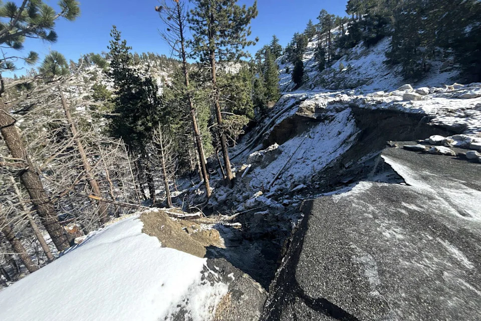
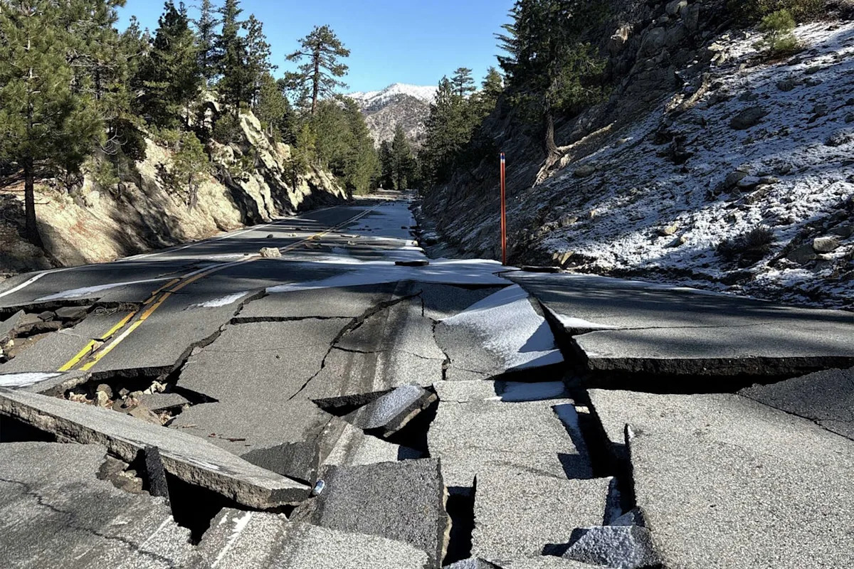
A portion of Angeles Crest Highway was severely damaged during Southern California’s December storms. The highway had just fully reopened at the end of August after a yearslong section closure. (Caltrans District 7)
Angeles Crest Highway runs roughly east-west through Angeles National Forest, stretching from the suburb of La Cañada Flintridge to just past the small mountain town of Wrightwood. The highway provides access to ski areas, hiking trails and picnic areas, and serves as the primary route that millions of Angelenos use each year to visit the vast national forest that’s often called LA’s extended backyard.
Before reopening in August, a roughly 10-mile stretch in the middle of Angeles Crest Highway had been closed since the winter of 2022-2023, when “relentless storms” collapsed roadways and caused rockslides, according to Caltrans. It took years to repair the highway, complicated by the September 2024 Bridge Fire, which caused additional damage.
Now it seems that 2025’s late summer reopening was short-lived.
Initial photos of this winter’s new storm damage to Angeles Crest Highway certainly indicate that another extended closure could be in the cards. December storms “caused significant damage to the roadbed in at least four locations,” Caltrans posted on social media Tuesday, with photos showing large chunks of the roadway missing and asphalt broken and lifted up. “ANGELES CREST HIGHWAY IS DESTROYED,” wrote Mike Leum, assistant director at Los Angeles County’s Sheriff’s Department, in an Instagram post Monday.

A portion of Angeles Crest Highway was severely damaged during Southern California’s December storms. The highway had just fully reopened at the end of August after a yearslong section closure. (Caltrans District 7)
For now, at least, the closure appears to mark the end of a brief but glorious four-month period when the road was fully accessible. But it’s far from the first or the last time that construction crews will battle Mother Nature to coerce a winding road through the ever-changing San Gabriel Mountains. Building the road between 1929 and 1956 required nearly 1,000 pounds of dynamite every day – and Southern California road crews and political officials have been struggling to keep it constantly open ever since.
More Los Angeles Coverage
–Once a California staple, rooftop doughnuts are disappearing
–The uncertain future of Orange County’s huge, eerie ghost mall
–The reservoir headache one Calif. desert city can’t leave behind
–As Hollywood struggles, one of its famous LA landmarks is taken down
For more SFGATE LA stories, subscribe to our new weekly newsletter The Southland here.
This article originally published at California mountain highway used by millions ‘destroyed’ by heavy rainfall.