
Northern California rain and snow forecast: Wet weather to ease Monday
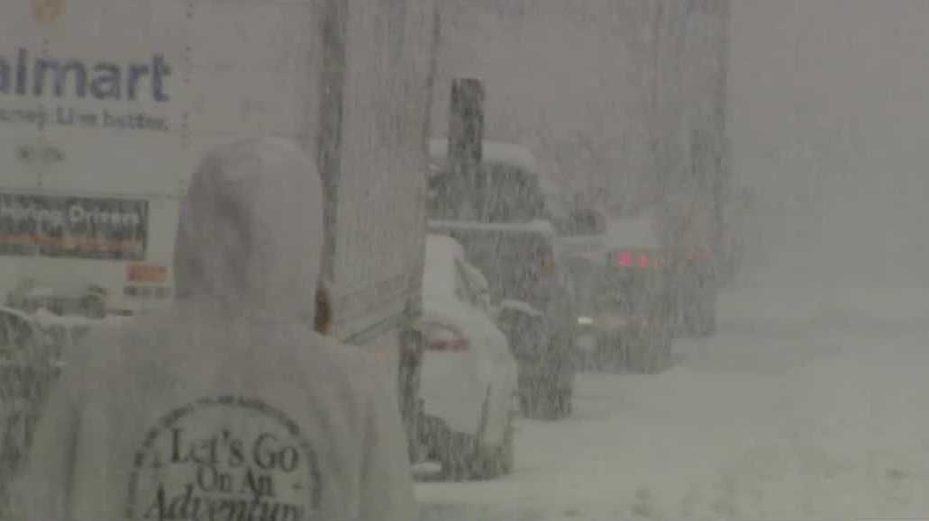
AS THIS INVESTIGATION MOVES FORWARD. GETTING BACK TO KCRA 3 WEATHER AND WE’VE GOT MORE RAIN AND SNOW IN OUR FORECAST FOR TODAY. THAT’S A LIVE LOOK OUT OF THE STOCKTON AREA THIS MORNING WHERE THEY ARE EXPECTING MORE RAIN TODAY AND WITH MORE SNOW EXPECTED IN THE SIERRA CHAIN CONTROLS REMAIN IN EFFECT ON INTERSTATE 80. OUR CREWS CAPTURED THIS VIDEO ALONG INTERSTATE 80 YESTERDAY. DAYTIME STUFF FOR NOW, THE KEY TO STAYING SAFE IS TAKING IT SLOW. BUT THERE IS GOOD NEWS ON THE HORIZON FOR DRIVERS AND THAT IS, SNOW WILL BE LETTING UP TODAY. YES IT WILL, BUT I’LL TELL YOU WHAT. IF YOU ARE IN THE THICK OF IT, YESTERDAY I MYSELF WAS IN LIVE TRACKER FOR OUR MORNING SHOW AND THEN GOT STUCK FOR AN HOUR AS THERE WAS A SPIN OUT. OUT OF HEAD IS OUT AHEAD OF US THERE AT BLUE CANYON ROAD AREA. SO YEAH. CONDITIONS WE KNEW YESTERDAY WERE PRETTY, PRETTY BAD, PRETTY TREACHEROUS. BUT WHAT I CAN TELL YOU ON THE BRIGHT SIDE IS THAT THE WINTER STORM WARNING THAT WAS UP FOR PRETTY MUCH A GOOD CHUNK OF THE WEEKEND HAS BEEN DOWNGRADED TO A WINTER WEATHER ADVISORY. SO WHAT DOES THAT MEAN? WELL, THAT SHOWS THAT CONDITIONS ARE ACTUALLY STARTING TO IMPROVE, ESPECIALLY FOR AREAS OF GREATER TAHOE AND TRUCKEE BASIN. SO FOR TODAY, SOME OF THOSE SHOWERS WILL LINGER THROUGH ABOUT THE 10:00 TIME FRAME. WINDS COULD STILL BE OCCASIONALLY GUSTY 30 PLUS MILES PER HOUR. THE MOST DIFFICULT TRAVEL I EXPECT WILL BE LIKELY IN THE MORNING, AS CALTRANS GETS A CHANCE TO GET OUTSIDE AND CLEAR OUT SOME OF THOSE CONDITIONS FROM THE NEW SNOW THAT FELL DURING THE DAY YESTERDAY. HERE’S A LIVE LOOK OUTSIDE FROM SUTTER HEALTH BALLPARK AND CONDITIONS ARE A LITTLE DAMP IF YOU’RE TRAVELING INTO THE CITY. 32 RIGHT NOW IN SOUTH LAKE TAHOE. LOW 50S AROUND THE VALLEY FLOOR, AND IT’S BEEN A LITTLE BIT BREEZY. THOSE WINDS PICKING UP ANYWHERE FROM TEN TO ABOUT 15MPH STRAIGHT FROM THE SOUTH TO THE NORTH. WE HAVE SOUTH WINDS GOING AT 14 RIGHT NOW IN PLACERVILLE, 16 IN AUBURN, AND YOU FEEL THE BREEZE IN TRUCKEE ALONG WITH THAT WIND CHILL WITH THOSE SOUTH WINDS AT 18MPH. TRUCKEE STILL GETTING SOME VERY LIGHT SNOW AT THIS POINT IN THE MORNING. WEATHER SYSTEM IS OFF THE COAST. AND AS IT KIND OF USHERS IN THIS FINAL PULSE OF MOISTURE, WE’RE DEFINITELY GOING TO FEEL SOME OF THE IMPACT OF IT IN TERMS OF THESE WIDELY SPREAD, SCATTERED SHOWERS. HERE’S 8:00 IN THE MORNING IF THAT’S WHEN HE TAKES THE LITTLE ONES BACK TO SCHOOL AFTER A LONG HOLIDAY BREAK. RIGHT. THIS IS 8:00 IN THE MORNING. YOU’VE GOT SOME SCATTERED SHOWERS HERE JUST AROUND THE NORTHERN SACRAMENTO VALLEY. AND THEN CHECK OUT THIS. THE BEST RAIN TODAY IS GOING TO BE HAPPENING ALONG THE COAST AND THE COASTAL HILLS. BUT THAT DOESN’T MEAN THAT WE CAN’T RULE OUT A PASSING SHOWER. EVEN GREETING THE VALLEY AND EVEN THE FOOTHILLS. AND THEN BY TOMORROW MORNING, WE’RE JUST GOING TO BE LEFT WITH A FEW SCATTERED CLOUDS. AND BY TOMORROW AFTERNOON, THINGS ARE GREATLY GOING TO IMPROVE IN TERMS OF SHOWING OFF PARTLY SUNNY SKIES AND DRYING OUT. RAINFALL AMOUNTS WON’T BE OVERLY IMPRESSIVE TODAY, 10TH OF AN INCH OR LESS IN MOST OF THE VALLEY. THOSE HEAVIER AMOUNTS HERE ALONG THE COAST AND IN THE FOOTHILLS WILL SQUEEZE OUT MAYBE A 10TH OF AN INCH OR LESS. THE SYSTEM CONTINUES, PIVOTING TO THE SOUTH OF US TUESDAY AND WEDNESDAY. ANOTHER ONE DROPS INTO PLACE AS WE GET INTO WEDNESDAY AND THURSDAY. THAT MAY TOUCH OFF A COUPLE OF SNOW SHOWERS, BUT LOOKING AHEAD TO NEXT WEEKEND, I DO EXPECT WE’RE GOING TO BE DRYING OUT AS THAT RIDGE OF HIGH PRESSURE BUILDS IN. SO FINALLY, FOR A CHANGE IN THE SEVEN DAY FORECAST, FOOTHILLS, SIERRA AND VALLEY, I DON’T ANTICIPATE ANY IMPACT OR A
Northern California rain and snow forecast: Wet weather to ease Monday

Updated: 7:18 AM PST Jan 5, 2026
Wet weather conditions are set to ease Monday for Northern California after a weekend of heavy rain and snow. Meteorologist Tamara Berg said some light showers may linger for morning commuters. Throughout the day, rain and snow will be hit-and-miss with limited impact on travel.The Sacramento Valley may see up to a tenth of an inch of rain, while the Foothills may get up to a half-inch of rain.In the mountains, Berg said snow levels will stay around elevations of 5,000 feet and higher. The National Weather Service said a Winter Storm Warning is in effect for the Tahoe area until 10 a.m. Monday. Afterward, the snow is expected to ease. Berg said the Sierra passes could see one to two inches of snow. The rest of the week appears to be dry, with the exception of some possible mountain showers by Wednesday and Thursday.REAL-TIME TRAFFIC MAPClick here to see our interactive traffic map.TRACK INTERACTIVE, DOPPLER RADARClick here to see our interactive radar.DOWNLOAD OUR APP FOR THE LATESTHere is where you can download our app.Follow our KCRA weather team on social mediaMeteorologist Tamara Berg on Facebook and X.Meteorologist Dirk Verdoorn on FacebookMeteorologist/Climate Reporter Heather Waldman on Facebook and X.Meteorologist Kelly Curran on X.Meteorologist Ophelia Young on Facebook and X.Watch our forecasts on TV or onlineHere’s where to find our latest video forecast. You can also watch a livestream of our latest newscast here. The banner on our website turns red when we’re live.We’re also streaming on the Very Local app for Roku, Apple TV or Amazon Fire TV.See more coverage of top California stories here | Download our app | Subscribe to our morning newsletter | Find us on YouTube here and subscribe to our channel
SACRAMENTO, Calif. —
Wet weather conditions are set to ease Monday for Northern California after a weekend of heavy rain and snow.
Meteorologist Tamara Berg said some light showers may linger for morning commuters. Throughout the day, rain and snow will be hit-and-miss with limited impact on travel.
The Sacramento Valley may see up to a tenth of an inch of rain, while the Foothills may get up to a half-inch of rain.
In the mountains, Berg said snow levels will stay around elevations of 5,000 feet and higher. The National Weather Service said a Winter Storm Warning is in effect for the Tahoe area until 10 a.m. Monday. Afterward, the snow is expected to ease.
Berg said the Sierra passes could see one to two inches of snow. The rest of the week appears to be dry, with the exception of some possible mountain showers by Wednesday and Thursday.
REAL-TIME TRAFFIC MAP
Click here to see our interactive traffic map.
TRACK INTERACTIVE, DOPPLER RADAR
Click here to see our interactive radar.
DOWNLOAD OUR APP FOR THE LATEST
Here is where you can download our app.
Follow our KCRA weather team on social media
Meteorologist Tamara Berg on Facebook and X.Meteorologist Dirk Verdoorn on FacebookMeteorologist/Climate Reporter Heather Waldman on Facebook and X.Meteorologist Kelly Curran on X.Meteorologist Ophelia Young on Facebook and X.
Watch our forecasts on TV or online
Here’s where to find our latest video forecast. You can also watch a livestream of our latest newscast here. The banner on our website turns red when we’re live.
We’re also streaming on the Very Local app for Roku, Apple TV or Amazon Fire TV.
See more coverage of top California stories here | Download our app | Subscribe to our morning newsletter | Find us on YouTube here and subscribe to our channel