

A parade of storms since New Year’s Day saturated the Sacramento region, pushing rainfall totals well above average for the season and delivering a much-needed boost to California’s mountain snowpack.
Although the rain has solidified the region’s water supply for now, experts cautioned that snowpack remains below average for this point in the year — a critical metric for long-term water storage. Many of this winter’s storms have been warmer, bringing rain instead of snow to mountain elevations that traditionally act as the state’s “water bank.”
As of Tuesday, Sacramento Executive Airport had recorded 2.51 inches of rain over the past six days, while Sacramento International Airport reported 2.65 inches. Totals in Folsom reached 2.37 inches, and American River College in Old Foothill Farms recorded 2.95 inches.
Rainfall totals were even higher in foothill and mountain communities. Georgetown in El Dorado County saw 6.83 inches, and nearby Placerville reported 5.65 inches. Jarbo Gap in Butte County led the region with 8.39 inches of rain over the same period. Blue Canyon, a high-elevation site in Placer County, recorded 6.87 inches.
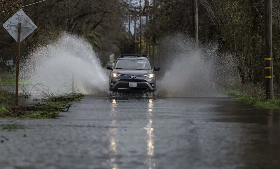
A motorist drives on the flooded Cherry Lane in Rio Linda on Friday, Dec. 26, 2025. Heavy rains on Christmas day brought flooding to the area from nearby Dry Creek.
Notable rainfall totals in Sacramento region
The most notable rainfall totals for the 144 hours ending at 1 p.m. Tuesday were in the Sierra foothills east of the capital.
Bullards Bar Reservoir: 5.13 inches
Snow depth changes across the Sierra
At higher elevations, snowfall has also surged. The UC Berkeley Central Sierra Snow Lab reported 40.9 inches of snow over the past week, with more than 20 inches falling in the 24 hours ending Monday morning. That single storm brought the lab’s snow total to the median for the 2026 water year.
Palisades Tahoe: 25 inches
Lost Lake in Alpine County: 25 inches
Mammoth Pass: 26.8 inches
How the reservoirs are doing
Despite the recent gains, California’s statewide snowpack remains uneven. Last week’s snow survey at Phillips Station recorded just 24% of the April 1 average and 71% of normal. The Northern Sierra, which feeds many of the state’s largest reservoirs, stood at 61% of normal.
Reservoir levels, however, are improving.
As of Tuesday, Shasta Lake held 79% of its capacity and 132% of its historical average. Lake Oroville was at 74% capacity and 135% of average. Folsom Lake reached 64% of capacity, while Trinity Lake and San Luis Reservoir stood at 83% and 70%, respectively.
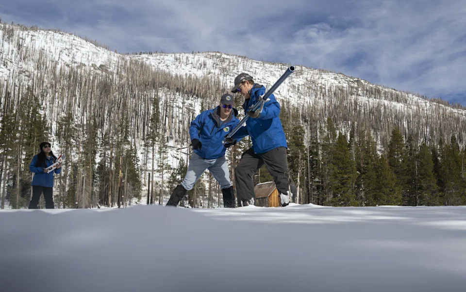
California Department of Water Resources engineers Jacob Kollen and Anthony Burdock, center, take the season’s first snow survey measurements with hydrometeorologist Angelique Fabbiani-Leon, left, at Phillips Station in El Dorado County on Tuesday, Dec. 30, 2025.
Snowpack improves, but remains uneven
California’s first snow survey of the winter on Dec. 30 found snowpack totals still lagging — particularly in the Northern Sierra — despite back-to-back storms that blanketed the mountains in the final week of the year.
Statewide snowpack measured 9.6 inches of snow water equivalent as of Tuesday, according to the Department of Water Resources. That’s 36% of the April 1 average and 90% of normal for this date. It marks a significant improvement from Dec. 1, when snowpack was just 5% of the April 1 average statewide.
Regionally, that breaks down to:
Northern Sierra: 7.0 inches snow-water equivalent, 26% of April 1 average, 67% of normal
Central Sierra: 10.4 inches snow-water, 37% of average, 91% of normal
Southern Sierra: 11.3 inches snow-water, 46% of average, 114% of normal
State officials said much of the precipitation in early winter fell as rain — rather than snow — due to elevated freezing levels. “Although this didn’t catch us up completely, it has put California in a much better place in terms of our water supply,” said Angelique Fabbiani-Leon, who led the December survey.
“With dry weather in the forecast for the next two weeks, those numbers will likely decrease,” said Dr. Michael Anderson, California’s state climatologist, told The Sacramento Bee on Monday “The timing, pace, and scale of storms between now and April 1 will influence the water year outcome.”