
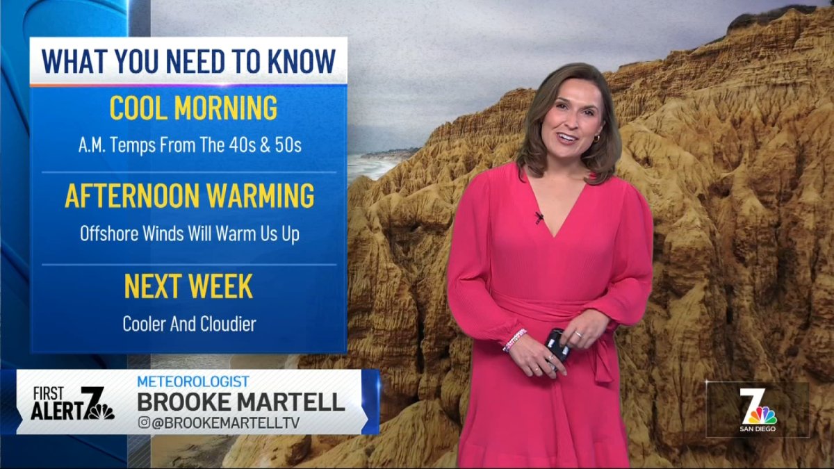
With high pressure and weak offshore winds hanging over the Desert Southwest, daytime temps will stay unusually warm through Monday. Humidity will stay low—especially in the mountains and deserts, where values could dip into the teens at times.
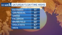
Saturday’s daytime highs were noticeably warmer than the past few days—not just in the valleys, but along the coast too. Places like Escondido and San Pasqual Valley hit 91 degrees, and even coastal spots saw highs in the upper 80s.
On Sunday, daytime temperatures along the coast and valleys will likely be about 5 degrees cooler than Saturday but still above average for this time of year. Meanwhile, the mountains and deserts are expected to warm up a few more degrees on Sunday and again on Monday.

Low pressure will bring cooler and cloudier weather next week. Right now, it looks like Wednesday could be the coolest day of the week with highs in the 60s for the mountains and low to mid-70s for the valleys.

For now, there’s only a 10% chance of light rain or more like drizzle from about Tuesday night into Wednesday morning, but we’ll continue to track the system and keep you updated.
SUNDAY
Coast: sunny – mid to upper 70s
Inland: sunny – mid to low 80s
Mountains: sunny – upper 60s to low 70
Deserts: sunny – upper 80s to low 90s