
Northern California forecast: Pleasant and warm rest of the weekend
Sunday will once again be warm as a ridge of high pressure remains the dominant weather feature.
THAT WAS VERY PLEASANT. YOU’RE RIGHT. THE EVENINGS ARE NICE AND COOL. BUT THE DAY TODAY WAS ALMOST A LITTLE A A LITTLE HOT, RIGHT? A LITTLE TOASTY AS TEMPERATURES APPROACHING 80 DEGREES. WE DIDN’T GET THERE, BUT WE WERE AWFULLY CLOSE. RIGHT NOW, THOUGH, IT FEELS REALLY NICE STEPPING OUT. REFRESHING AND COOL. WE’VE GOT MID 60S FROM THE VALLEY ALL THE WAY INTO THE FOOTHILLS OF THE SIERRA, 45 DEGREES UNDER CLEAR SKIES, AND THOSE WINDS VIRTUALLY NONEXISTENT. EARLIER THIS AFTERNOON WE HAD UPPER 70S UP AND DOWN THE VALLEY, EVEN OUT IN FAIRFIELD, CLOSE TO 80 DEGREES SAN FRANCISCO TOPPED OUT AT 77. THAT IS VERY WARM FOR THEM. MID 70S IN THE FOOTHILLS. EVEN TRUCKEE TAPPING 70 AT THEIR AIRPORT TODAY, ALL THANKS TO HIGH PRESSURE THAT MOVED IN FROM THE WEST COAST. NOW WE ARE WATCHING A STORM SYSTEM TO THE NORTHWEST. IT’S BRINGING SOME SHOWERS TO PARTS LIKE SEATTLE AND PORTLAND, BUT IT LOOKS LIKE THIS SYSTEM IS GOING TO CUT RIGHT EAST AND OUR NICE WEATHER WILL CONTINUE THIS WEEKEND. SO THIS IS WHAT YOUR SUNDAY LOOKS LIKE. BREEZY IN THE SIERRA. OCCASIONALLY TEMPERATURES CLIMBING TO MID 60S. VERY MUCH LIKE TODAY 69 IN ARNOLD, YOSEMITE AND QUINCY AT 72, IN GRASS VALLEY. TOMORROW 70 DEGREES, A LITTLE BIT WARMER. THE FOOTHILLS FURTHER SOUTH, CLIMBING INTO THE LOW TO MID 70S. ANOTHER WARM DAY IN THE DELTA AND THE BAY AREA THANKS TO AN OFFSHORE FLOW. 74 IN SAN FRANCISCO. THAT’S NOT TOO FAR OFF FROM THE UPPER 70S IN FAIRFIELD, CONCORD AND SAN JOSE, AND IN THE SAN JOAQUIN VALLEY. MOST SPOTS IN THE UPPER 70S UNDER SUNNY SKIES. WE’LL NOTICE A FEW CLOUDS IN THE SACRAMENTO VALLEY AS TEMPERATURES CLIMB TO UPPER 70S, ELK GROVE AND VACAVILLE JUST A LITTLE BIT COOLER, BUT STILL IN THE MID TO UPPER 70S. SO ANOTHER WARM DAY THANKS TO HIGH PRESSURE THAT REMAINS THE DOMINANT WEATHER FEATURE. HOWEVER, WE ARE WATCHING ANOTHER STORM SYSTEM. THIS ONE DOES NOT ARRIVE UNTIL NEXT WEEKEND, SO THAT’S HOW LONG HIGH PRESSURE IS GOING TO STICK AROUND. BUT WHEN THIS STORM SYSTEM ARRIVES, SOME FORECAST MODELS ARE SAYING IT’S GOING TO DRAG IN A PRETTY GOOD MOISTURE PIPELINE WITH SHOWERS AS EARLY AS FRIDAY NIGHT, A COUPLE SHOWERS POSSIBLE THEN AND THEN. FORECAST MODELS ARE SAYING THAT IT’S GOING TO DRAG THAT MOISTURE PIPELINE RIGHT ACROSS NORTHERN CALIFORNIA, MAYBE EVEN CENTRAL CALIFORNIA. NOW, AGAIN, THIS IS A WEEK OUT. A LOT CAN CHANGE, BUT THIS IS WHAT WE DO KNOW SO FAR, IS THAT THE POSSIBILITY OF WET WEATHER DOES RETURN NEXT WEEK. AND I’D LIKE TO EMPHASIZE WEATHER IN THE WEEKENDS, BECAUSE PEOPLE LIKE TO BE OUT THERE IS A POSSIBILITY FOR MOUNTAIN SNOW. IF WET WEATHER DOES ARRIVE TO THE REGION, BUT IT WILL BE VERY HIGH ELEVATION. WE’RE TALKING 8500FT AND ABOVE, AND TIMING AND AMOUNTS ARE HIGHLY UNCERTAIN FOR NOW. BUT OF COURSE THAT WILL CHANGE AS WE PROGRESS THROUGH THE WEEK. SPEAKING OF THE WEEK IN THE SIERRA. REALLY NICE ALL THE WAY THROUGH THE WEEK. POSSIBLE SHOWER AND WEDNESDAY AS A SMALL SYSTEM MOVES THROUGH THE PACIFIC OR THE DESERT SOUTHWEST. AND THEN WE’VE GOT SOME BREEZES ON FRIDAY PRECEDING SOME SHOWERS ON SATURDAY IN THE FOOTHILLS. BEAUTIFUL WEEK. WE DROP IN THE 60S, THURSDAY AND FRIDAY, SO IF THEY WANT SOME COOLER WEATHER, THEY’LL HAVE TO WAIT UNTIL THEN. ON SATURDAY THEY’RE BACK IN THE 50S WITH SOME SHOWERS, AND HERE IN THE SACRAMENTO VALLEY, UPPER 70S TOMORROW, MONDAY, TUESDAY, BASICALLY A RINSE AND REPEAT FOR THE FIRST HALF OF THE WEEK. A LITTLE BIT COOLER. WEDNESDAY, THURSDAY, FRIDAY AS WE DROP INTO THE LOW 70S. AND THEN WE HAVE THOSE POSSIBLE SHOWERS ON SATURDAY WITH HIGHS BACK IN THE 60S. CECIL OPHELIA YOUNG, THANK YOU
Northern California forecast: Pleasant and warm rest of the weekend
Sunday will once again be warm as a ridge of high pressure remains the dominant weather feature.

Updated: 9:21 PM PDT Oct 18, 2025
Sunday will once again be warm as a ridge of high pressure remains the dominant weather feature.Valley highs will climb into the upper 70s; foothill highs to the low 70s; and the Sierra will see afternoon temperatures in the mid-60s, with occasional breezes.A weak low will pass to our north, but impacts look limited to a Sierra breeze, a few clouds Sunday, and regional northerly winds on Monday.Temperatures will cool a few degrees midweek as a quick system moves through the Southwest, and a shower in the Sierra is possible Wednesday. The rest of the week looks partly cloudy and a couple of degrees cooler as we prepare for the next impactful weather system arriving next weekend.For now, models differ significantly on timing and amounts, but they suggest next weekend’s system may carry significant moisture. If rain does arrive, snow levels are not expected to be as low as in the last storm.
SACRAMENTO, Calif. —
Sunday will once again be warm as a ridge of high pressure remains the dominant weather feature.
Valley highs will climb into the upper 70s; foothill highs to the low 70s; and the Sierra will see afternoon temperatures in the mid-60s, with occasional breezes.
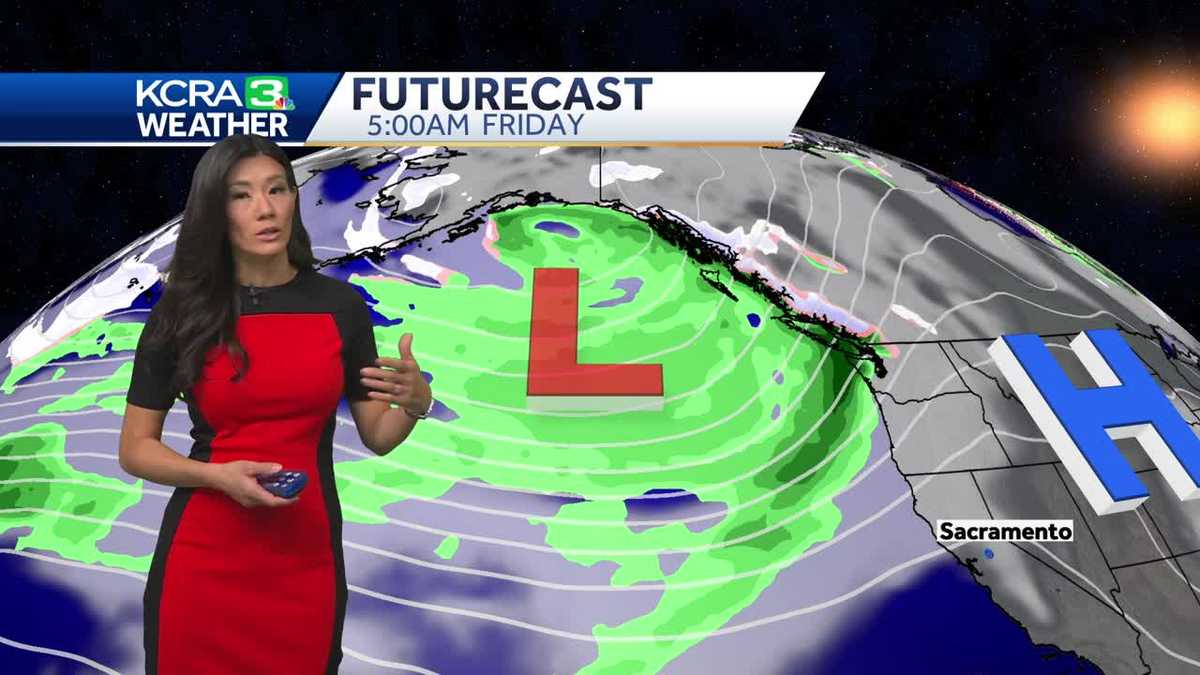
A weak low will pass to our north, but impacts look limited to a Sierra breeze, a few clouds Sunday, and regional northerly winds on Monday.
Temperatures will cool a few degrees midweek as a quick system moves through the Southwest, and a shower in the Sierra is possible Wednesday. The rest of the week looks partly cloudy and a couple of degrees cooler as we prepare for the next impactful weather system arriving next weekend.
For now, models differ significantly on timing and amounts, but they suggest next weekend’s system may carry significant moisture. If rain does arrive, snow levels are not expected to be as low as in the last storm.