
Parts of the Bay Area are seeing wildly different temperatures thanks to an unusually “dramatic” weather pattern.
A ridge of high pressure is causing a major temperature inversion in the Bay Area, with temperatures hitting the 70s at high altitudes while dropping close to freezing in some areas at lower altitudes, according to the National Weather Service.
“This is leading to pretty dramatic thermal belting, with warm air in the mountains and cold air settling in the valleys,” according to the weather service’s forecast discussion released on Friday.
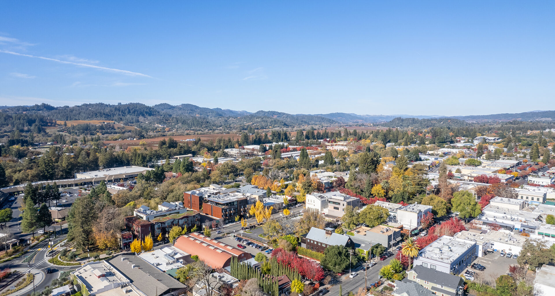
The major temperature differential was evident in the North Bay on Friday, with Healdsburg seeing temperatures in the 30s, while the nearby Healdsburg Hills had balmy weather, with the temperature reaching 70 degrees at 1,700 feet elevation.
Roger Gass, a meteorologist with the weather service, explained that the high pressure combined with weak winds can essentially keep cold air from moving out of those lower altitudes, resulting in cooler temperatures and more chances for fog.
“We have high pressure over the region that is allowing radiation cooling to occur in the valley location, while it’s very warm aloft,” he explained. “There’s some weak offshore flow across that region that’s really driving the warmer temperatures in those higher elevations.”
Gass said this warm weather is at 1,000 feet elevation and is expected to last for the next several days as the high pressure remains squarely above the region.
“Especially if you’re going out for like an early morning hike, yeah … it’s going to stay warm in the higher terrain,” he said.
The temperature inversion will likely last through much of the weekend, although the biggest temperature differential will be evident in overnight and early morning hours.
The Bay Area is expected to see sunshine and relatively moderate temperatures for the weekend, with San Francisco expected to have lows in the 40s and highs reach the mid-60s. The North Bay can expect to see temperatures range from the 40s to 60s, although Santa Rosa dipped to 34 on Friday. The East Bay is expected to see similar temperatures, with Livermore forecast to see a low of 42 on Friday and a high of 63 on Saturday.
The ridge of high pressure is keeping out any potential stormy weather until next week when it is expected to weaken slightly, with the earliest chance of rain likely being Thursday.