
Northern California forecast: Less fog, but more high clouds on Sunday
The morning will start with some patchy fog under increasing clouds. Highs in both the
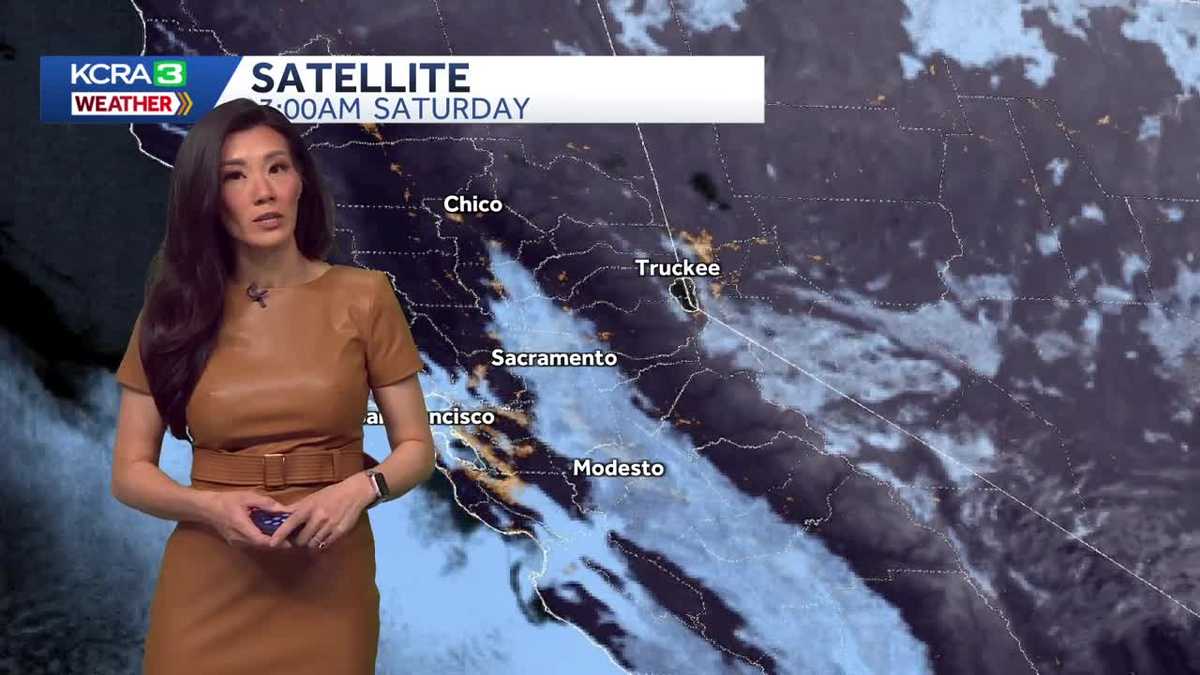
OPHELIA. OKAY. IT’S REALLY COLD OUT THERE. THANKFULLY NOT AS COLD HERE, BUT YOU’RE TRACKING THAT STORM SYSTEM, RIGHT? WE CERTAINLY ARE IN OKLAHOMA AND KANSAS. THE STATES THAT HAVE RECEIVED THE MOST SNOW FROM THIS STORM ANYWHERE. LIKE YOU SAID, 2 TO 7IN IN THOSE STATES. AND AS MORE MOISTURE MOVES INTO THE PLAINS, THEY’RE LOOKING AT A POTENTIAL FOR ANOTHER NINE INCHES IN OKLAHOMA CITY, THE STORM JUST ARRIVING TO COLUMBUS EARLIER THIS AFTERNOON. THEY’RE LOOKING FROM NOW UNTIL TOMORROW NIGHT, 1.5FT OF SNOW. AND IN NEW YORK, WHERE ALL THEY’VE GOTTEN ARE CLOUDS. SO FAR, THEY’RE LOOKING AT THE POTENTIAL FOR A FOOT. THE MOST DESTRUCTION MIGHT BE DUE TO ICE, WHERE YOU SEE IN THE PURPLE HERE. THIS IS WHERE PRECIPITATION IS MELTING IN A WARM LAYER AND FALLING TO THE GROUND, POTENTIALLY AS FREEZING RAIN OR SLEET. SO THAT IS AN AREA THAT WILL CERTAINLY BE WATCHING OUT FOR. THEY’RE ALREADY REPORTING ICE ON THE ROADS IN THOSE STATES BACK HERE ON THE WEST COAST. ALMOST FEEL GUILTY REPORTING THAT WE HIT 65 DEGREES UNDER SUNNY SKIES TODAY. THAT WAS A FEW DEGREES WARMER THAN OUR NORMAL. AND AS WE LOOK OUT RIGHT NOW, WE’RE STILL UNDER CLEAR SKIES. THE WINDS ARE CALMING DOWN, SO IT’S TURNING OUT TO BE A REALLY NICE SATURDAY EVENING HERE IN SACRAMENTO. WINDS ARE BELOW TEN MILES PER HOUR. LOOKS LIKE A LITTLE BREEZE IS LINGERING AND FAIRFIELD AND STOCKTON. WHAT’S LEFT OF THE WINDS ARE GOING TO TAPER. AND BY TONIGHT WE’RE LOOKING AT QUIET CONDITIONS. BUT BOY, DO THOSE WINDS REALLY DO US A FAVOR BY PUSHING THE FOG SOUTH. BY NOON TODAY, WE WERE UNDER CLEAR SKIES. RIGHT NOW, HOWEVER, WE DO HAVE A LITTLE FOG THAT’S MOVING BACK THROUGH MODESTO UNDER CLEAR SKIES FOR NOW, BUT I DON’T EXPECT IT TO REMAIN THAT WAY AS ANOTHER DISTURBANCE WILL SWING SOME CLOUDS INTO NORTHERN CALIFORNIA OVERNIGHT. EXPECT INCREASING CLOUDS BY TOMORROW. WALKING OUT TO PARTLY CLOUDY SKIES IN THE AFTERNOON. IT WILL TURN INTO MOSTLY CLOUDY SKIES AS A DISTURBANCE MOVES. A WEAK FRONT THROUGH AND THAT’S GOING TO CUT OUR WARM UP OFF AT 54 DEGREES IN THE VALLEY TOMORROW. 54. IN THE FOOTHILLS, THE SIERRA, BY COMPARISON, WILL HAVE A WARMER DAY TODAY. THEY TOPPED OUT IN THE 30S AND THE SIERRA, LOOKING AT TEMPERATURES CLIMBING TO 44 DEGREES TOMORROW. BEYOND THE WEEKEND, HIGH PRESSURE RETURNS MONDAY AND TUESDAY IS QUIET WEDNESDAY. HOWEVER, LOOKING AT THE POTENTIAL FOR RAIN IN THE MORNING, IF IT DOES ARRIVE, AND THAT’S ACCORDING TO JUST SOME WEATHER MODELS, IT WILL BE LIGHT RAIN, PROBABLY BEFORE WE GET OUT OF BED. BEYOND WEDNESDAY. TEMPERATURES CONTINUE TO BE ABOVE NORMAL. PRECIPITATION DRY. WE’RE LOOKING AT A DRY END OF JANUARY AND START TO FEBRUARY. ACCORDING TO SUGGESTIONS BY THE CLIMATE PREDICTION CENTER ON WEDNESDAY. NO RAIN FOR THE FOOTHILLS IN THE SIERRA IF IT EVEN MAKES IT INTO NORTHERN CALIFORNIA. SOME FORECAST MODELS ARE SAYING THAT IT’S REALLY GOING TO DRY OUT BEFORE IT ARRIVES HERE, SO THE VALLEY WILL BE LUCKY TO GET SOME SHOWERS, BUT THE SEVEN DAY FORECAST IS DRY FOR THE FOOTHILLS AND SIERRA TEMPERATURES HOVERING IN THE 40S IN THE SIERRA. HERE IN THE VALLEY, TEMPERATURES WILL BE IN THE 50S AFTER THE CHANCE OF SHOWERS ON WEDNESDAY. HIGH PRESSURE RETURNS AGAIN. UPPER 50S THURSDAY AND FRIDAY. THOSE TEMPERATURES ARE NICE AND IT’S NICE TO HAVE DRY WEATHER, BUT WE REALLY, REALLY NEED RAIN. WE’
Northern California forecast: Less fog, but more high clouds on Sunday
The morning will start with some patchy fog under increasing clouds. Highs in both the

Updated: 8:18 PM PST Jan 24, 2026
Mostly cloudy skies will keep temperatures on the cooler side for the second half of your weekend.The morning will start with some patchy fog under increasing clouds. Highs in both the valley and foothills will be in the mid-50s. Temperatures in the Sierra will warm into the mid-40s. Winds will be light, but skies will remain mostly cloudy into the evening.High pressure returns to start the week, and patchy morning fog will return, clearing by midday. Expect more sunshine in the afternoons, with valley highs returning to the upper 50s.Weather models still disagree on whether a system will bring rain to the region on Wednesday. If we get any showers, they will likely be very light, mainly in the morning, and limited to the valley; the foothills and Sierra look dry.Beyond Wednesday, dry and quiet weather returns with only occasional cloud cover.
SACRAMENTO, Calif. —
Mostly cloudy skies will keep temperatures on the cooler side for the second half of your weekend.
The morning will start with some patchy fog under increasing clouds. Highs in both the valley and foothills will be in the mid-50s. Temperatures in the Sierra will warm into the mid-40s. Winds will be light, but skies will remain mostly cloudy into the evening.
High pressure returns to start the week, and patchy morning fog will return, clearing by midday. Expect more sunshine in the afternoons, with valley highs returning to the upper 50s.
Weather models still disagree on whether a system will bring rain to the region on Wednesday. If we get any showers, they will likely be very light, mainly in the morning, and limited to the valley; the foothills and Sierra look dry.
Beyond Wednesday, dry and quiet weather returns with only occasional cloud cover.