
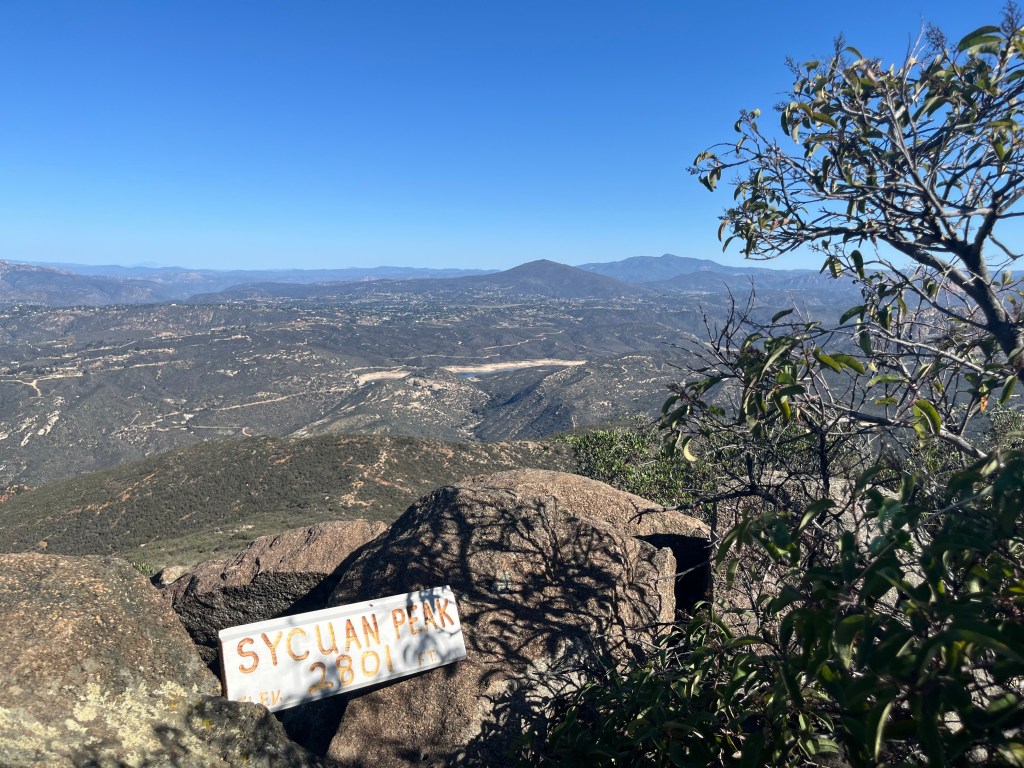
As I scanned the 360-degree scenery from Sycuan Peak, my eyes landed on a blue structure in the distance to the northwest: a water tower.
But not just any water tower — the water tower in my hometown of Crest, a small unincorporated community in East County.
It shouldn’t have come as much of a surprise. Sycuan Peak, in Jamul, sits at about 2,800 feet above sea level and offers an impressive view of the entire county. I saw our notable mountains, like the peaks of Cowles, Viejas and El Cajon toward the north and Lyons and Lawson toward the south. But there’s something special about spotting such a familiar marker like a water tower — a little reminder that I’m home.
The view from the top of Sycuan Peak is just one highlight from this hike. The roughly 2-mile uphill climb to the top will raise your heart rate, and the terrain is challenging, with several rocky sections and deep crevices caused by years of erosion. The out-and-back trail is straightforward — largely a direct line from the trailhead to the peak — and I will likely return when I’m itching for a short but effective workout.
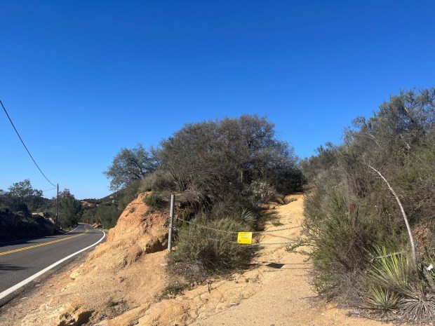 The trailhead for Sycuan Peak is hard to miss and parking is limited. (Maura Fox / The San Diego Union-Tribune)
It is entirely exposed to the sun, so I’d recommend this hike for an early morning or on a cooler day. The plus side to the exposure is that hikers can admire the scenery as they climb the 750 feet of elevation to the summit. On the day I hiked, Jamul’s hillsides were a bright green, despite the weeks since it rained.
The trailhead is located on Lawson Valley Road, just east of Inverness Way. Parking is limited — only a few cars can fit safely along the side of the road. On a weekday, I only shared the trail with one other hiker.
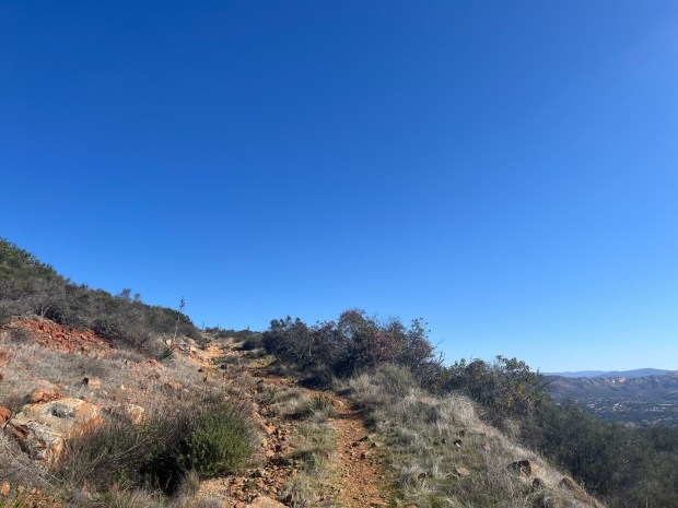 The trail leading to Sycuan Peak steadily inclines for about a mile. (Maura Fox / The San Diego Union-Tribune)
Begin by heading northwest up the trail, which starts behind a sign for the ecological boundary. The trail is rugged as it ascends. Along the way, hikers are surrounded by mafic southern mixed chaparral, a unique type of chaparral vegetation that is found in mafic soils, which are rich in magnesium and iron.
Near the 0.6-mile mark, the trail briefly flattens before climbing the final half-mile to the peak. According to the California Department of Fish and Wildlife, peregrine falcons use the peak as a foraging territory. It certainly feels like a good place to soar above the vegetation in pursuit of a meal.
At the top, there was a refreshing breeze as I took in the landscape. Don’t miss the short scramble to the official summit, where there is a trail register marking the spot, surrounded by boulders to perch on.
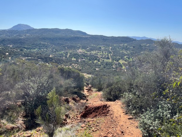 Sections of the trail are eroded and rocky, and hikers should be cautious, especially going downhill. (Maura Fox / The San Diego Union-Tribune)