
Northern California is about to get some much-needed rain and snow. It’s been more than a month since the region has seen a beneficial storm and that has the Sierra snowpack lacking. But the current outlook shows several storms that could help make up for lost time between now and the last week of February. Here’s what the KCRA 3 weather team knows about the forecast so far.Rain, snow return Tuesday, continue WednesdayThe first in this potential rain weather systems will arrive Tuesday and last through Wednesday. Both days are KCRA 3 weather Impact Days. This system won’t be strong, but it will bring the first round of meaningful rain and snow we’ve seen in a while. Scattered rain showers and light to moderate Sierra snow will pick up around midday and last through Wednesday. Roads will be wet in the Valley and Foothills, but flooding will not occur. Chain controls will likely be needed over the Tahoe area passes. As of Sunday night, the KCRA 3 weather team is expecting 6 to 10 inches of snow over Donner Summit. Echo Summit will see 4 to 6 inches. Spots at lake level around Lake Tahoe will pick up a couple of slushy inches. Rain totals will range between a quarter-inch and a half-inch of rain along and north of Interstate 80 in the Valley. Places south of I-80 will see a couple of tenths of an inch of rain. Adjacent Foothills communities will see about double those numbers. Stronger storm for Valentine’s Day weekendThursday and Friday will be dry, but a slow-moving, stronger storm is in the forecast for Valentine’s Day weekend. This system has the potential to bring feet of heavy snow to the Sierra passes over a period of several days starting late Saturday. Valley rain totals may be measured in inches between late Saturday and early next week. The KCRA 3 weather team will provide details on day-to-day timing and totals as we get closer to the weekend. Those with plans for Valentine’s Day, especially those with plans in the Sierra, should watch this forecast closely and be ready to adjust those plans. See more coverage of top California stories here | Download our app | Subscribe to our morning newsletter | Find us on YouTube here and subscribe to our channel
SACRAMENTO, Calif. —
Northern California is about to get some much-needed rain and snow.
It’s been more than a month since the region has seen a beneficial storm and that has the Sierra snowpack lacking. But the current outlook shows several storms that could help make up for lost time between now and the last week of February.
Here’s what the KCRA 3 weather team knows about the forecast so far.
Rain, snow return Tuesday, continue Wednesday
The first in this potential rain weather systems will arrive Tuesday and last through Wednesday. Both days are KCRA 3 weather Impact Days.
This system won’t be strong, but it will bring the first round of meaningful rain and snow we’ve seen in a while.

Hearst Owned
Rain totals Tuesday and Wednesday will be enough to keep roads wet in the Valley and Foothills, but flooding will not occur.
Scattered rain showers and light to moderate Sierra snow will pick up around midday and last through Wednesday. Roads will be wet in the Valley and Foothills, but flooding will not occur. Chain controls will likely be needed over the Tahoe area passes.

Hearst Owned
Snow totals Tuesday through Wednesday will be measured in inches, not feet over Donner summit. But drivers should expect long delays because of chain control restrictions both days.
As of Sunday night, the KCRA 3 weather team is expecting 6 to 10 inches of snow over Donner Summit. Echo Summit will see 4 to 6 inches. Spots at lake level around Lake Tahoe will pick up a couple of slushy inches.
Rain totals will range between a quarter-inch and a half-inch of rain along and north of Interstate 80 in the Valley. Places south of I-80 will see a couple of tenths of an inch of rain. Adjacent Foothills communities will see about double those numbers.
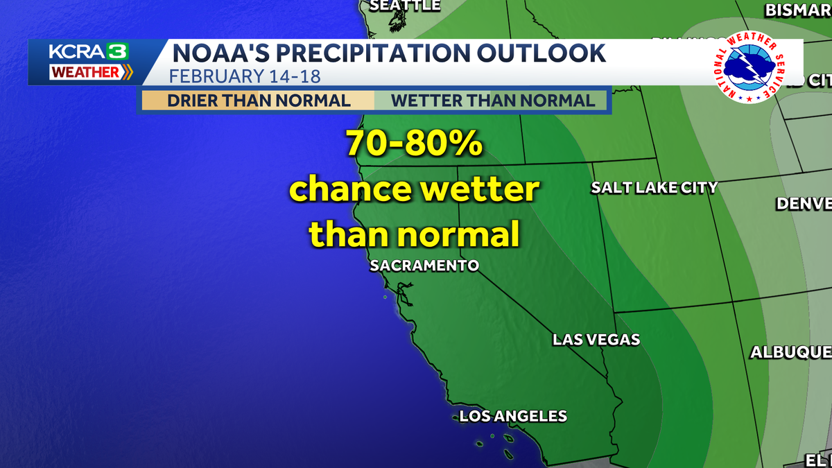
Stronger storm for Valentine’s Day weekend
Thursday and Friday will be dry, but a slow-moving, stronger storm is in the forecast for Valentine’s Day weekend.
This system has the potential to bring feet of heavy snow to the Sierra passes over a period of several days starting late Saturday.
Valley rain totals may be measured in inches between late Saturday and early next week.
The KCRA 3 weather team will provide details on day-to-day timing and totals as we get closer to the weekend. Those with plans for Valentine’s Day, especially those with plans in the Sierra, should watch this forecast closely and be ready to adjust those plans.
See more coverage of top California stories here | Download our app | Subscribe to our morning newsletter | Find us on YouTube here and subscribe to our channel