
Central California is bracing for widespread rain and thunderstorms starting Tuesday, with conditions expected to persist through early Thursday, including gusty winds and potential hail. The Santa Lucias have a 75% chance of receiving at least 1.50 inches of rain. The forecast also includes potential for isolated thunderstorms, gusty winds, small hail, and brief heavier rain from Tuesday afternoon through early Wednesday.Strengthening south winds are anticipated from Tuesday into early Wednesday, with gusts potentially reaching up to 40 mph in the high terrain of the Central Coast, peaking late Tuesday. A break in rain chances is expected late Thursday into Friday, but rain is forecast to return Saturday and continue into early next week.Mid to high-level clouds are present over much of the state today as the storm track undergoes a shift. A cold front exited the Central Coast of California early this morning, bringing cooler air with temperature trends generally 2 to 8 degrees cooler than yesterday. Light north winds behind the weak boundary have been influenced by local terrain and coastal interactions, with occasional gusts up to 15 to 20 mph observed in higher elevations such as the Santa Cruz Mountains, Diablo Range, and some East/North Bay mountains.
SALINAS, Calif. —
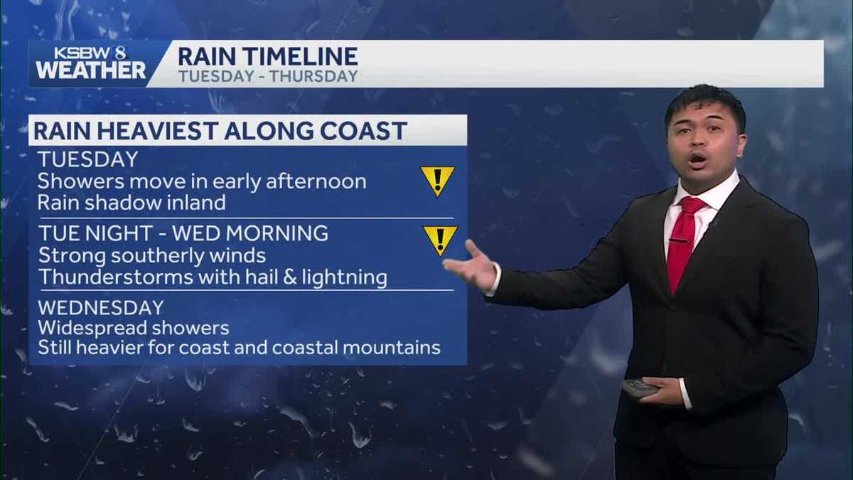
Central California is bracing for widespread rain and thunderstorms starting Tuesday, with conditions expected to persist through early Thursday, including gusty winds and potential hail. The Santa Lucias have a 75% chance of receiving at least 1.50 inches of rain.
The forecast also includes potential for isolated thunderstorms, gusty winds, small hail, and brief heavier rain from Tuesday afternoon through early Wednesday.
Strengthening south winds are anticipated from Tuesday into early Wednesday, with gusts potentially reaching up to 40 mph in the high terrain of the Central Coast, peaking late Tuesday.
A break in rain chances is expected late Thursday into Friday, but rain is forecast to return Saturday and continue into early next week.
Mid to high-level clouds are present over much of the state today as the storm track undergoes a shift.
A cold front exited the Central Coast of California early this morning, bringing cooler air with temperature trends generally 2 to 8 degrees cooler than yesterday.
Light north winds behind the weak boundary have been influenced by local terrain and coastal interactions, with occasional gusts up to 15 to 20 mph observed in higher elevations such as the Santa Cruz Mountains, Diablo Range, and some East/North Bay mountains.