
Northern California rain and snow forecast: Wet, windy conditions expected Wednesday
YOU DO IT? I WOULD ABSOLUTELY DO IT. AND WHAT’S GREAT ABOUT THAT IS YOU DON’T HAVE TO HAVE, LIKE, HAIR AND MAKEUP DONE. YOU’RE A BUSH. GET IN AND YOU MAKE UP REQUIRED. THERE YOU GO. AND I WOULD DO IT FOR FREE. YEAH, I THINK I PROBABLY WOULD. TOTALLY A COOL EXPERIENCE FOR SURE. AND IN NORTHERN CALIFORNIA, WE’VE BEEN EXPERIENCING SOME RAIN SHOWERS OVERNIGHT AND SOME BRIEF GUSTY WINDS AS WELL. AN IMPACT DAY BECAUSE WE’LL SEE THESE SHOWERS SPIN UP ON OCCASION. SOME OF THEM MAY BE MODERATE TO HEAVY AT TIMES, AND SOME WILL BE ON THE LIGHTER SCALE. LIVE LOOK OUTSIDE RIGHT NOW IN RANCHO CORDOVA. YOU CAN SEE SOME BROKEN APART CLOUDS THERE AS YOU LOOK OVER THE HIGHWAY 50 STRETCH. AND YEAH, TODAY IS GOING TO BE ONE OF THOSE DAYS WHERE THINGS ARE JUST KIND OF A POTPOURRI OF WEATHER WHERE YOU MAY GET ONE LIGHT SHOWER AND THEN A HEAVIER SHOWER AN HOUR LATER, AND YOU MAY EVEN SEE SOME BREAKS OF SUNSHINE ONCE THE SUN COMES UP. ABOUT AN HOUR FROM NOW. TRACKING MID 50S RIGHT NOW IN THE VALLEY 28 DEGREES WITH THE LAYERING OF CLOUDS. AND WHO IS SEEING SHOWERS RIGHT NOW? WITHIN THE LAST THREE HOURS WE’VE BEEN SEEING MOST OF THESE BANDS KIND OF HUG PART OF THE I-5 CORRIDOR. AND IF YOU’RE DRIVING INTERSTATE 80, THERE MAY BE SOME POCKETS OUT THERE. BUT THIS IS NOT THE TYPE OF RAIN THAT WE’RE SEEING. ANY STANDING WATER OR PUDDLES AT LEAST EXTENDING ON THE HIGHWAYS, JUST KIND OF THAT SHEEN. LOOK AS YOUR HEADLIGHTS HIT THE ROAD AND THE TRACK THERE ALONG INTERSTATE 80, A COUPLE OF BANDS OF SHOWERS. IF YOU’RE TRAVELING AND YOU’RE SUPER COMMUTER, MAYBE YOU’RE LEAVING STOCKTON AREA, GOING ACROSS THE TRACY TRIANGLE AND INTO THE BAY AREA. YOU’RE GOING TO TURN ON THOSE WINDSHIELD WIPERS JUST TO THE WEST OF TRACY AND OUT INTO AREAS LIKE BRENTWOOD. BIG PICTURE VIEW. HERE’S OUR PIECE OF ENERGY SPINNING HERE ACROSS NORTHERN CALIFORNIA. AND IT’S JUST GOING TO LINGER OFFSHORE. AND IT BASICALLY HAS A, YOU KNOW, SPOKES OF ENERGY WRAPPING AROUND IT THAT CHURN UP THE MOISTURE AND BRING IN AND DRIVE SOME OF THOSE OCCASIONAL BANDS OF SHOWERS. I THINK THE SNOWFALL TODAY WILL STAY PRIMARILY ABOVE 5500FT ADDITIONAL, MAYBE 1 TO 3IN LIKELY AT THE PASSES. WINDS COULD BE GUSTY AT TIMES 20 TO 35MPH, ESPECIALLY IN THE FOOTHILLS AND THE VALLEY. AND I’M NOT GOING TO RULE OUT MAYBE A RUMBLE OF THUNDER FROM NOW ALL THE WAY UNTIL THE SUN GOES DOWN TONIGHT. SO THE SYSTEM MOVES IN AND OUT OF THE AREA. IT ACTUALLY SINKS TO THE SOUTH OF US OVERNIGHT TONIGHT, WE’RE GOING TO BE LOOKING AT A DRY FORECAST THURSDAY AGAIN ON FRIDAY, AND THEN CHECKING IN ON SATURDAY. I KNOW IT’S A HOLIDAY BECAUSE IT’S VALENTINE’S DAY. THE WIND WILL START TO PICK UP THIS ONSHORE BREEZE OR SOUTHERLY FLOW, BUT NO RAIN. IN FACT, WE’LL SEE THOSE CLOUDS ZIPPING IN SATURDAY, BUT IT LOOKS LIKE IT’S GOING TO BE A DRY FORECAST FOR ANY OUTDOOR PLANS. YOU HAVE. FRONT HALF OF SUNDAY STARTS OUT DRY, AND THEN OUR NEXT ROUND OF RAIN STARTS TO MOVE INTO THE AREA. STARTS OUT INITIALLY LATE SUNDAY, LATE IN THE AFTERNOON. PICKS UP THE PACE AS WE GO THROUGH THE OVERNIGHT SUNDAY, MONDAY AND IMPACT DAY AS THE NEXT ROUND OF RAIN MOVES THROUGH. THIS ONE WILL HAVE SOME COLDER AIR TO WORK WITH, WHICH IS GREAT NEWS FOR THE MOUNTAINS AS WE’LL SEE SOME GOOD STEADY SNOWFALL LATE SUNDAY AND INTO THE DAYTIME MONDAY AND AGAIN ON TUESDAY. FOR THE FOOTHILLS, THAT DOES MEAN SOME RAIN, AND WE COULD EVEN SEE WITH THE COLDER AIR RUSHING IN BY MONDAY NIGHT INTO TUESDAY, SNOW LEVELS GETTING AS LOW AS AROUND 4000FT. WHAT THAT MEANS FOR YOU HERE IN THE VALLEY AGAIN, WE’VE GOT A DRY STRETCH OF WEATHER AHEAD AFTER TODAY AND THEN THE RAIN ARRIVING LATE SUNDAY AND LASTING
Northern California rain and snow forecast: Wet, windy conditions expected Wednesday

Updated: 8:16 AM PST Feb 11, 2026
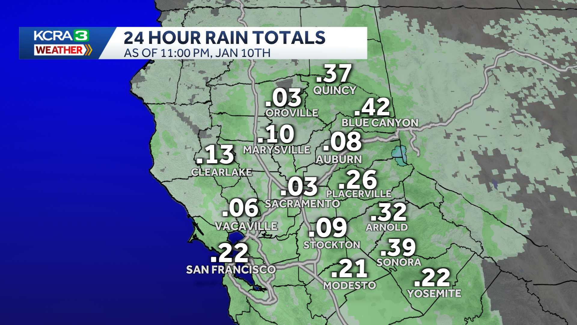
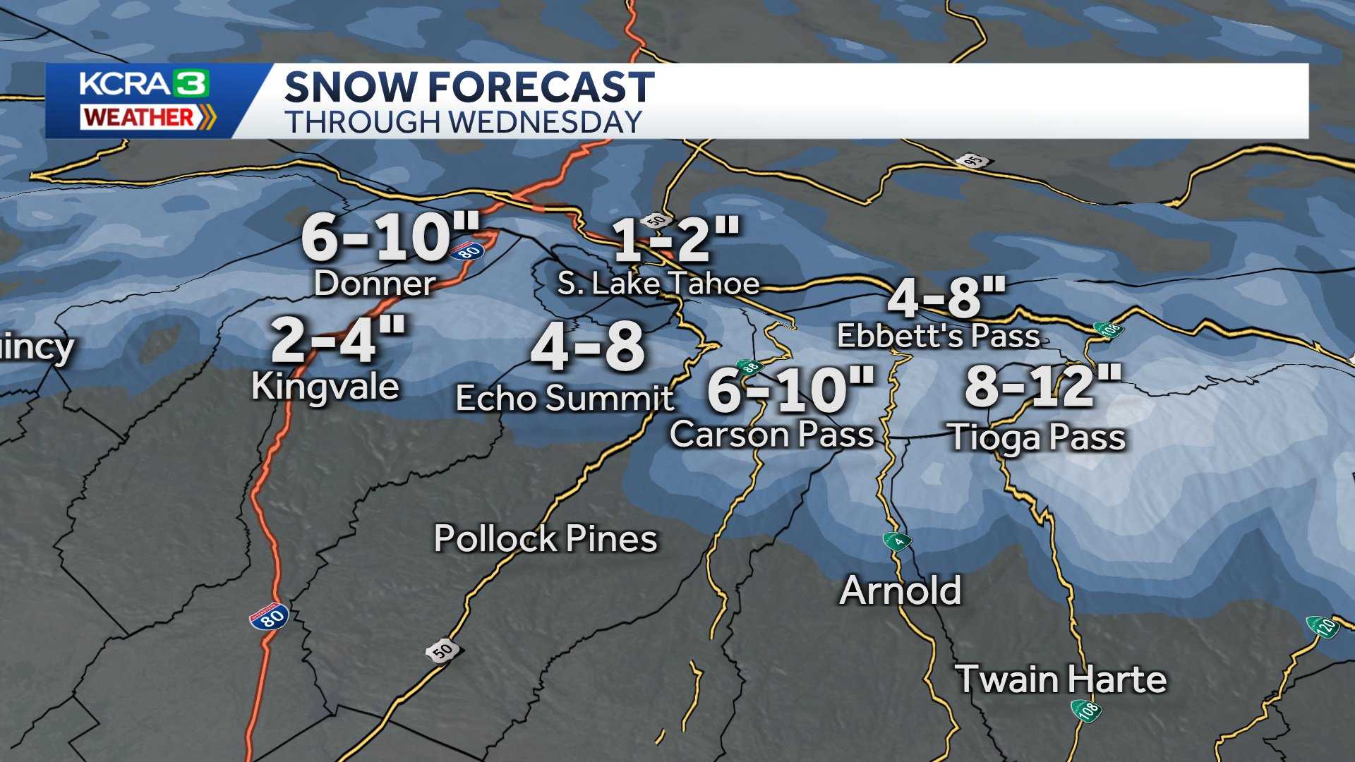
Northern California will see a second day of wet weather following a long stretch of dry conditions.The KCRA 3 weather team is issuing an Impact Day because of how rain and snow could impact travel and outdoor activities. Morning commuters are likely to see damp conditions.Sierra snow is likely to lead to continued chain controls on the highways. When chain controls are in effect, that means drivers should have chains installed on their tires with the exception of vehicles with four-wheel-drive and snow tires equipped.The speed limit on freeways is adjusted when chain controls are in effect. On Interstate 80, it is 30 mph. On Highway 50, it is 25 mph.Meteorologist Tamara Berg provided these estimated totals for rain and snow:Sacramento Valley: Up to a quarter-inch of rainFoothills: Up to a half-inch of rainLake level: An inch of snowSierra passes: 1 to 3 inches of snowThe afternoon is also likely to be windy, with gusts ranging from 25 to 35 mph. After sunset, the wind should taper off. Isolated thunderstorms are also possible, which could lead to heavy rain, lightning and small hail.Another round of showers could happen Thursday before sunrise. Afterward, Northern California is expected to dry out through early Sunday.Berg said the next storm is colder and stronger for Monday and Tuesday.REAL-TIME TRAFFIC MAPClick here to see our interactive traffic map.TRACK INTERACTIVE, DOPPLER RADARClick here to see our interactive radar.DOWNLOAD OUR APP FOR THE LATESTHere is where you can download our app.Follow our KCRA weather team on social mediaMeteorologist Tamara Berg on Facebook and X.Meteorologist Dirk Verdoorn on FacebookMeteorologist/Climate Reporter Heather Waldman on Facebook and X.Meteorologist Kelly Curran on X.Meteorologist Ophelia Young on Facebook and X.Watch our forecasts on TV or onlineHere’s where to find our latest video forecast. You can also watch a livestream of our latest newscast here. The banner on our website turns red when we’re live.We’re also streaming on the Very Local app for Roku, Apple TV or Amazon Fire TV.See more coverage of top California stories here | Download our app | Subscribe to our morning newsletter | Find us on YouTube here and subscribe to our channel
SACRAMENTO, Calif. —
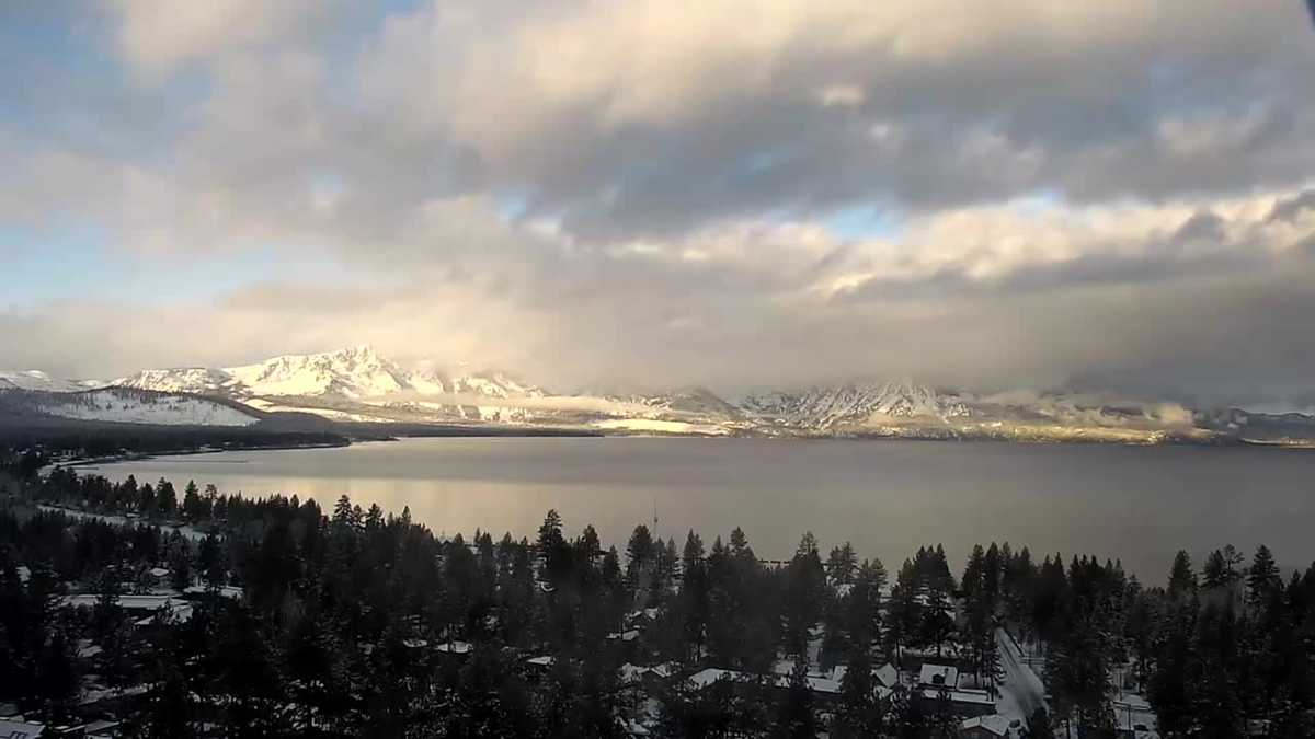
Northern California will see a second day of wet weather following a long stretch of dry conditions.
The KCRA 3 weather team is issuing an Impact Day because of how rain and snow could impact travel and outdoor activities. Morning commuters are likely to see damp conditions.
Sierra snow is likely to lead to continued chain controls on the highways. When chain controls are in effect, that means drivers should have chains installed on their tires with the exception of vehicles with four-wheel-drive and snow tires equipped.
The speed limit on freeways is adjusted when chain controls are in effect. On Interstate 80, it is 30 mph. On Highway 50, it is 25 mph.
Meteorologist Tamara Berg provided these estimated totals for rain and snow:
Sacramento Valley: Up to a quarter-inch of rainFoothills: Up to a half-inch of rainLake level: An inch of snowSierra passes: 1 to 3 inches of snow
The afternoon is also likely to be windy, with gusts ranging from 25 to 35 mph. After sunset, the wind should taper off. Isolated thunderstorms are also possible, which could lead to heavy rain, lightning and small hail.
Another round of showers could happen Thursday before sunrise. Afterward, Northern California is expected to dry out through early Sunday.
Berg said the next storm is colder and stronger for Monday and Tuesday.
REAL-TIME TRAFFIC MAP
Click here to see our interactive traffic map.
TRACK INTERACTIVE, DOPPLER RADAR
Click here to see our interactive radar.
DOWNLOAD OUR APP FOR THE LATEST
Here is where you can download our app.
Follow our KCRA weather team on social media
Meteorologist Tamara Berg on Facebook and X.Meteorologist Dirk Verdoorn on FacebookMeteorologist/Climate Reporter Heather Waldman on Facebook and X.Meteorologist Kelly Curran on X.Meteorologist Ophelia Young on Facebook and X.
Watch our forecasts on TV or online
Here’s where to find our latest video forecast. You can also watch a livestream of our latest newscast here. The banner on our website turns red when we’re live.
We’re also streaming on the Very Local app for Roku, Apple TV or Amazon Fire TV.
See more coverage of top California stories here | Download our app | Subscribe to our morning newsletter | Find us on YouTube here and subscribe to our channel