
How Much Rain, Snow To Expect Across West
A much wetter pattern next week will soak parts of California with flooding rain and feet of Sierra snow, but also bring much-needed replenishment to a western snowpack that is record low for this time of year from the Pacific Northwest to the Rockies.
What a strange winter we have seen in the West.
Sustained warmth broke records across the region. And to top it off, there was hardly any precipitation.
![]()
Weather in your inbox
By signing up you agree to the Terms & Privacy Policy. Unsubscribe at any time.
(MORE: Did Winter Forget The West?)
But that warm, dry pattern that lasted through much of the winter is finally breaking down.
And with that comes cooler temperatures and the chance for rain and mountain snow. That’s beneficial for much of the West. But it could become too much of a good thing in California.
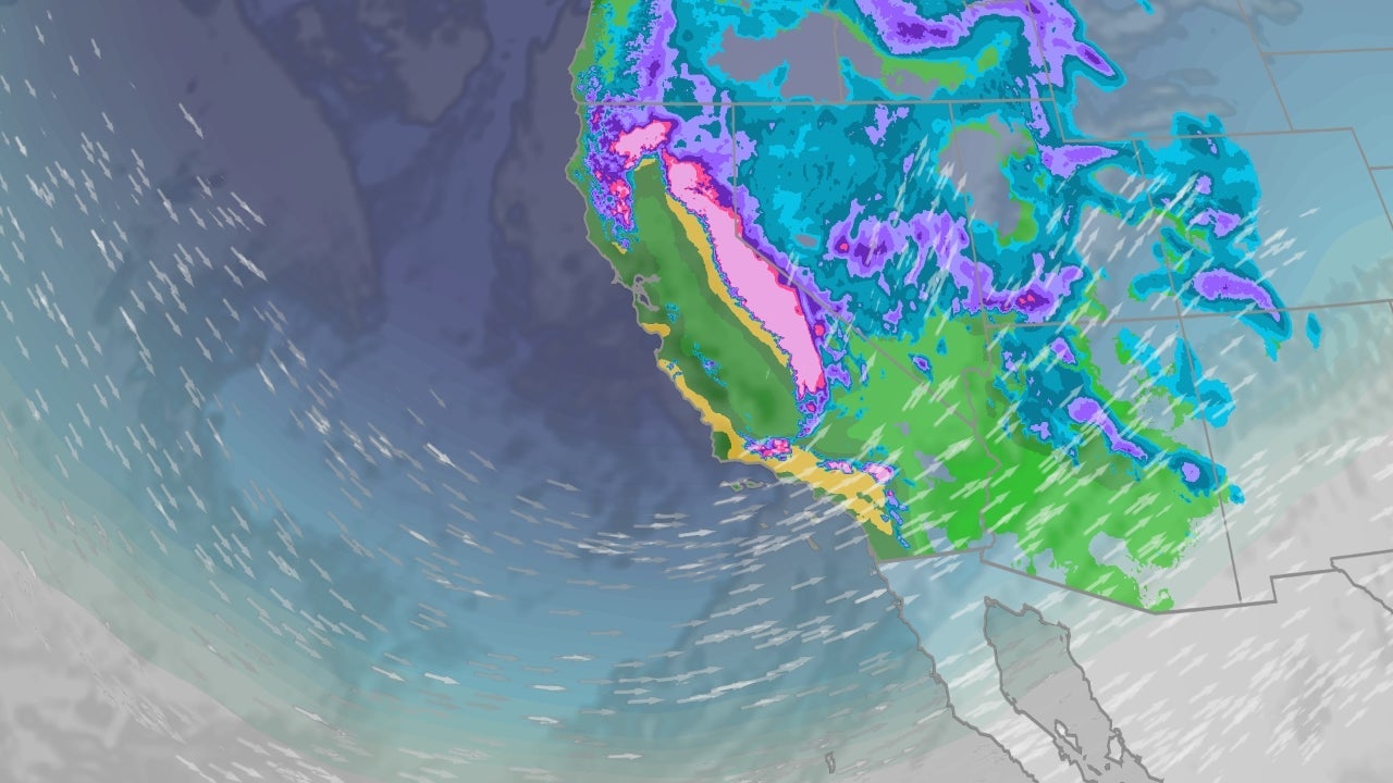
Soggy And Snowy Starts Sunday
Forecast models are pointing to a much wetter round of precipitation beginning Sunday and lasting for several days next week.
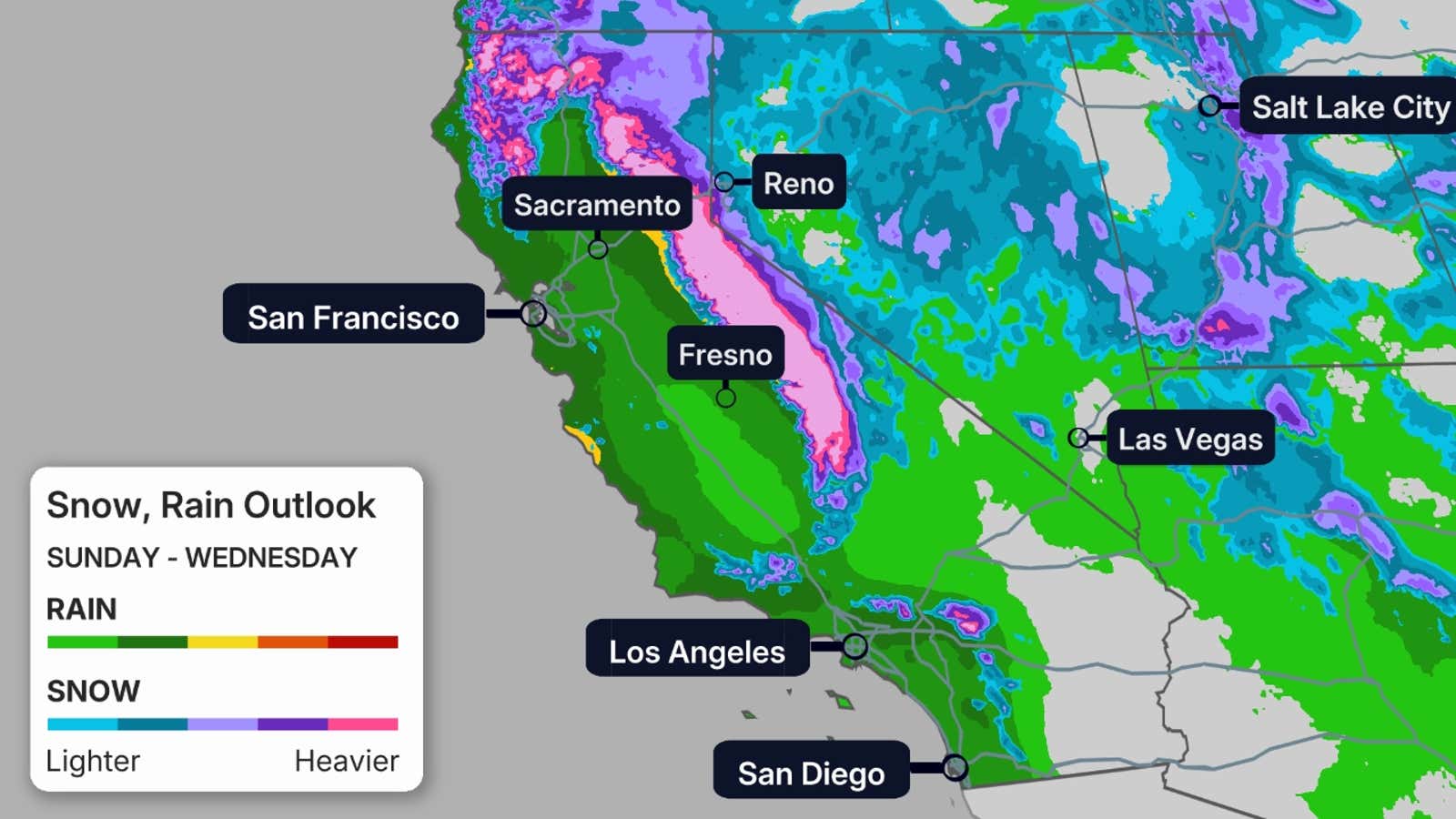
With this pattern shift, there is a chance of days of sustained, locally heavy rainfall across California. That also means there is an increasing flood threat for the state, especially across burn scars. The areas in the darker green and yellow contours on the map below show the highest chance of the heaviest rainfall.
That includes all of Southern California, the central California coast and Sierra foothills below snow level.
(FORECAST: Los Angeles | San Diego)
California’s snowpack will also see a major boost. Specifically, feet of Sierra snowfall, and some heavy snowfall in the Southern California mountains is likely next week. Travel in this higher terrain will become increasingly challenging, if not impossible, at times.
Despite the travel challenge, this boost in Sierra snowpack is needed, as it’s currently running only about 50% of average for this time of the year, according to the California Department of Water Resources.
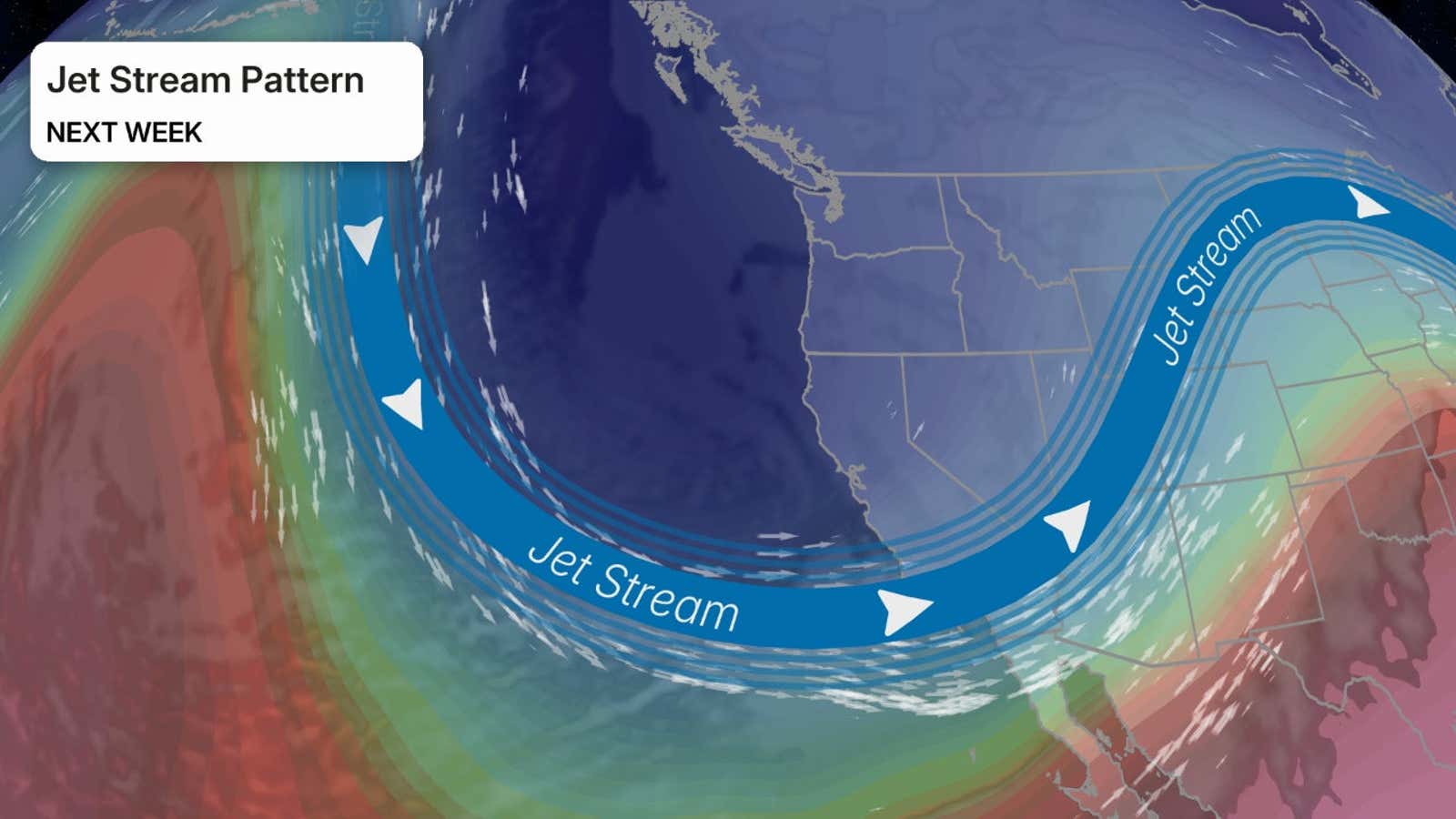
 Why The Shift?
Most of the winter has seen the jet stream riding well north into western Canada, then plunging southward into the East. This pattern leads to less rainfall and warmer temperatures out West.
The graphic below shows what will happen next week. The jet stream will, instead, take its sharp southward plunge into the West, leading to cooler temperatures and an influx of much-needed rain and snow.
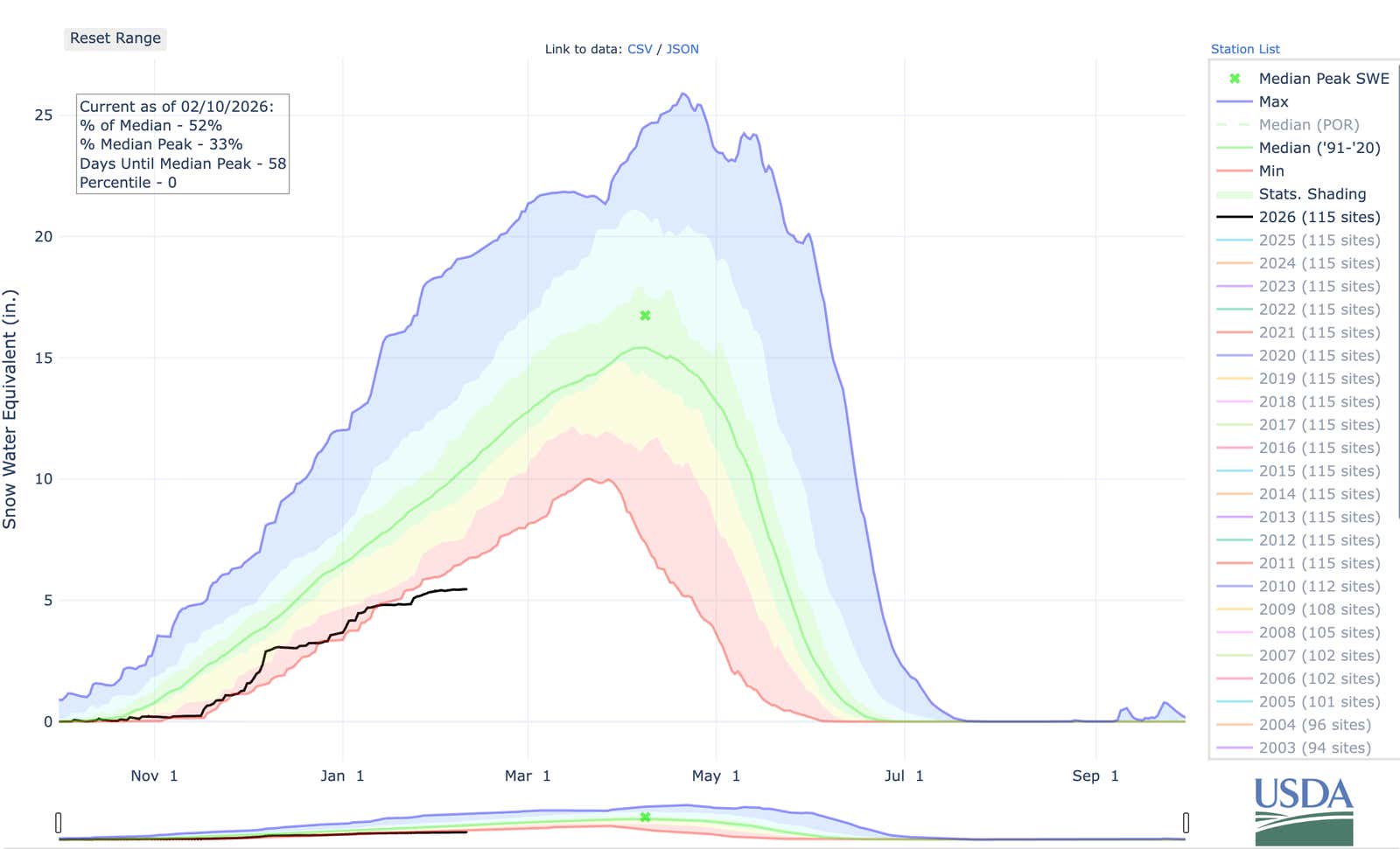
 Why Snowpack Matters
The snowpack across the West isn’t just for skiers and snowboarders. It also helps provide a freshwater source to the West in the drier months.
This is why the lack of snowfall has been so concerning. The West is dependent on snow, which they haven’t been seeing.

This map shows the status of the West’s snowpack (as measured by the water locked in the snow) compared to average as of late January 2026.
(USDA/NRCS)
According to the National Resources Conservation Service, dozens of locations from Colorado and Utah to the Pacific Northwest have snowpack that is lowest at this time of year in at least a decade or more.
This graphic shows the Colorado is seeing its lowest snowpack on record. Feet of snowfall are needed just to reach normal levels.
(Colorado Snow Survey Products)
First Round Recap
The first round of rain and snow arrived in California Tuesday and wrapped up the end of the day Wednesday.
Parts of central and Southern California picked up 1 to 2 inches of rain. There were about two dozen reports of mainly minor flash flooding.
Winds gusted from 60 to 70 mph in a few areas, a few trees or tree limbs were downed in parts of Southern California, and just under 8,000 customers lost power in the state.
All in all, this was mainly an appetizer round for the Golden State, which will come to an end later today.
There was also some snowfall across the Sierra Nevada Mountain Range, where Mammoth Mountain Ski Base saw 17 inches.
Rob Shackelford is a meteorologist and climate scientist at weather.com. He received his undergraduate and master’s degrees from the University of Georgia studying meteorology and experimenting with alternative hurricane forecasting tools.