
It was still dark when I rose from my sleeping bag at 5 a.m. to prepare for a morning climb up Whale Peak in Anza-Borrego Desert State Park.
I knew the 11-mile hike to the 5,300-foot peak would be strenuous and take time, and I wanted to beat the heat of the desert’s winter sun.
But before I unzipped my tent, I heard footsteps on the road near my campsite. I willed myself to believe it was a fellow camper out for a morning stroll. But was it?
I’ve been thinking a lot about the beasts that are said to live in Southern California’s deserts — towering creatures with glowing eyes and names like the “Yucca Man,” the “Missing Link” and the “Borrego Sandman.” I didn’t know about any of them until I started reading Ken Layne’s “Desert Oracle,” which bills itself as holding “strange true tales from the American southwest.” I read it at night before bed, foolishly.
Haunting tales like these thrill me, much like the desert itself. It’s mysterious and otherworldly, and there’s an element of danger that keeps it interesting. Yet it also repeatedly shows me beautiful, comforting things. As I left my tent to make coffee — still slightly nervous about the potential monsters around me — the sunrise painted the sky and the birds set out on their morning rounds, and I knew I’d be okay.
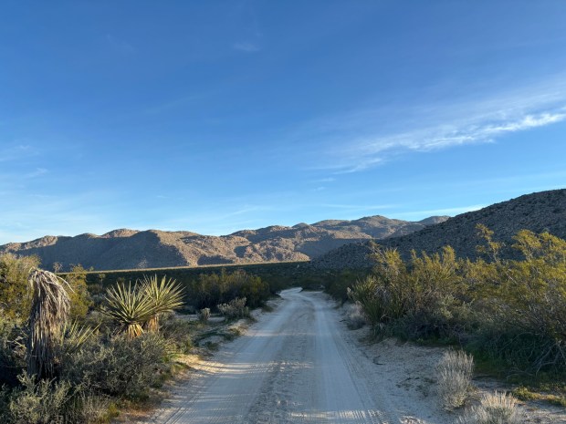 The dirt road between Morteros Trailhead and the Pictograph Trailhead in Little Blair Valley. (Maura Fox / The San Diego Union-Tribune)
I was glad to be up early for the Whale Peak ascent. Its trailheads are located on rugged dirt roads, but I don’t have a high-clearance or four-wheel drive vehicle, so I needed to start farther away. My route was roughly 11 miles long from the Morteros Trailhead in the Little Blair Valley Cultural Preserve.
It’s also a tough hike. Large sections of it involves Class 2 to 3 rock scrambling, but there are some flatter sections, especially at the beginning. I would recommend using a charted route, such as one on AllTrails. Even with a map, it’s easy to get off-trail. Bring a lot of water on this hike, too. Desert hiking is no joke, even in the winter.
The Morteros Trailhead is located on Little Blair Valley Road, about 1.5-miles from County Route S-2. It’s a dirt road and still requires some cautious driving. Begin hiking northeast from the trailhead, down a wide dirt road. Walk for about 1.5 miles before reaching the Pictograph Trailhead. This is where hikers could begin the route if they have a high-clearance vehicle.
Continue up the trail toward Smuggler Canyon — mostly easy as it gradually inclines — for about a mile before coming to pictographs on a rock face, created by the Kumeyaay people thousands of years ago. This is a great destination in itself for hikers who aren’t feeling up to summit Whale Peak.
To continue to the summit, backtrack from the pictographs slightly to where a trail snakes northeast and then north further into Smuggler Canyon. There’s not an exact trail, but the goal is to walk north before turning east into the first side canyon. You’ll begin your rock scrambling ascent around the 3.5-mile mark.
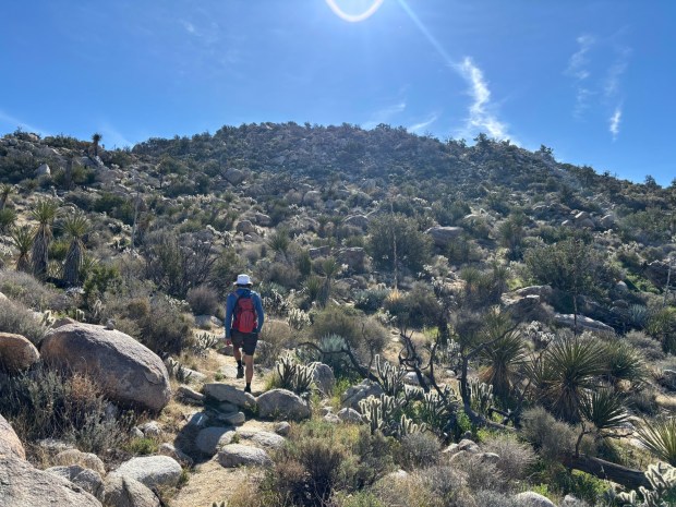 The reporter’s hiking companion makes his way south toward Whale Peak, though the peak is not yet visible. (Maura Fox / The San Diego Union-Tribune)
I veered off-route a few times as I scrambled up, but it wasn’t a big deal. To a certain extent, you want to find the route that works best for you. In that way, this section of the hike feels like a puzzle.
Around 5 miles in, I started heading south, and there were several cairns marking the way. Keep an eye out for jumping cholla, too, which also serves as a guide — or warning — to keep hikers on trail.
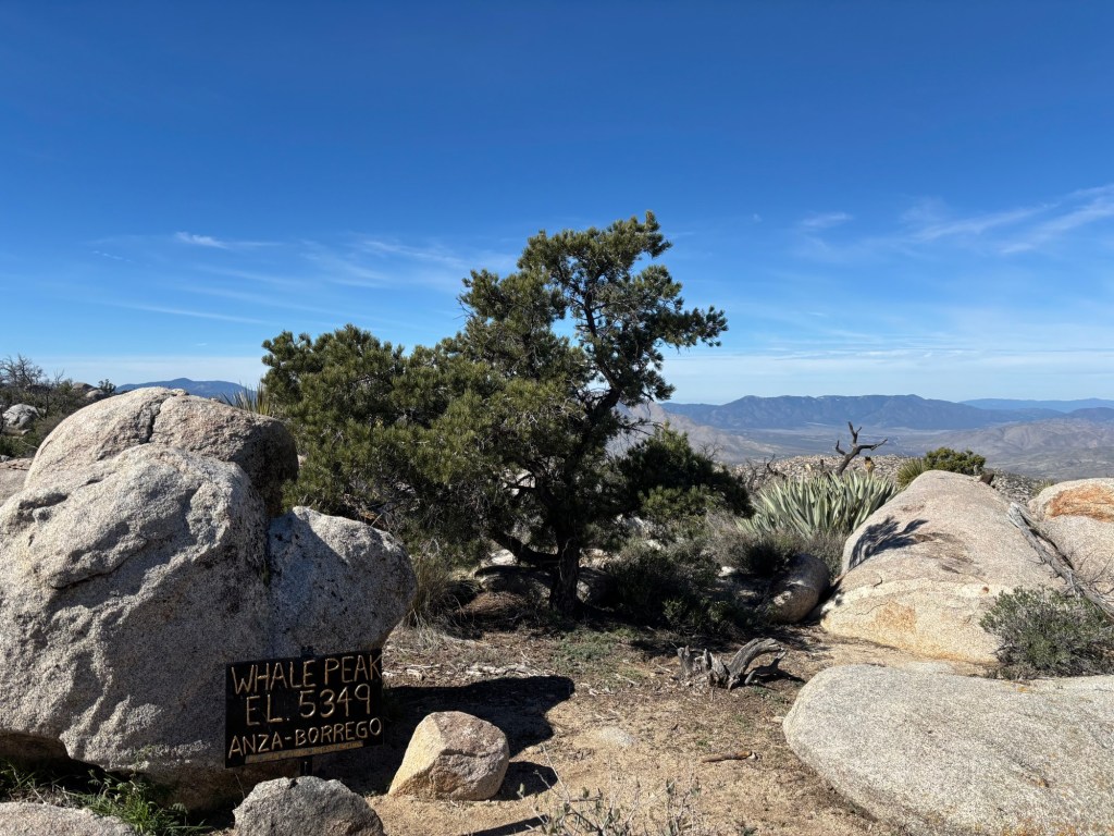
The final 0.2 miles is a steep scramble to the peak, but I couldn’t help but race to the top. I was so excited for the view — and for my veggie hot dog lunch.
Once there, take in the 360-degree scenery. You can see everything: the Salton Sea to the east, Garnet Peak to the southwest, San Jacinto to the far north. When you’re ready to return, retrace your steps back, making sure to watch for cairns to help stay on route.
Back at the Pictograph Trailhead, I was ready to walk the final 1.5 miles back to my car, but a couple of friendly hikers offered me a ride down. It was a lucky happenstance, and it gave me the extra time I needed to hit the Julian Pie Company on my way back to San Diego. Celebratory pie after a rewarding mountain summit — with no sightings of the Yucca Man — just go hand in hand.
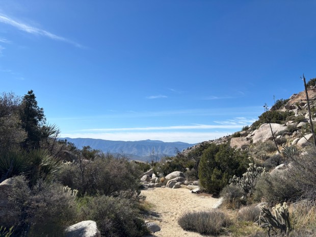 There are some flat sections between the rock scrambling on the return hike. (Maura Fox / The San Diego Union-Tribune)